USGS Flood Inundation Mapping Science
Provisional data, subject to review

FLOOD-INUNDATION
|
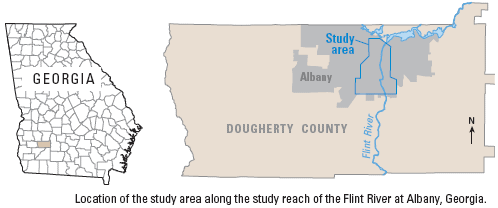
Flood-Inundation Model of the Flint River at Albany, GeorgiaPotential flow characteristics of future flooding along a 4.8-mile reach of the Flint River in Albany, Georgia, were simulated using recent digital-elevation-model data and the U.S. Geological Survey finite-element surface-water modeling system for two-dimensional flow in the horizontal plane (FESWMS-2DH). Simulated inundated areas, in 1-foot (ft) increments, were created for water-surface altitudes at the Flint River at Albany streamgage (02352500) from 192.5-ft altitude with a flow of 123,000 cubic feet per second (ft3/s) to 179.5-ft altitude with a flow of 52,500 ft3/s.
Flood-Inundation Model of the Flint River at Albany, GeorgiaUse the links below to download flood-inundation images and geospatial data. For each stage, data is offered in two formats:
|

![]() U.S. Department of the Interior |
U.S. Geological Survey
U.S. Department of the Interior |
U.S. Geological Survey
URL: http://water.usgs.gov/osw/flood_inundation/projects/albany/index.html
Page Contact Information: Marie Peppler
Page Last Modified: Tuesday, 25-Feb-2014 09:07:49 EST
