USGS Water-Quality Information
![[Photo: USGS scientist collects water-quality samples.]](/owq/images/sidebar/Hawaii-2015.jpg "USGS scientists deploy SPMD and POCIS samplers to collect waterborne contaminants in Manoa Stream on Oahu, Hawaii.")
USGS scientists deploy SPMD and POCIS samplers to collect waterborne contaminants in Manoa Stream on Oahu, Hawaii. NoteworthyPress Releases
Featured Science:
Water Quality DataToday's Water Conditions Get continuous real-time water-quality measurements from Water-Quality Watch maps. Water Quality Portal (WQP) Get current and historical USGS and EPA water-quality data at the WQP. BioData Get stream ecosystem aquatic bioassessment data from BioData. For More Data View a complete list of USGS water-quality data resources. USGS in Your AreaUSGS Water Science Centers are located in each state. ![[Map: There is a USGS Water Science Center office in each State.]](/owq/images/usmapsmall.gif)
|
Selected Water-Quality Topics > Wildfire > Briefing Sheet Briefing Sheet: Wildfire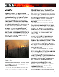
Initial release date: October 25, 2013 IntroductionIn the last several decades, both the incidence of large wildfires and the duration of the wildfire season across much of the United States have increased (Westerling and others, 2006, American Water Works Assn, 2008; Finco and others, 2012). Future projections, based on forecasted climate scenarios generated by global general circulation models (GCM's), and down-scaled regional climate models (RCM's) indicate both an increase in the expected severity of wildfires, and an expansion of wildfire season (Liu and others, 2010; Liu and others, 2012) over much of the northern hemisphere, particularly for western North America. Approximately 80 percent of the U.S's freshwater resource originates on forested land, and more than 3,400 public drinking-water systems are located in watersheds containing national forest lands (USDA, 2006). Thus, potential impacts from current and forecast wildfire occurrence on the quantity and quality of runoff used for sourcewater and to support fisheries and aquatic habitats are considerable. DownloadDownload the complete briefing document [280KB PDF]. For more information, contact:George Ritz |
![]() U.S. Department of the Interior |
U.S. Geological Survey
U.S. Department of the Interior |
U.S. Geological Survey
URL: https://water.usgs.gov/owq/topics/wildfire/briefing.html
Page Contact Information: USGS Office of Water Quality
Page Last Modified: Wednesday, 28-Dec-2016 18:56:18 EST

![[Sample Water-Quality Watch Map]](http://waterwatch.usgs.gov/images/?g=wqw&w=200)