USGS Water-Quality Information
![USGS scientists deploy SPMD and POCIS samplers to collect waterborne contaminants in Manoa Stream on Oahu, Hawaii. [Photo: USGS scientist collects water-quality samples.]](/owq/images/sidebar/Hawaii-2015.jpg)
USGS scientists deploy SPMD and POCIS samplers to collect waterborne contaminants in Manoa Stream on Oahu, Hawaii. NoteworthyPress Releases
Featured Science:
Water Quality DataToday's Water Conditions Get continuous real-time water-quality measurements from Water-Quality Watch maps. Water Quality Portal (WQP) Get current and historical USGS and EPA water-quality data at the WQP. BioData Get stream ecosystem aquatic bioassessment data from BioData. For More Data View a complete list of USGS water-quality data resources. USGS in Your AreaUSGS Water Science Centers are located in each state. ![[Map: There is a USGS Water Science Center office in each State.]](/owq/images/usmapsmall.gif)
|
USGS Water-Quality Sampling of Flood Waters > 2011 - Mississippi Flood Waters Photos of May 2011 flooding and USGS activities. USGS Water-Quality Sampling of the Mississippi Flood Waters – May 2011Summary reports are now available (Updated November 19, 2013):
Originally posted May 18, 2011; Updated May 27, 2011
Ohio and Mississippi Rivers (Illinois, Kentucky, Missouri, Tennessee)The Ohio and Mississippi Rivers reached historic flood levels from precipitation that has been 125 to 150% above normal. The pressures on the levee systems from the high stage led to a decision by the U.S. Army Corps of Engineers (USACE) to open the New Madrid floodway below Cairo, IL. The area is a little more than 130,000 acres and used primarily for farming. Water from the flooded area is re-entering the Mississippi River near New Madrid, MO about 56 miles south of the entry point at Birds Point, MO. The USGS Water Resources mission area has a long-term water-quality program, the National Stream Quality Accounting Network (NASQAN), with a major objective of measuring the concentrations and loads of selected constituents delivered by major rivers to the coastal waters of the United States. Annual sample schedules for this program include bi-monthly samples at sites on the Ohio and Mississippi Rivers during the typical timeframe for spring runoff and the resulting high flows. The routine water-quality samples collected include:
Given the decision to open the New Madrid floodway, additional sites were sampled and samples for additional analyses were collected. Additional samples at routine sites were added to better capture the effect of the flood since it occurred later in the season than normal. Below are summaries of the additions to the routine samples and descriptions of the benefit of collecting these samples. Sites Added:
Sample Collection Added to Routine NASQAN Sites:
Analyses Added:Water samples from the Mississippi flood are being analyzed for pesticide schedules 2033 and 2060 (National Water Quality Laboratory (NWQL)) and the Glyphosate schedule (Organic Geochemistry Research Laboratory (OGRL)). The two pesticide schedules encompass many of the most widely used herbicides, fungicides, insecticides and some of their degradation products and were designed to be complimentary. Schedule 2033 is a GC/MS method used for the less water soluble (less polar) compounds. It includes most of the commonly used corn and soybean herbicides (e.g. atrazine and metolachlor except for glyphosate). It covers a larger number of the most commonly used compounds than the 2060 schedule and so, is the choice for routine analyses in the NASQAN sample plan. The 2060 schedule is being added to ensure that the potential input to the Mississippi River from the opening of the New Madrid floodway is being evaluated. The 2060 schedule uses an HPLC/MS method that is for the more water soluble (more polar) compounds. It includes some important lesser used pesticides (e.g. 2,4-D which is often used in conjunction with RoundUp®) and in particular increases the number of fungicides being looked for. Glyphosate is the most widely used herbicide (aka RoundUp®), but was not among the compounds provided by schedules 2033 and 2060 from the NWQL, so this analysis was also added to the flood water sample plan. The routine suspended sediment samples were collected at the NASQAN sites as well as the added sites and analyzed for a refined particle size distribution to provide better definition of the sediment being moved by the flood waters and the water coming off of the New Madrid floodway. Lower Mississippi and Atchafalaya Rivers (Mississippi, Louisiana)Video: USGS measures flooding and collects water-quality samples at Morganza Spillway and across Louisiana. (Visit the USGS Multimedia Gallery to download this video. As the flood waters move down river, the USACE is taking additional actions to mitigate the impacts of the historic flow. The Bonnet Carré Diversion from the Mississippi River into Lake Pontchartrain and the Morganza Floodway in the Atchafalaya Basin have both been opened to divert water from the Mississippi River. Nutrient Transport to Gulf of Mexico:Nutrient delivery, particularly during the months of April and May, has been identified as one of the primary factors controlling the size of the northern Gulf of Mexico hypoxic zone, which is the second largest hypoxic zone in the world. USGS releases preliminary estimates of monthly nutrient fluxes from the Mississippi and Atchafalaya Rivers to the Gulf of Mexico in early June each year. These estimates are used by National Oceanic and Atmospheric Administration (NOAA) supported researchers to predict the size of the hypoxic zone. Nutrient fluxes for previous years are available at: http://toxics.usgs.gov/hypoxia/mississippi/flux_ests/ Water flowing through the Morganza floodway may require the USGS to modify the data normally used to calculate the loads to the Gulf of Mexico. Tracking spring and annual loads of nutrients delivered to the Gulf of Mexico helps States and Federal partners serving on the Gulf of Mexico Hypoxia Taskforce measure progress towards reducing nutrient runoff and reducing the size of the hypoxic zone. Sample Collection Added to Routine NASQAN Sites:In coordination with the USACE, plans are being developed to double the routine NASQAN sample schedule so that samples are collected every week through June 2011 and every other week through July 2011 at 6 sites:
Analyses Added:The plans implemented further upstream to sample for additional pesticides and glyphosate will be continued in the lower Mississippi River and the Atchafalaya River. USACE is supporting additional analyses at the Melville site and the Morgan City site on the Atchafalaya River for diesel range and gasoline range organic compounds to evaluate water moving through the Morganza Floodway for the potential introduction of these compounds. The Melville site will serve as an upstream location that will not be effected by the Morganza Floodway and the Morgan City site will be the downstream site in the Atchafalaya after the Morganza Floodway water re-enters the river. The USACE has also partnered with the USGS Louisiana Water Science Center to deploy nutrient sensors in Lake Pontchartrain to track the influx of nutrient rich freshwater from the Bonnet Carré diversion of the Mississippi River because of the probability of algal blooms in the Lake. For more information:

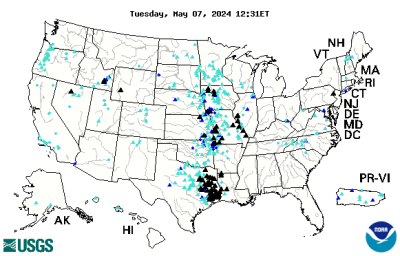
The USGS WaterWatch (http://waterwatch.usgs.gov) web site displays maps, graphs, and tables describing real-time, recent, and past streamflow conditions for the United States. The real-time information generally is updated on an hourly basis. USGS Flood Monitoring and Data CollectionFor more information on USGS water-quality sampling, contact the USGS Office of Water Quality. For additional information on USGS flood monitoring and data collection activities, see:
To learn more about USGS water-quality sampling methods and protocols, see:
Health and Safety InformationEvery effort should be made to limit contact with flood water due to potentially elevated levels of contamination associated with raw sewage and other hazardous substances.
In the MediaThe following links are examples of news media coverage of USGS water-quality sampling of flood waters.
Links and pointers to non-USGS sites are provided for information only and do not constitute endorsement by the USGS, U.S. Department of the Interior, or U.S. Government. Please note that the USGS does not control and cannot guarantee the relevance, timeliness, or accuracy of these outside materials. |