USGS - science for a changing world

Science In Your Watershed

Science in Your Watershed
triangle icon Home
triangle icon Locate Your Watershed (Legacy 8-digit HUC)
triangle icon Locate Your Watershed by 12-digit HUC
triangle icon Links By Watershed

triangle icon Information Discovery
triangle icon Active Projects
triangle icon Databases
triangle icon Publications
triangle icon Reports

triangle icon Data Integration:
triangle icon Watersheds
triangle icon Education

triangle icon Case Studies:
triangle icon Analysis
triangle icon Assessment
triangle icon Characterization
triangle icon Management
triangle icon Stream Restoration

triangle icon Customer Service
triangle icon Glossaries
triangle icon Conferences/Events

triangle icon [Gateway to Watershed Information] [Know Your Watershed] [How's My Waterway] [Science in Your Watershed] [Watershed Gateways] [Watershed Gateways]

USGS Home | Core Science | Ecosystems | Energy and Minerals Mission Area | Natural Hazards | Water

Science in Your Watershed

Locate Your Watershed
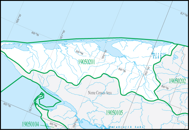
Click on the Additional Information for this Watershed link below the map Mint River Mint River Pinguk River Yankee River Mint River Mint River Grouse Creek Yankee River Trout Creek Mint River Upkuarok Creek Kugrupaga River Nuluk River Skookum Creek Upkuarok Creek Upkuarok Creek Trout Creek York Creek Pinguk River York Creek Deep Creek Nuluk River Deep Creek Pinguk River Nuluk River Kugrupaga River Cooper Creek Nuluk River Lost River Tin Creek Tin Creek Trout Creek Crosby Creek Kugrupaga River Tin Creek Elkington Creek Pinnacle Creek Don River Arctic River Arctic River California River Sanaguich River Arctic River Arctic River North Fork Nuluk River Cowpack River Serpentine River Mission Creek Singeakpuk River Kalik River Mission Creek Nuluk River Serpentine River Agiapuk River Eldorado Creek Arctic Creek Portage Creek Serpentine River South Fork Serpentine River Sanaguich River Kitluk River Serpentine River North Fork Serpentine River Agiapuk River Kitluk River American River North Fork Serpentine River Eldorado Creek Serpentine River Grayling Creek Nugnugaluktuk River Kitluk River Kitluk River Kitluk River Nugnugaluktuk River American River Serpentine River Lone Butte Creek Kougachuk Creek Nugnugaluktuk River Rock Creek North Fork Serpentine River South Fork Serpentine River Kougachuk Creek Grayling Creek American River Lone Butte Creek Budd Creek North Creek Nugnugaluktuk River Agiapuk River Serpentine River Dese Creek Brown Creek Eagle Creek Brown Creek Hot Springs Creek Schlitz Creek Right Fork Bluestone River Igloo Creek American River Schlitz Creek Rock Creek Hot Springs Creek Hot Springs Creek McKinley Creek Agiapuk River Nugnugaluktuk River North Fork Serpentine River Nugnugaluktuk River Lane River Washington Creek Bluestone River Lane River Agiapuk River Henry Creek Flat Creek Kougarok River Pish River Duck Creek Agiapuk River Agiapuk River Taylor Creek Kougarok River Duck Creek Kougarok River Humboldt Creek Humboldt Creek Hunter Creek Duck Creek Ballarat Creek Coco Creek Coarse Gold Creek Humboldt Creek Duck Creek Goodhope River Kougarok River Kaviruk River Kaviruk River Kaviruk River Davidsons Slough Please Click on the Additional Information for this Watershed link below the map
Additional Information for this Watershed


USGS Water How's My Waterway Know Your Watershed HELP!

Accessibility FOIA Privacy Policies and Notices

USAGov logo U.S. Department of the Interior
U.S. Geological Survey
URL: https://water.usgs.gov/wsc/cat/19050201.html
Page Contact Information: Webmaster
Page Last Modified: Wednesday, 10-Jan-2024 04:18:06 EST