USGS - science for a changing world

Science In Your Watershed

Science in Your Watershed
triangle icon Home
triangle icon Locate Your Watershed (Legacy 8-digit HUC)
triangle icon Locate Your Watershed by 12-digit HUC
triangle icon Links By Watershed

triangle icon Information Discovery
triangle icon Active Projects
triangle icon Databases
triangle icon Publications
triangle icon Reports

triangle icon Data Integration:
triangle icon Watersheds
triangle icon Education

triangle icon Case Studies:
triangle icon Analysis
triangle icon Assessment
triangle icon Characterization
triangle icon Management
triangle icon Stream Restoration

triangle icon Customer Service
triangle icon Glossaries
triangle icon Conferences/Events

triangle icon [Gateway to Watershed Information] [Know Your Watershed] [How's My Waterway] [Science in Your Watershed] [Watershed Gateways] [Watershed Gateways]

USGS Home | Core Science | Ecosystems | Energy and Minerals Mission Area | Natural Hazards | Water

Science in Your Watershed

Locate Your Watershed (Legacy 8-digit HUC)

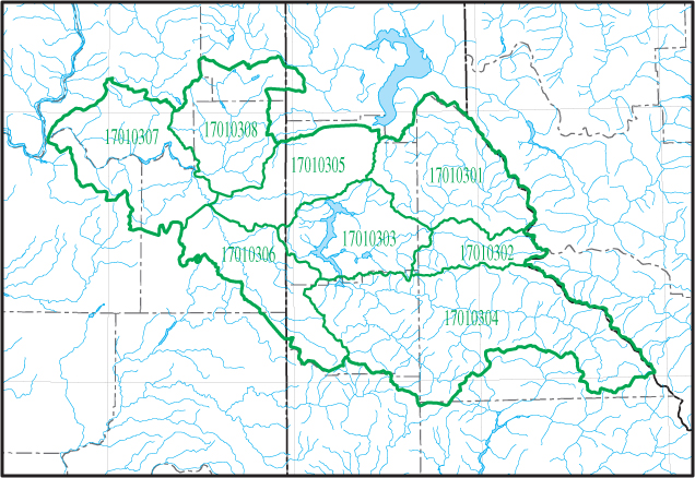
Click on a Cataloging Unit Boundary (17010308) Little Spokane (17010307) Lower Spokane (17010301) Upper Coeur D'alene (17010305) Upper Spokane (17010306) Hangman (17010303) Coeur D'alene Lake (17010302) South Fork Coeur D'alene (17010304) St. Joe Please Select a Cataloging Unit Within the Map Area
Click on the Map Above to View a Particular Cataloging Unit Boundary

USGS Water How's My Waterway Know Your Watershed HELP!

Accessibility FOIA Privacy Policies and Notices

USAGov logo U.S. Department of the Interior
U.S. Geological Survey
URL: https://water.usgs.gov/wsc/acc/170103.html
Page Contact Information: Webmaster
Page Last Modified: Thursday, 20-Jun-2024 16:52:34 EDT