USGS Groundwater Information
|
USGS Groundwater Information > April 1, 2016 Highlights USGS Monthly Groundwater News and Highlights: April 1, 2016Featured Product: Evaluating the Source of Water to Wells Using Metamodeling![Map showing the location of the Lake Michigan Basin groundwater flow model [ Map showing the location of Lake Michigan Basin groundwater flow model ]](images/feature/20160401-fienen-etal.png)
Map showing the location of the Lake Michigan Basin groundwater flow model used as the basis for the metamodels. Colors indicate zones defined in the original figure, adapted from Feinstein et al. (2010). Numerical groundwater modeling is a strength of the USGS, from software development (like MODFLOW) to applications, such as the regional groundwater availability studies highlighted in the December 2015 News and Highlights. Numerical models are our most powerful tools for decision making. But these models require expertise to operate and require significant computational resources. Natural resource managers need reliable models to predict surface water impacts dues to installation of new groundwater wells and may not have the expertise or computer resources to run the necessary simulations. An alternative is to emulate the numerical process model with a statistical “metamodel”, or surrogate model. This new paper illustrates the use of a metamodel in the aquifers within the Lake Michigan basin, a temperate region where shallow groundwater is closely connected with lakes, wetlands, and streams. A groundwater flow model was emulated using three statistical techniques -- a Bayesian Network, an Artificial neural network, and a Gradient Boosted Regression Tree. A numerical MODFLOW-USG model was used for the evaluation. USGS Groundwater-Related Press Releases 
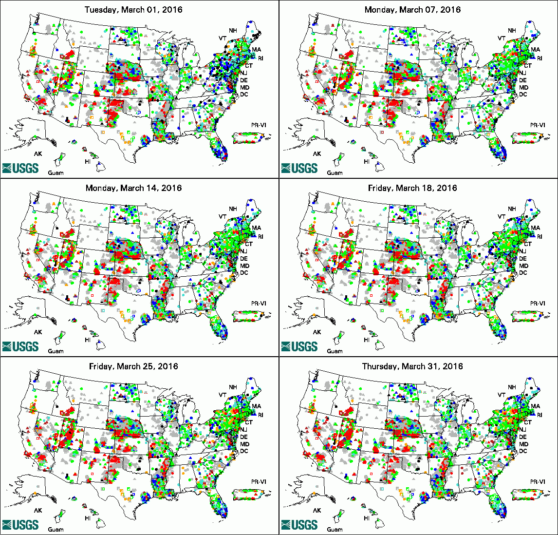
The USGS Active Groundwater Level Network includes about 20,000 wells that have been measured by the USGS or USGS cooperators at least once within the past 13 months. The animation shows a daily snapshot of water-level statistics in the network for March 2016. Credit: USGS. The image is in the public domain. USGS Seeks National Ground-Water Monitoring Network Proposals 2016 Round II Drought and Management Actions Affect World Waterway--the Rio Grande
USGS Groundwater-Related PublicationsSimulation of groundwater storage changes in the eastern Pasco Basin, Washington Flood- and Drought-Related Natural Hazards Activities of the U.S. Geological Survey in New England Transportation and Hydrology Studies of the U.S. Geological Survey in New England Groundwater Contaminant Science Activities of the U.S. Geological Survey in New England Groundwater data network interoperability Isotope hydrology of the Chalk River Laboratories site, Ontario, Canada
USGS Groundwater-Related Software Updates and New ReleasesFloPy v3.2.4.: Python package for creating, running, and post-processing MODFLOW-based models
Field Photo: USGS Groundwater SamplingDid you know the USGS collects samples of groundwater and analyzes the samples to understand what is in the water? USGS scientists collected water samples from domestic wells in the Hinkley, California, area, in January 2016, to measure concentrations of hexavalent chromium and other trace elements including arsenic, manganese and uranium. In these photos, USGS scientists are collecting groundwater samples and other groundwater data around Hinkley. The sample collection is part of a larger USGS study that is assessing the occurrence of both natural and man-made hexavalent chromium in the Hinkley area. The scope of the study is outlined in a new USGS fact sheet and on the USGS California Water Science Center web site. Archive of Past Highlights: |