USGS Monthly Groundwater News and Highlights:
December 1, 2015
Featured Product: Regional Groundwater Availability Studies
The depletion of groundwater at local and regional scales and the compounding effects of recent droughts around the Nation have emphasized the need for an improved understanding of groundwater resources at the aquifer-wide and regional scales. The USGS is studying regional groundwater availability to improve our understanding of groundwater conditions in major aquifers across the Nation.
Water-resource managers, municipalities, and policy makers use the outcomes of these regional USGS studies to inform decisions about how best to protect our local and regional groundwater resources in order to meet current and future needs.
Learn more:
USGS Groundwater-Related Press Releases


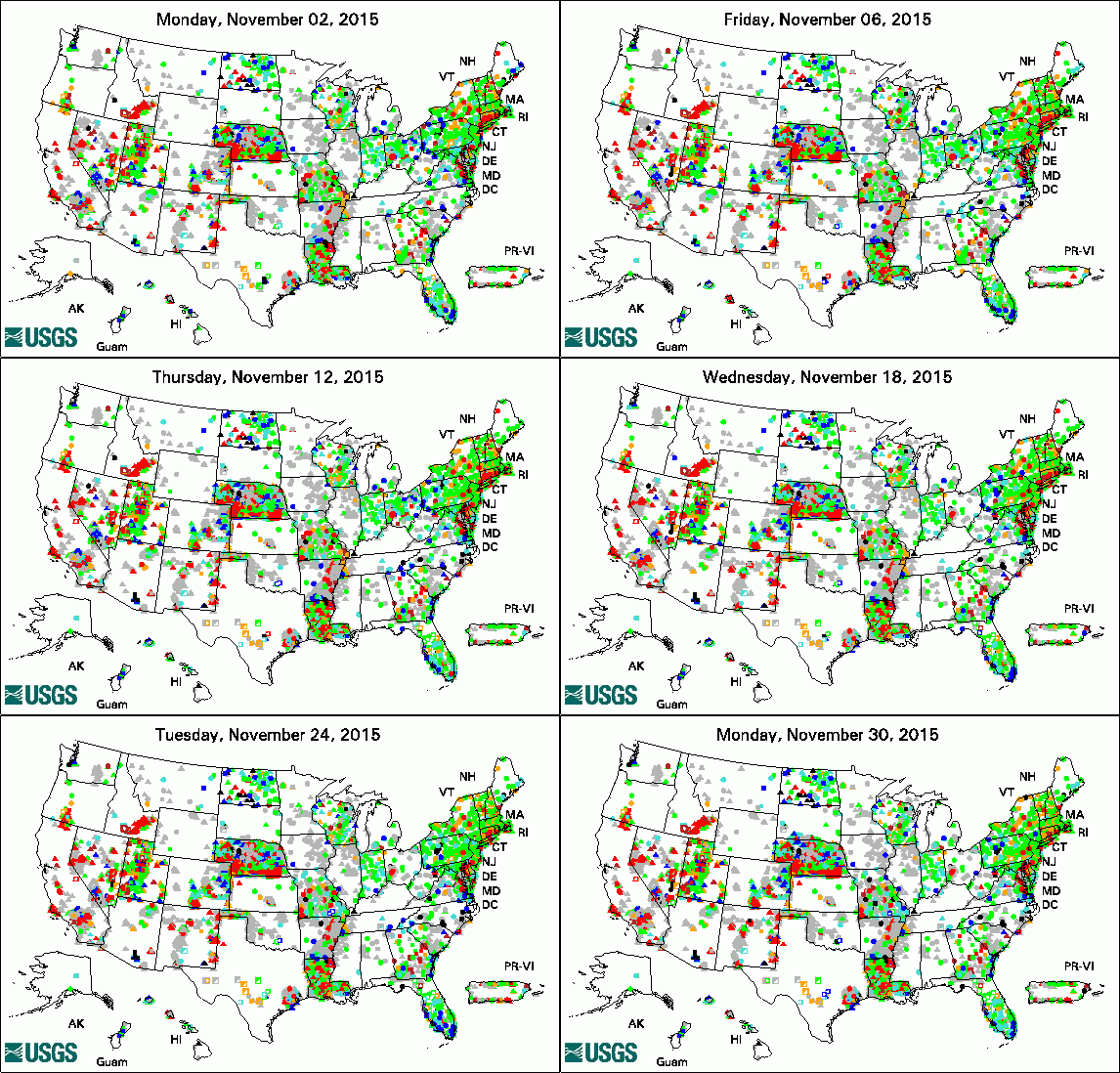
The USGS Active Groundwater Level Network includes about 20,000 wells that have been measured by the USGS or USGS cooperators at least once within the past 13 months. The animation shows a daily snapshot of water-level statistics in the network for November 2015. Credit: USGS. The image is in the public domain.
Groundwater Study Assists in Crucial Sustainable Water-Management in Borrego Valley, California
Water Resource Availability and Quality by Parish
USGS Seeks National Ground-Water Monitoring Network Proposals
Storage and Treatment of Liquid Waste from Landfills Doesn't Remove All Contaminants, Including Pharmaceuticals
Las Vegas Holds Key to Abrupt Climate Change
Removing Nitrogen from Groundwater Has New Ally: Anammox
Report Shows Potential Groundwater Supplies in Valleys of New York's Eastern Chemung County
New Tool Rates Stream Vulnerability to Unconventional Oil and Gas Development
USGS Groundwater-Related Publications
Aquifer geometry, lithology, and water levels in the Anza-Terwilliger area -- 2013, Riverside and San Diego Counties, California
Hydrogeology, hydrologic effects of development, and simulation of groundwater flow in the Borrego Valley, San Diego County, California
Persistent U(IV) and U(VI) following in-situ recovery (ISR) mining of a sandstone uranium deposit, Wyoming, USA
Groundwater/surface-water interactions in the Bad River Watershed, Wisconsin
Geohydrology and water quality of the stratified-drift aquifers in Upper Buttermilk Creek and Danby Creek Valleys, Town of Danby, Tompkins County, New York
Dynamic response of desert wetlands to abrupt climate change
Probing the carbonyl functionality of a petroleum resin and asphaltene through oximation and schiff base formation in conjunction with N-15 NMR
Reactive transport modeling of geochemical controls on secondary water quality impacts at a crude oil spill site near Bemidji, MN
Flushing of distal hillslopes as an alternative source of stream dissolved organic carbon in a headwater catchment
Hydrogeochemical effects of a bulkhead in the Dinero mine tunnel, Sugar Loaf mining district, near Leadville, Colorado
Groundwater quality in the Chemung River, Eastern Lake Ontario, and Lower Hudson River Basins, New York, 2013
smwrData -- An R package of example hydrologic data, version 1.1.1
Hydrogeology and sources of water to select springs in Black Canyon, south of Hoover Dam, Lake Mead National Recreation Area, Nevada and Arizona
Climate and streamflow characteristics for selected streamgages in eastern South Dakota, water years 1945-2013
Field Photo:

Photo Credit: USGS. The photo is in the public domain.
Why does the USGS drill groundwater wells? Wells are drilled as part of some USGS groundwater studies. Data collected from the well can help us understand groundwater conditions at the location and the geological formations through which the groundwater flows. Data collected over time can help us understand how the groundwater levels and quality change over time.
In Idaho, the USGS Idaho Water Science Center conducts applied research at the Idaho National Labratory, in cooperation with the U.S. Department of Energy. In this field photo, we see the USGS Research Drilling Program crew that recently deepened a corehole from about 840 feet below land surface to 1,880 feet below land surface. USGS scientists are collecting data in the well to improve our understanding of the Snake River Plain aquifer.
Learn more USGS Idaho Water Science Center and research by its Idaho National Laboratory Field Office.