National Water-Quality Assessment (NAWQA) Project
Go to:
Estimation Methods:
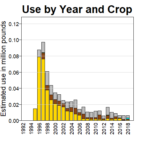
Beginning 2015, the provider of the surveyed pesticide data used to derive the county-level use estimates discontinued making estimates for seed treatment application of pesticides because of complexity and uncertainty. Pesticide use estimates prior to 2015 include estimates with seed treatment application.
| 1992 | 1993 | 1994 | 1995 | 1996 | 1997 | 1998 | 1999 | 2000 | 2001 | 2002 | 2003 | 2004 | 2005 | 2006 | 2007 | 2008 | 2009 | 2010 | 2011 | 2012 | 2013 | 2014 | 2015 | 2016 | 2017 | 2018 | 2019 |
CAUTION:
State-based and other restrictions on pesticide use were not incorporated into EPest-high or EPest-low estimates. EPest-low estimates usually reflect these restrictions because they are based primarily on surveyed data. EPest-high estimates include more extensive estimates of pesticide use not reported in surveys, which sometimes include States or areas where use restrictions have been imposed. Users should consult with State and local agencies for specific use restrictions.


EPest-low and EPest-high provide lower and upper estimates of the geographic distribution of pesticide use.


