TE Synthesis stuff you should know
Book
"Arsenic in ground water: Occurrence and
geochemistry
," ed. by Alan Welch & Ken Stollenwerk.
Ground-water data
Our national GW dataset currently includes TE data from 31,000 wells and
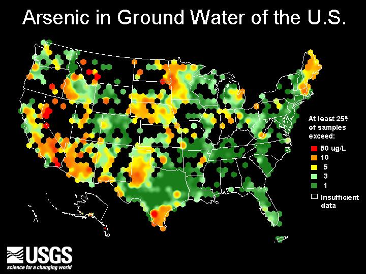
springs. The arsenic map below shows the dataset's spatial extent.
Arsenic summary map
USGS arsenic data* compiled for WRI 99-4279:
*NOTE: The files listed here are not for public release because they include water use identifiers and
lat/longs. Files for public release with water use identifiers removed are on the public page.
Other TE Synthesis info
Archive of "TE News" emails
Fun with trace elements
TE NatSyn Planning Team documents
|
TE occurrence summaries
- Material for use
in preparation for 1997 Study Units Summary Reports
Understanding TEs in ground water
- National frameworks
- Regional frameworks
- Aquifer delineation by water chemistry
- Geochemical process hypotheses
- Geographic & geologic frameworks
- Land use as source and influence
- Plumbing as a source
- Sharing local knowledge
- Existing work by NAWQA, co-ops, GD/NRP, & outside agencies
- '01-start Study Units' thoughts on partnerships, knowledge
gaps, & potential multi-Study Unit research questions
- Contacts with GD, NRP, & outside agencies
|
Sampling, schedules, and QA/QC
TE data collection
Guidance for mercury topical study
Guidance for mercury status studies
QA/QC
|