USGS Groundwater Information
|
USGS Groundwater Information > March 1, 2019 USGS Monthly Groundwater News and Highlights: March 1, 2019Subscribe to get the latest USGS groundwater news and science sent to your inbox every month! ![[ National Groundwater Awareness Week logo ]](images/feature/20190301_gwaw19-vert.png "National Groundwater Awareness Week")
Source: National Groundwater Association. Feature: National Groundwater Awareness WeekThe USGS joins our community partners, including the National Ground Water Association, in recognizing March 10-16, 2019, as National Groundwater Awareness Week because groundwater is important to all of us! Although many people associate the early Geological Survey only with mapping and mining of the West, the USGS was studying groundwater as early as the 1890s! Today, USGS scientists work constantly to improve our understanding of how groundwater moves through the subsurface and what human and natural factors affect the quantity and quality of that groundwater. USGS tools, information, and data are used every day by water-resource managers, regulators, policy makers, well operators, and others to make decisions about how best to protect our groundwater to meet current and future needs. USGS Groundwater-Related Press Releases and Technical Announcements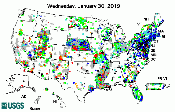 
The USGS Active Groundwater Level Network includes about 20,000 wells that have been measured by the USGS or USGS cooperators at least once within the past 13 months. The animation shows a daily snapshot of water-level statistics in the network for February 2019. Credit: USGS. The image is in the public domain. USGS Groundwater-Related PublicationsLinking landscapes and people -- Projecting the future of the Great Plains (02/11/19) The Mississippi Alluvial Plain aquifers -- An engine for economic activity (02/06/19) Preferential groundwater seepage in karst terrane inferred from geoelectric measurements (02/01/19)
Field PhotoDid you know groundwater can sometimes flow up or down a well and out into other parts of an aquifer? This can be a problem if a well allows contaminated groundwater to flow into shallower or deeper parts of an aquifer system. USGS scientists are studying how groundwater moves through wells at Edwards Air Force Base (AFB) in California. The wells were previously used to pump out groundwater so that it could be treated to remove trichlorethylene and heavy metals. Now that the wells are not being pumped anymore, site managers want to be sure the wells aren't acting as a way for the trichlorethylene and heavy metals to move into different parts of the aquifer system at the site. USGS is using special dyes to trace the movement of groundwater in the wells, to map where the water flows in and out of the well. This information can be used by site managers to inform decisions about how best to manage the wells. In these photos, USGS scientists are conducting tests on wells at Edwards Air Force Base (AFB) in June 2018. The close-up photo shows the well with a smaller white pipe inside it, which is used to insert the dye into the well. ![[ Photo of scientists operating equipment over a well next to a truck in the desert ]](images/field/20190301_PHOTO3_ed.jpg "Photo of scientist working over a well")
Credit: USGS/Christopher Ely. Photo is in the public domain. Click on photo for larger version. ![[ Close up view of well with equipment in it ]](images/field/20190301_PHOTO2_ed.jpg "Close up view of well with equipment in it")
Credit: USGS/Nicholas Teague. Photo is in the public domain. Click on photo for larger version. Archive of Past Highlights: |
![]() U.S. Department of the Interior |
U.S. Geological Survey
U.S. Department of the Interior |
U.S. Geological Survey
URL: http://water.usgs.gov/ogw/highlights/2019-03-01.html
Page Contact Information: Contact the USGS Office of Groundwater
Page Last Modified: Monday, 04-Mar-2019 14:13:48 EST
