Colorado River Basin Focus Area Study
Study Components

Evapotranspiration

irrigation system

New USGS-developed, remote-sensing based approaches were used to quantify agricultural irrigation water consumption on a field-by-field scale. The work produced the first ever Colorado River Basin-wide, 100-m scale actual ET estimate (2010) using Landsat imagery.

Snowpack Hydrodynamics

snow field

The Focus Area Study examined factors affecting snowpack distribution, snowmelt, and losses of snowpack water due to sublimation in the Upper Colorado River Basin. Also, as part of the FAS, the USGS has developed methods to make physical measurements of snowpack sublimation.

Water Use

hydroelectric dam

Water-use data were compiled as annual total withdrawals by source and aggregated to 8-digit Hydrologic Unit Code watersheds from 1985 to 2010 in five year intervals. The new compilation allows for an evaluation of water-use trends in the Colorado River Basin and the effect of use on the water budget.

Groundwater Discharge to Streams

diagram of stream/aquifer interaction

Methods were developed in the CRB FAS to estimate groundwater discharge to streams in the upper Colorado River Basin (UCBR) using in-stream water-quality data. Results indicate groundwater discharge to streams contributes an average of 48 percent of total streamflow in the UCRB.

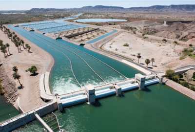
Colorado River Indian Tribes (CRIT) main canal. Photo by Jeremy Dodds, US Bureau of Reclamation.