USGS Groundwater Information
|
USGS Groundwater Information > December 3, 2018 Highlights USGS Monthly Groundwater News and Highlights: December 3, 2018To continue to get the latest highlights, we recommend you subscribe to get the latest USGS groundwater news and science sent to your inbox every month! Feature: Fourth National Climate Assessment![United States map showing groundwater depletion data [ United States map showing groundwater depletion data ]](images/feature/20181201_NCA_figure3_2-1200.png)
Figure: Groundwater supplies have been decreasing in the major regional aquifers of the United States over the last century (1900-2000). This decline has accelerated recently (2001-2008) due to persistent droughts in many regions and the lack of adequate surface water storage to meet demands. Source: Fourth National Climate Assessment, Volume II. USGS hydrologists contributed to the recently released Fourth National Climate Assessment, Volume II: Impacts, Risks, and Adaptation in the United States. The report summarizes the current science of climate change and variability and its impacts across the United States, now and throughout this century, including impacts on our Nation's water resources. According to the assessment, water systems face considerable risk, even without anticipated future climate changes. In many parts of the United States, groundwater is being depleted due to increased pumping during droughts and concentrated demands in urban areas. Drought risk is being exacerbated by increasing human water use and the depletion of groundwater that serves as a buffer against water scarcity. Increasing air temperatures, insufficient precipitation, and associated increases in irrigation requirements will likely result in greater groundwater depletion in the coming decades. For more information, view the Assessment water chapter executive summary, the complete Water chapter, or the overall Assessment. USGS Groundwater-Related Technical Announcements 
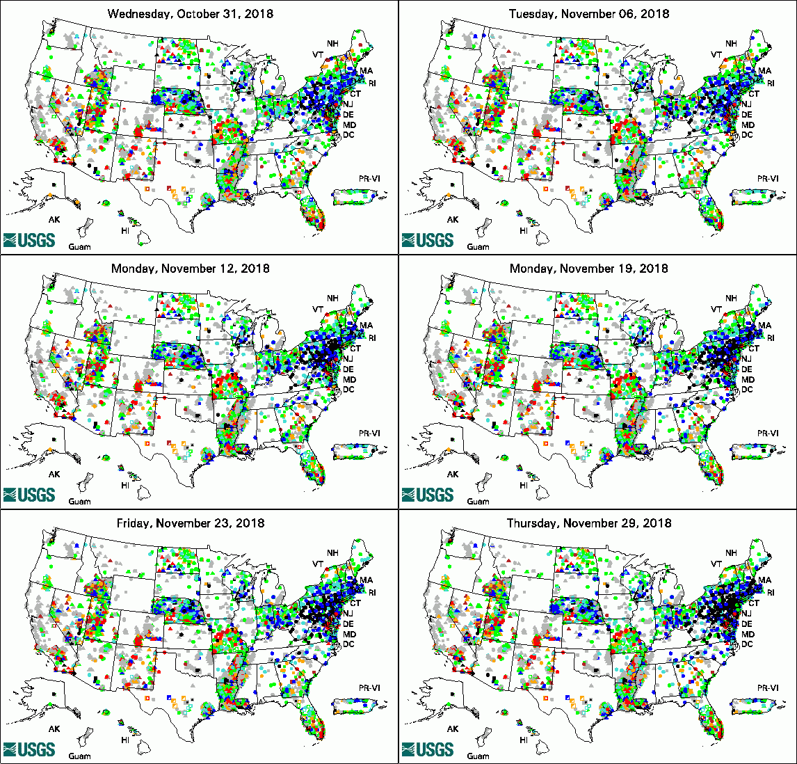
The USGS Active Groundwater Level Network includes about 20,000 wells that have been measured by the USGS or USGS cooperators at least once within the past 13 months. The animation shows a daily snapshot of water-level statistics in the network for November 2018. Credit: USGS. The image is in the public domain. USGS Groundwater-Related PublicationsPreparations for water sampling (11/28/18) Groundwater quality in the Floridan aquifer system, Southeastern United States (11/26/18) Chemical and isotopic characteristics of methane in groundwater of Ohio, 2016 (11/19/18)
USGS Groundwater Flow and Transport Model Data ReleasesNote: The following links take you to data.doi.gov Field Photos:In this photo, USGS Research Hydrologist Paul Hsieh collects seismic data during a groundwater study at Pinnacles National Park in California. The USGS is collaborating with the U.S. National Park Service to understand the Park's groundwater resources. The red seismometer on the ground measures ambient seismic noise, which includes microtremors induced by wind, ocean waves, and human activity. The seismic data collected can be used to estimate unconsolidated sediment thickness, map the bedrock surface, and infer fault locations. Results of the study will be used to develop strategies for long-term management of groundwater in the park. Archive of Past Highlights: |