USGS Groundwater Information
|
USGS Groundwater Information > October 1, 2018 Highlights USGS Monthly Groundwater News and Highlights: November 1, 2018Want the monthly groundwater highlights sent direct to your inbox? Subscribe to our email newsletter! Feature: Mississippi Alluvial Plain (MAP) Regional Water Availability StudyThe Mississippi Alluvial Plain (MAP) has become one of the most important agricultural regions in the US, and it relies heavily on a groundwater system that is poorly understood and shows signs of substantial change. The heavy use of the available groundwater resources has resulted in significant groundwater-level declines and reductions in base flow in streams within the MAP. The USGSis conducting a regional groundwater availability study of the MAP to provide stakeholders and managers information and tools to better understand and manage groundwater resources. The study focuses on quantifying the status of the groundwater system in the MAP and determining how groundwater resources respond to development. Advanced characterization of the MAP, synthesis of field data, and numerical modeling will be used in the study as described on these web pages. Learn more about the MAP study or read about how airborne geophysical surves are being used to study MAP groundwater resources. ![[ Map of Mississippi Alluvial Plain study area ]](images/feature/20181101_MAP_basemap.jpg "Map of Mississippi Alluvial Plain study area")
Figure: Map of Mississippi Alluvial Plain study area. (Source. Figure is in the public domain.) USGS Groundwater-Related Press ReleasesSeeking Water from Above: Low-Level Helicopter to Fly Above Mississippi Alluvial Plain(10/25/2018) Scientists to Measure Wood River Valley Groundwater Levels (10/15/2018)
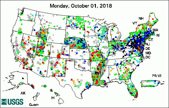 
The USGS Active Groundwater Level Network includes about 20,000 wells that have been measured by the USGS or USGS cooperators at least once within the past 13 months. The animation shows a daily snapshot of water-level statistics in the network for October 2018. Credit: USGS. The image is in the public domain. USGS Groundwater-Related PublicationsPreliminary investigation of groundwater quality near a Michigan cemetery, 2016-17 (10/25/18)
USGS Groundwater Flow and Transport Model Data ReleasesNote: The following links take you to data.doi.gov
Field Photo:Ever wonder what it means when you hear about "artesian well water"? This is a photo of a flowing well in John Pennekamp Coral Reef State Park, Key Largo, Florida, popularly referred to as an artesian well. The term “artesian well water” tells us about the groundwater flow conditions but does not tell us anything about the quality or safety of the water for drinking. Where groundwater moves beneath a layer of clay or other dense, low-permeability material, it is effectively confined, often under pressure. The pressure in most confined aquifers, sometimes called artesian aquifers, causes the water level in a well tapping the aquifer to rise above the top of the aquifer. In a flowing well, the pressure in the aquifer raises the groundwater in the well above ground level where it can be collected for use with little or no pumping. ![[ Photo of well with groundwater flowing out of it ]](images/field/20181101_groundwater photo-01.jpg "Photo of well with groundwater flowing out of it")
Credit: USGS. Photo is in the public domain. Click on photo for larger version. Archive of Past Highlights: |
![]() U.S. Department of the Interior |
U.S. Geological Survey
U.S. Department of the Interior |
U.S. Geological Survey
URL: http://water.usgs.gov/ogw/highlights/2018-11-01.html
Page Contact Information: Contact the USGS Office of Groundwater
Page Last Modified: Wednesday, 12-Dec-2018 16:36:57 EST
