USGS - science for a changing world

USGS Groundwater Information

*  Home *  Monthly Highlights *  Data & Information *  Publications *  Methods & Modeling *  Selected Topics *  Programs *  About *  Contact Us

USGS Groundwater Information > August 1, 2018 Highlights


USGS Monthly Groundwater News and Highlights: August 1, 2018

To continue to get the latest highlights, we recommend you subscribe to get the latest USGS groundwater news and science sent to your inbox every month!


Feature: Secondary hydrogeologic regions of the conterminous United States

USGS previously identified and mapped 62 Principal Aquifers in the U.S., with 57 located in the conterminous states. Areas outside of the Principal Aquifers, which account for about 40% of the conterminous U.S., were collectively identified as "other rocks." A new study from the USGS subdivides this large area into Secondary Hydrogeologic Regions. Secondary Hydrogeologic Regions generally consist of low permeability rocks or deposits, but can include locally productive aquifers. Together with the Principal Aquifers of the U.S., the Secondary Hydrogeologic Regions provide a comprehensive, national-scale hydrogeologic framework for assessing and understanding groundwater systems.


 [ Map of Secondary hydrogeologic regions of the conterminous United States ]

Figure: Secondary hydrogeologic regions of the conterminous United States. Source: Belitz and others, 2018. Figure is in the public domain.
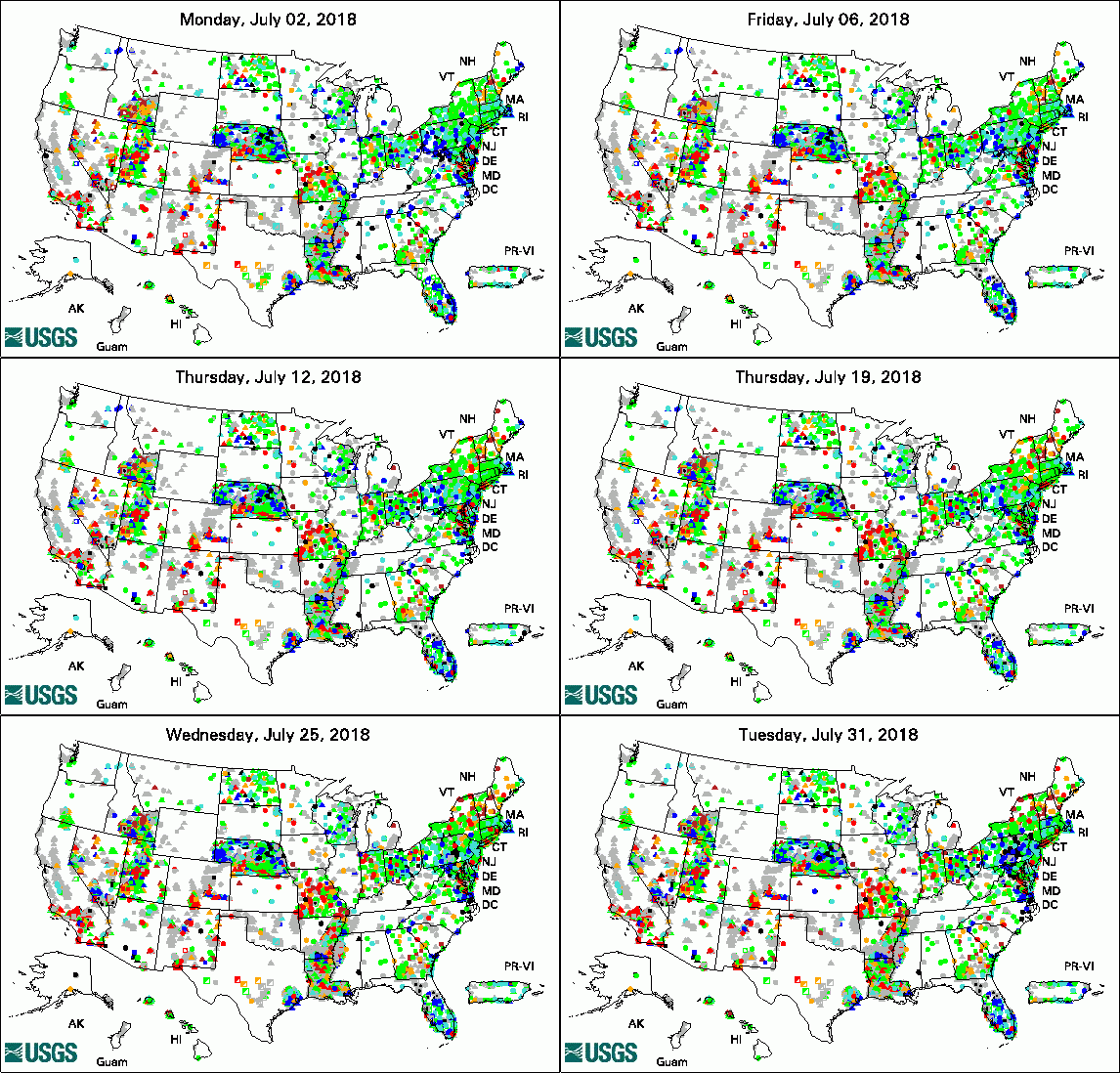

Animation of Groundwater Watch Active Water Level Network, 30 days
legend

The USGS Active Groundwater Level Network includes about 20,000 wells that have been measured by the USGS or USGS cooperators at least once within the past 13 months. The animation shows a daily snapshot of water-level statistics in the network for July 2018. Credit: USGS. The image is in the public domain.

USGS Groundwater-Related Publications

What can trees tell us about the air we breathe at home? (07/31/18)

Simulation of zones of groundwater contribution to wells south of the Naval Weapons Industrial Reserve Plant in Bethpage, New York (07/31/18)

SWB Version 2.0 -- A soil-water-balance code for estimating net infiltration and other water-budget components (07/31/18)

Spatial and temporal trends in selenium in the upper Blackfoot River watershed, southeastern Idaho, 2001-16 (07/27/18)

Geochemistry and microbiology of groundwater and solids from extraction and monitoring wells and their relation to well efficiency at a Federally operated confined disposal facility, East Chicago, Indiana (07/24/18)

Groundwater discharge characteristics for selected streams within the Loup River Basin, Nebraska, 2014-16 (07/24/18)

Preliminary groundwater salinity mapping near selected oil fields using historical water-sample data, central and southern California (07/25/18)

Evaluation of sockeye salmon after passage through an innovative upstream fish-passage system at Cle Elum Dam, Washington, 2017 (07/24/18)

Quality-assurance plan for groundwater activities, U.S. Geological Survey Dakota Water Science Center (07/24/18)

Prioritization of oil and gas fields for regional groundwater monitoring based on a preliminary assessment of petroleum resource development and proximity to California's groundwater resources (07/23/18)

Geohydrology, geochemistry, and numerical simulation of groundwater flow and land subsidence in the Bicycle Basin, Fort Irwin National Training Center, California (07/20/18)

Monitoring the water-quality response of agricultural conservation practices in the Bucks Branch watershed, Sussex County, Delaware, 2014-16 (07/19/18)

Secondary hydrogeologic regions of the conterminous United States (07/19/18)

Simulation of potential groundwater recharge for the glacial aquifer system east of the Rocky Mountains, 1980-2011, using the Soil-Water-Balance Model (07/18/18)

Idaho water use, 2015 (07/20/18)

Water budget of the upper Chehalis River Basin, southwestern Washington (07/17/18)

Preliminary evaluation of the hydrogeology and groundwater quality of the Mississippi River Valley Alluvial Aquifer and Memphis Aquifer at the Tennessee Valley Authority Allen Power Plants, Memphis, Shelby County, Tennessee (07/13/18)

Santa Barbara and Foothill groundwater basins Geohydrology and optimal water resources management -- Developed using density dependent solute transport and optimization models (07/16/18)

Groundwater-quality and select quality-control data from the National Water-Quality Assessment Project, January through December 2015, and previously unpublished data from 2013 to 2014 (07/03/18)

Geochemical characterization and modeling of regional groundwater contributing to the Verde River, Arizona between Mormon Pocket and the USGS Clarkdale gage (07/16/18)


USGS Groundwater Flow and Transport Model Data Releases

Note: The following links take you to data.doi.gov

iTOUGH2-EOS7C model used to analyze multiphase flow and underpressured shale at the Bruce Nuclear Site, Ontario, Canada

MODFLOW-NWT inset models from the regional Lake Michigan Basin Model in support of groundwater age calculations for glacial aquifers


Field Photo of the Month

Did you know that USGS summer interns are gaining first-hand experience doing science at field sites, laboratories, and offices across the Nation this summer? In this photo, intern Kimberly Moore monitors wind conditions while providing field support for drones being used to study interaction between groundwater and surface water in the Elk Mountain Range in July 2018. Kimberly is interning with USGS to work on applied hydrogeophysics through the National Association of Geoscience Teachers (NAGT)/USGS 2018 Cooperative Summer Field Training Program.


 [ Photo of scientist operating equipment in the field ]

Credit: USGS. Photo is in the public domain. Click on photo for larger version.


Archive of Past Highlights:

Past monthly summaries are available online.


USGS Home Water Climate and Land Use Change Core Science Systems Ecosystems Energy and Minerals Environmental Health Natural Hazards

Accessibility FOIA Privacy Policies and Notices

USA.gov logo U.S. Department of the Interior | U.S. Geological Survey
URL: http://water.usgs.gov/ogw/highlights/2018-08-01.html
Page Contact Information: Contact the USGS Office of Groundwater
Page Last Modified: Thursday, 02-Aug-2018 01:45:17 EDT