|
USGS Groundwater Information > July 2, 2018 Highlights
USGS Monthly Groundwater News and Highlights: July 2, 2018
To continue to get the latest highlights, we recommend you subscribe to get the latest USGS groundwater news and science sent to your inbox every month!
Feature: 2015 Groundwater Use in the United States
How much groundwater does the United States use? Every five years, the USGS compiles water-use information into a national water-use data system with state-level data published in a national circular. Highlights from the new report summarizing 2015 water-use for the United States include:
- Total groundwater withdrawals were 84,700 million gallons per day, of which 97 percent was freshwater.
- Total groundwater withdrawals increased about 6.52 billion gallons per day (about 8 percent) between 2010 and 2015.
- Thirty-nine percent of water withdrawn for public supply was from groundwater.
- More than 98 percent of the self-supplied domestic withdrawals were from groundwater.
- Irrigation accounted for 70 percent of the total fresh groundwater withdrawals nationwide.
- States with the largest increases in groundwater withdrawals were California, Arkansas, Idaho, and Nebraska, mostly for irrigation uses.
![[ Map of groundwater withdrawals in the United States in 2015 ]](images/feature/20180701_total-groundwater-map.png "Map of groundwater withdrawals in the United States in 2015")
Figure: Map of groundwater withdrawals in the United States in 2015. Source: USGS. Figure is in the public domain.
USGS Groundwater-Related Press Releases
Water Use Across the United States Declines to Levels Not Seen Since 1970 (6/19/2018)
Oklahoma Study Reveals Possible, Previously Unknown Sources of Earthquakes (6/1/2018)
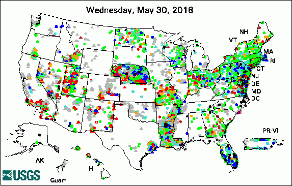

The USGS Active Groundwater Level Network includes about 20,000 wells that have been measured by the USGS or USGS cooperators at least once within the past 13 months. The animation shows a daily snapshot of water-level statistics in the network for June 2018. Credit: USGS. The image is in the public domain.
USGS Groundwater-Related Publications
Estimates of water use and trends in the Colorado River Basin, Southwestern United States, 1985-2010 (06/27/18)
Extraction and development of inset models in support of groundwater age calculations for glacial aquifers (06/22/18)
Tracing enhanced oil recovery signatures in casing gases from the Lost Hills oil field using noble gases (06/22/18)
Arsenic geochemistry of alluvial sediments and pore waters affected by mine tailings along the Belle Fourche and Cheyenne River floodplains (06/22/18)
Origin of methane and sources of high concentrations in Los Angeles groundwater (06/20/18)
Summary of estimated water use in the United States in 2015 (06/19/18)
Estimated use of water in the United States in 2015 (06/19/18)
Quantifying anthropogenic contributions to century-scale groundwater salinity changes, San Joaquin Valley, California, USA (06/18/18)
Streamflow and selenium loads during synoptic sampling of the Gunnison River and its tributaries near Delta, Colorado, November 2015 (06/14/18)
Preliminary geologic framework developed for a proposed environmental monitoring study of a deep, unconventional Marcellus Shale drill site, Washington County, Pennsylvania (06/11/18)
Against the current -- The Mojave River from sink to source: The 2018 Desert Symposium field trip road log (06/11/18)
Water-quality observations of the San Antonio segment of the Edwards aquifer, Texas, with an emphasis on processes influencing nutrient and pesticide geochemistry and factors affecting aquifer vulnerability, 2010-16 (06/08/18)
Water-table and potentiometric-surface altitudes in the upper glacial, Magothy, and Lloyd aquifers of Long Island, New York, April-May 2016 (06/07/18)
Minimum energy requirements for desalination of brackish groundwater in the United States with comparison to international datasets (06/06/18)
Agriculture -- A river runs through it -- The connections between agriculture and water quality (06/07/18)
Groundwater flux estimation in streams: A thermal equilibrium approach (06/05/18)
Rio Grande transboundary integrated hydrologic model and water-availability analysis, New Mexico and Texas, United States, and Northern Chihuahua, Mexico (06/07/18)
Conceptual framework and trend analysis of water-level responses to hydrologic stresses, Pahute Mesa-Oasis Valley groundwater basin, Nevada, 1966-2016 (06/06/18)
Groundwater quality in the shallow aquifers of the Monterey Bay, Salinas Valley, and adjacent highland areas, California (06/22/18)
Status and understanding of groundwater quality in the Monterey-Salinas Shallow Aquifer Study Unit, 2012-13: California GAMA Priority Basin Project (06/04/18)
USGS Groundwater Flow and Transport Model Data Releases
Note: The following links take you to data.doi.gov
MODFLOW-2005 and MODPATH6 models used to simulate groundwater flow and transport and base-flow age in two tributaries to the Upper Chester River, Maryland
MODFLOW-2005 and MT3DMS models used to design and evaluate a bioremediation experiment at the former Naval Air Warfare Center, West Trenton, NJ
MODFLOW-2005 data sets for simulation of Groundwater-Flow Budget for the Lower Apalachicola-Chattahoochee-Flint River Basin in Southwestern Georgia and Parts of Florida and Alabama, 2008-12
MODFLOW-2005 model used to evaluate the potential effects of sea-level rise on the Kirkwood-Cohansey aquifer system in the vicinity of Edwin B. Forsythe National Wildlife Refuge, New Jersey
MODFLOW-2005 used to evaluate the effects of withdrawals from two aquifers in the New Jersey Coastal Plain for Cumberland County and vicinity, New Jersey
MODFLOW-NWT and MODPATH5 models used to identify potential flow paths from San Juan Mine to hydrologic receptors, San Juan County, New Mexico
MODFLOW-NWT model data sets used to evaluate changes in the hydrodynamics of Anvil Lake, Wisconsin
MODFLOW-NWT model of groundwater flow in the Ozark Plateaus aquifer system
SEAWAT Data Sets for Simulation of Effluent Transport in the Floridan Aquifer System at the North District Wastewater Treatment Plant, Southeastern Florida, 1997-2011: U.S. Geological Survey Data Release
SUTRA model simulations used to evaluate heat flow from microbial activity at a crude oil-contaminated site.
VS2DI model used to evaluate groundwater connectivity of wetlands in the Prairie Pothole Region, North Dakota
Field Photo
Long-term study is key to understanding what happens to crude oil released into the environment. USGS has been conducting science studies for more than thirty years at a site near Bemidji, Minnesota, where a pipeline transporting crude oil broke in 1979. This long-term investigation has provided an understanding of what happens to the oil in the shallow subsurface and groundwater over time, information site managers and policy makers can use to inform decisions about preventing and responding to other spills. In these photos, USGS Research Hydrologist Barbara Bekins and Hydrologist Jared Trost operate a geoprobe at the USGS National Crude Oil Spill Fate and Natural Attenuation Research site near Bemidji, Minnesota, in June 2018.
![[ Photo of scientists operating equipment in the field ]](images/field/20180701_IMG_3211.JPG "Photo of scientists operating equipment in the field")
Credit: USGS. Photo is in the public domain. Click on photo for larger version.
![[ Photo of scientists operating equipment in the field ]](images/field/20180701_Barbara&Jaredgeoprobe2.JPG "Photo of scientists operating equipment in the field")
Credit: USGS. Photo is in the public domain. Click on photo for larger version.
| ![[ Photo of scientists operating equipment in the field ]](images/field/220180701_Barbara&Jaredgeoprobe2.JPG "Photo of scientists operating equipment in the field")
