USGS Groundwater Information
|
USGS Groundwater Information > June 1, 2018 Highlights USGS Monthly Groundwater News and Highlights: June 1, 2018To continue to get the latest highlights, we recommend you subscribe to get the latest USGS groundwater news and science sent to your inbox every month! Feature: Explosive eruptions at Kīlauea: What's groundwater got to do with it?You have probably heard about the ongoing volcanic eruption of Kīlauea on the Island of Hawai'i, but did you hear about how groundwater can affect the eruptions? When the lava column at Kīlauea drops below the water table, groundwater can come into contact with magma or hot rocks. This rapidly heats the groundwater, causing violent steam explosions. The role of groundwater in Kīlauea eruptions is part of ongoing USGS research and has been observed before. For example, in 1924, lava drained from Halema'uma'u Crater and dropped below the water table. Collapse of the crater walls, and influx of groundwater into the conduit to Halema'uma'u, caused repeated explosions between May 11 and 27, 1924. These explosions threw rocks more than 10 inches in diameter for more than 0.6 miles from the vent. Ash from the explosions fell from North Hilo to beyond Pāhala, pea-size rocks were reported to have fallen at the Volcano House, and gravel-size rocks were deposited 2 miles southwest of Halema'uma'u. (Source: The May 1924 Explosive Eruption of Kīlauea) Want to learn more about Kīlauea?
![[ Diagram showing how groundwater can cause explosive eruptions ]](images/feature/20180601_img3355_900w_692h.png "Diagram showing how groundwater can cause explosive eruptions")
Figure: Diagram showing how an explosive eruption can occur when groundwater interacts with hot rock, building steam pressure and then exploding. Source: USGS. Figure is in the public domain. USGS Groundwater-Related Publications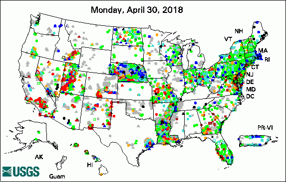 
The USGS Active Groundwater Level Network includes about 20,000 wells that have been measured by the USGS or USGS cooperators at least once within the past 13 months. The animation shows a daily snapshot of water-level statistics in the network for May 2018. Credit: USGS. The image is in the public domain. Influence of climate on alpine stream chemistry and water sources (05/30/18) Imidacloprid sorption and transport in cropland, grass buffer and riparian buffer soils (05/17/18) Compilation and analysis of multiple groundwater-quality datasets for Idaho (05/14/18) Groundwater-level data from an earthen dam site in southern Westchester County, New York (05/01/18)
USGS Groundwater Flow and Transport Model Data ReleasesNote: The following links take you to data.doi.gov MODFLOW-NWT model data sets used to evaluate changes in the hydrodynamics of Anvil Lake, Wisconsin MODFLOW-NWT model of groundwater flow in the Ozark Plateaus aquifer system Field PhotoScientists never stop learning! USGS scientists participate in ongoing training to keep up on the latest scientific methods, tools, and best practices. In this photo, USGS scientists participate in a field class about collecting groundwater data using USGS standards and procedures. A field technician is lowering an electric tape into a well to measure the depth to groundwater. He is leaning over the well to listen for the beep the tape makes when it comes into contact with the water. Other students are tracking the time, taking notes, and observing. Using common standards and procedures ensures that groundwater data meet USGS data quality standards and enables USGS scientists to better compare and analyze data collected at the same location over time, or data collected at different locations by different scientists. You can also watch a video about measuring water levels with an electric tape. ![[ Photo of scientist lowering tool into a well ]](images/field/20180601_DSCF0588_GW1227_2017.JPG "Photo of scientist lowering tool into a well")
Credit: USGS. Photo is in the public domain. Click on photo for larger version. Archive of Past Highlights: |
![]() U.S. Department of the Interior |
U.S. Geological Survey
U.S. Department of the Interior |
U.S. Geological Survey
URL: http://water.usgs.gov/ogw/highlights/2018-06-01.html
Page Contact Information: Contact the USGS Office of Groundwater
Page Last Modified: Monday, 04-Jun-2018 14:50:07 EDT
