USGS Monthly Groundwater News and Highlights: March 5, 2018
Subscribe and get the latest USGS groundwater news and science sent to your inbox every month!
Featured Product: Groundwater Data
![[ Screenshot of Geolog web site map ]](images/feature/20180301_geolog.png "Screenshot of Geolog web site map")
Figure: Map interface for USGS GeoLog Locator, a web-based tool for USGS borehole geophysical logs and related data files.
March 3, 2018, is Open Data Day, but every day is open groundwater data day at USGS! USGS groundwater data and interpretive products are publicly available online as part of U.S. federal government open science and open data efforts. The data can be downloaded and used by State and Federal agencies, hydrology students, consultants, and the general public. Examples of available USGS groundwater data include:
- More than 850,000 records of wells, springs, test holes, tunnels, drains, and excavations in the United States, through the USGS National Water Information System.
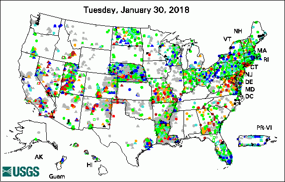
- Current conditions in USGS groundwater level network sites that have been monitored in the last 13 months, through USGS Groundwater Watch
- USGS groundwater models published since October 1, 2016, in data.gov
- Over 8,000 USGS borehole geophysics logs, in the USGS GeoLog Locator
- Groundwater quality data, through the Water Quality Portal
USGS Groundwater-Related Publications

The USGS Active Groundwater Level Network includes about 20,000 wells that have been measured by the USGS or USGS cooperators at least once within the past 13 months. The animation shows a daily snapshot of water-level statistics in the network for February 2018. Credit: USGS. The image is in the public domain.
General introduction for the "National field manual for the collection of water-quality data" (02/28/18)
Groundwater quality in the North San Francisco Bay shallow aquifer, California (02/26/18)
Status and understanding of groundwater quality in the North San Francisco Bay Shallow Aquifer study unit, 2012; California GAMA Priority Basin Project (ver. 1.1, February 2018) (02/26/18)
Groundwater conditions in Georgia, 2015-16 (02/22/18)
Variability in soil-water retention properties and implications for physics-based simulation of landslide early warning criteria (02/20/18)
Volume-weighted particle-tracking method for solute-transport modeling; Implementation in MODFLOW-GWT (02/16/18)
Phytoforensics: Trees as bioindicators of potential indoor exposure via vapor intrusion (02/16/18)
Characterizing the subsurface geology in and around the U.S. Army Camp Stanley Storage Activity, south-central Texas (02/16/18)
Distribution of effluent injected into the Boulder Zone of the Floridan aquifer system at the North District Wastewater Treatment Plant, southeastern Florida, 1997-2011 (02/12/18)
Assessment of water resources and the potential effects from oil and gas development in the Bureau of Land Management Tri-County planning area, Sierra, Doña Ana, and Otero Counties, New Mexico (02/07/18)
Accommodating state shifts within the conceptual framework of the wetland continuum (02/06/18)
Regional variability of nitrate fluxes in the unsaturated zone and groundwater, Wisconsin, USA (02/22/18)
Relations between total phosphorus and orthophosphorus concentrations and rainfall, surface-water discharge, and groundwater levels in Big Cypress Seminole Indian Reservation, Florida, 2014-16 (02/07/18)
The Colorado River and its deposits downstream from Grand Canyon in Arizona, California, and Nevada (02/05/18)
The suitability of using dissolved gases to determine groundwater discharge to high gradient streams (02/07/18)
Assessing intrinsic and specific vulnerability models ability to indicate groundwater vulnerability to groups of similar pesticides: A comparative study (02/07/18)
Hydrogeologic controls and geochemical indicators of groundwater movement in the Niles Cone and southern East Bay Plain groundwater subbasins, Alameda County, California (02/07/18)
Maps showing predicted probabilities for selected dissolved oxygen and dissolved manganese threshold events in depth zones used by the domestic and public drinking water supply wells, Central Valley, California (02/01/18)
Control of landslide volume and hazard by glacial stratigraphic architecture, Northwest Washington state, USA (02/08/18)
USGS Groundwater-Related Software Updates and New Releases
- FloPy v 3.2.9: Python package for creating, running, and post-processing MODFLOW-based models
USGS Groundwater Flow and Transport Model Data Releases
Note: The following links take you to data.gov
MODFLOW-NWT model used to evaluate potential effects of alterations to the hydrologic system in the vicinity of Long Lake, Indiana Dunes National Lakeshore, near Gary, Indiana
MODFLOW-LGR data sets for the Great Basin carbonate and alluvial aquifer system model version 3.0: Revisions in southwestern Utah and east central Nevada
GSFLOW groundwater/surface-water model 2016 update for the Trout Lake Watershed
Field Photo
Did you know USGS scientists use ambient seismic noise, such as microtremors induced by wind, ocean waves, and human activity, to study the earth? By analyzing these seismic data, scientists can estimate unconsolidated sediment thickness, map the bedrock surface, and infer fault locations. This information is used to improve our understanding of subsurface geology and how it affects groundwater flow. This is one of many scientific methods USGS scientists are using to study the Washita River alluvial aquifer in Oklahoma. In the photo, scientists are preparing a seismometer (the red box) to measure this seismic noise.
![[ Photo of scientists preparing to deploy a seismometer ]](images/field/20180301_OK_WashitaReach_DSCN0406.jpg "Photo of scientists preparing to deploy a seismometer")
Credit: USGS. Photo is in the public domain. Click on photo for larger version.
