USGS Groundwater Information
|
USGS Groundwater Information > October 01, 2017 Highlights USGS Monthly Groundwater News and Highlights: October 01, 2017Subscribe and get the latest USGS groundwater news and science sent to your inbox every month! Featured Product: Annual estimates of recharge, quick-flow runoff, and ET for the contiguous U.S.![Map: Annual average effective recharge [ Map: Annual average effective recharge ]](images/feature/20171001_ReitzEtAlFig7B.jpg)
Annual average effective recharge values for the 2000-2013 time period. This total value reflects the total water available to recharge the groundwater table and supply discharge into streams as baseflow. Source: Reitz and others, Figure 7B. A new USGS study presents new data-driven, annual estimates of the division of precipitation into the recharge, quick-flow runoff, and evapotranspiration (ET) water budget components for 2000-2013 for the contiguous United States (CONUS). Comparisons of recharge estimates with groundwater extraction data show that in 15% of the country, groundwater is being extracted at rates higher than the local recharge. These maps are expected to provide reliable first-order estimates of these hydrologic parameters, even where field measurements are sparse. Download the journal article to learn more. USGS Groundwater-Related Press Releases 
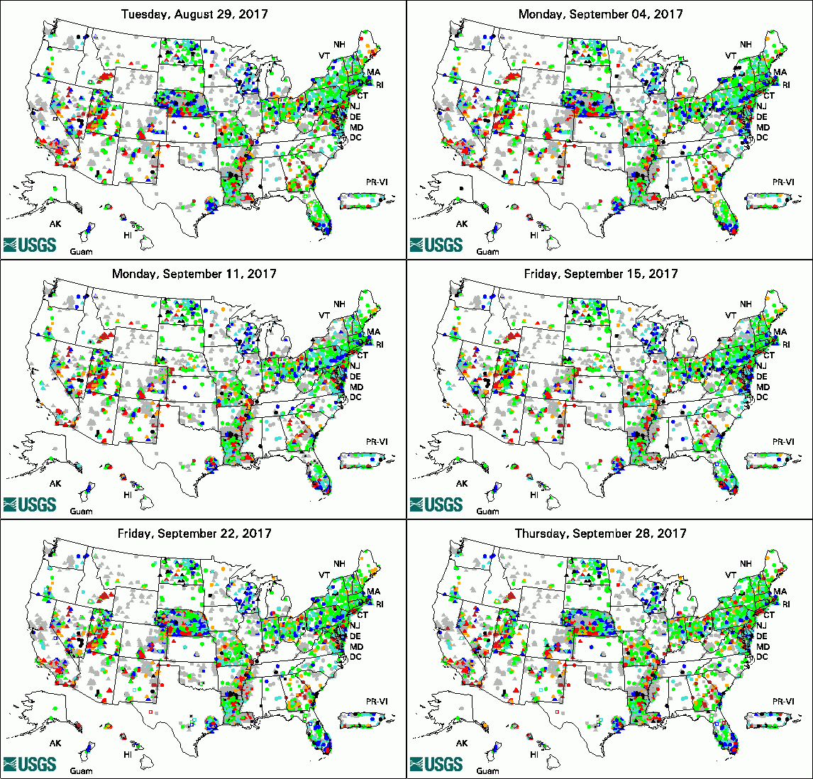
The USGS Active Groundwater Level Network includes about 20,000 wells that have been measured by the USGS or USGS cooperators at least once within the past 13 months. The animation shows a daily snapshot of water-level statistics in the network for September 2017. Credit: USGS. The image is in the public domain. Groundwater Modeling Software MODFLOW 6 Now Available (09/26/17) USGS to Conduct Dye Tracer and Aerial Mapping Surveys on Kootenai River (09/18/17) Borehole Geophysical Logs Now Easily Accessible through new USGS Online Map (09/13/17) USGS Seeks National Ground-Water Monitoring Network Proposals for 2018 (09/08/17) Groundwater Pumping, Precipitation Can Affect Lake Levels in Twin Cities (09/06/17)
USGS Groundwater-Related PublicationsUsing models to identify the best data: An example from northern Wisconsin (09/25/17) Atoll groundwater movement and its response to climatic and sea-level fluctuations (09/13/17) The role of alluvial aquifer sediments in attenuating a dissolved arsenic plume (09/08/17) Climate variability and vadose zone controls on damping of transient recharge (09/05/17)
USGS Groundwater-Related Software Updates and New Releases
USGS Groundwater Flow and Transport Model Data ReleasesNote: The following links take you to data.gov Field PhotoUSGS collects groundwater data across the Nation. Did you know that USGS collects near real-time water-level data from over 1700 wells across the United States? At these wells, real-time data are transmitted continuously from a well to the USGS by satellite or telephone at least once per day. Real-time data reflect current groundwater conditions in the well. This photo shows a USGS well and telemetry equipment in Osage County, Oklahoma. Archive of Past Highlights: |