USGS - science for a changing world

USGS Groundwater Information

*  Home *  Monthly Highlights *  Data & Information *  Publications *  Methods & Modeling *  Selected Topics *  Programs *  About *  Contact Us

USGS Groundwater Information > July 5, 2017 Highlights


USGS Monthly Groundwater News and Highlights: July 5, 2017

Subscribe and get the latest USGS groundwater news and science sent to your inbox every month!


Featured Product: High Plains Aquifer Groundwater Levels Continue to Decline

 [ Map: High Plains aquifer water-level changes, predevelopment (about 1950) to 2015. ]

High Plains aquifer water-level changes, predevelopment (about 1950) to 2015. Source: Figure 1 from USGS SIR 2017-5040.

The USGS has released a new report detailing changes of groundwater levels in the High Plains aquifer. The report presents water-level change data in the aquifer for two separate periods: from 1950 -- the time prior to significant groundwater irrigation development -- to 2015, and from 2013 to 2015. The change in storage for the 2013 to 2015 comparison period was a decline of 10.7 million acre-feet, which is about 30 percent of the change in recoverable water in storage calculated for the 2011 to 2013 comparison period. The smaller decline for the 2013 to 2015 comparison period is likely related to reduced groundwater pumping.

Learn more:


USGS Groundwater-Related Press Releases
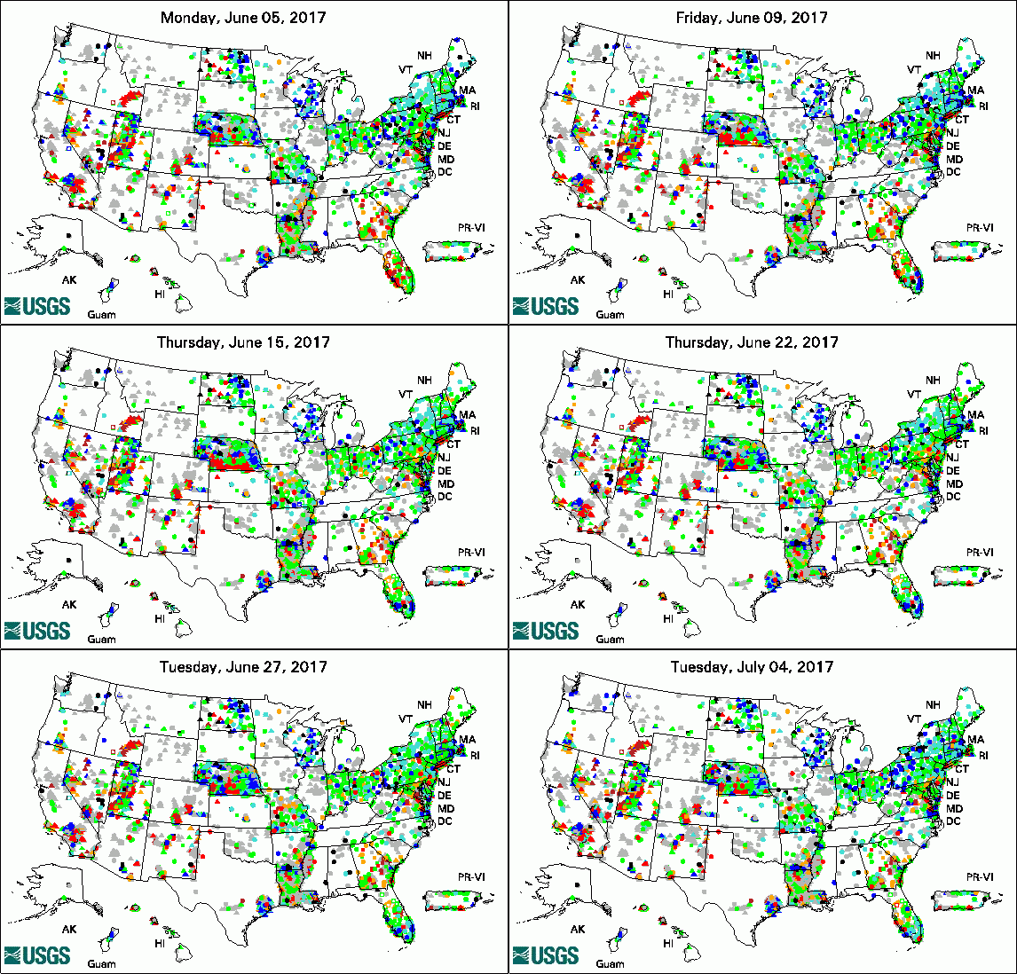
Animation of Groundwater Watch Active Water Level Network, 30 days
legend

The USGS Active Groundwater Level Network includes about 20,000 wells that have been measured by the USGS or USGS cooperators at least once within the past 13 months. The animation shows a daily snapshot of water-level statistics in the network for June 2017. Credit: USGS. The image is in the public domain.

Human Activity Alters Streamflow Throughout Kansas (06/26/17)

USGS: High Plains Aquifer Groundwater Levels Continue to Decline (06/16/17)

New USGS Science Plan Designed to Help Plan for Drought Effects on People, Communities, and Ecosystems (06/05/17)


USGS Groundwater-Related Publications

Response of deep groundwater to land use change in desert basins of the Trans-Pecos region, Texas, USA: Effects on infiltration, recharge, and nitrogen fluxes (06/30/17)

A hybrid machine learning model to predict and visualize nitrate concentration throughout the Central Valley aquifer, California, USA (06/28/17)

Optimal hydrograph separation using a recursive digital filter constrained by chemical mass balance, with application to selected Chesapeake Bay watersheds (06/26/17)

Highlighting the complexities of a groundwater pilot study during an avian influenza outbreak: Methods, lessons learned, and select contaminant results (06/26/17)

Streamflow alteration at selected sites in Kansas (06/26/17)

Groundwater quality in the Bear Valley and Lake Arrowhead Watershed, California (06/22/17)

Status and understanding of groundwater quality in the Bear Valley and Lake Arrowhead Watershed Study Unit, 2010: California GAMA Priority Basin Project (06/22/17)

Geophysics- and geochemistry-based assessment of the geochemical characteristics and groundwater-flow system of the U.S. part of the Mesilla Basin/Conejos-Mèdanos aquifer system in Doña Ana County, New Mexico, and El Paso County, Texas, 2010-12 (06/23/17)

Relationship between water and aragonite barium concentrations in aquaria reared juvenile corals (06/13/17)

Groundwater resources of the Devils Postpile National Monument -- Current conditions and future vulnerabilities (06/16/17)

Archaeal diversity and CO2 fixers in carbonate-/siliciclastic-rock groundwater ecosystems (06/30/17)

Synoptic sampling and principal components analysis to identify sources of water and metals to an acid mine drainage stream (06/12/17)

Groundwater quality in the western San Joaquin Valley, California (06/22/17)

Hydrogeologic framework and hydrologic conditions of the Piney Point aquifer in Virginia (06/07/17)

Depletion mapping and constrained optimization to support managing groundwater extraction (06/07/17)

Effects of changes in pumping on regional groundwater-flow paths, 2005 and 2010, and areas contributing recharge to discharging wells, 1990-2010, in the vicinity of North Penn Area 7 Superfund site, Montgomery County, Pennsylvania (06/06/17)

Evaluation of long-term trends in hydrologic and water-quality conditions, and estimation of water budgets through 2013, Chester County, Pennsylvania (06/02/17)

Methane and benzene in drinking-water wells overlying the Eagle Ford, Fayetteville, and Haynesville Shale hydrocarbon production areas (06/20/17)

Water-level and recoverable water in storage changes, High Plains aquifer, predevelopment to 2015 and 2013-15 (06/01/17)

Poly- and perfluoroalkyl substances in contaminated groundwater, Cape Cod, Massachusetts, 2014-2015 (06/28/17)

Hydrogeologic framework and selected components of the groundwater budget for the upper Umatilla River Basin, Oregon (06/01/17)

Measuring surface-water loss in Honouliuli Stream near the 'Ewa Shaft, O'ahu, Hawai'i (06/22/17)

Avian influenza virus RNA in groundwater wells supplying poultry farms affected by the 2015 influenza outbreak (06/29/17)


USGS Groundwater-Related Software Updates and New Releases

USGS Groundwater Flow and Transport Model Data Releases

Note: The following links take you to data.gov

MODFLOW-2000 and MODPATH5 model data sets used to evaluate the effects of changes in pumping on regional groundwater-flow paths, 2005 and 2010, and areas contributing recharge to discharging wells, 1990-2010, in the vicinity of North Penn Area 7 Superfund site, Montgomery County, Pennsylvania

Model data for pore network modeling of the electrical signature of solute transport in dual-domain media, U.S. Geological Survey data release


Field Photos

During the cold Alaska winters, groundwater discharging in springs at the ground surface freezes, causing thick accumulations of ice called aufeis in areas with permafrost. Scientists from the USGS Office of Groundwater, Branch of Geophysics and the Crustal Geophysics and Geochemistry Science Center are using geophysics to study aufeis features, including potential thawed zones beneath. Geophysical tools provide us with noninvasive ways to see through ice and the earth, much like how medical imaging lets us see inside the human body. In these photos from April 2017, USGS Research Hydrologists Neil Terry and Martin Briggs collect ground-penetrating radar (GPR) data. Using hydrogeophysical tools such as GPR enables scientists to collect images of the structure and conditions of the ice below them. Learn more about this project and see more photos.


 [ Photo: Scientist operates equipment console while towing GPR on ice. ]

Credit: USGS. Photo is in the public domain. Click on photo for larger version.

 [ Photo: Scientist tows GPR over ice. ]

Credit: USGS. Photo is in the public domain. Click on photo for larger version.


Archive of Past Highlights:

Past monthly summaries are available online.


USGS Home Water Climate and Land Use Change Core Science Systems Ecosystems Energy and Minerals Environmental Health Natural Hazards

Accessibility FOIA Privacy Policies and Notices

USA.gov logo U.S. Department of the Interior | U.S. Geological Survey
URL: http://water.usgs.gov/ogw/highlights/2017-07-05.html
Page Contact Information: Contact the USGS Office of Groundwater
Page Last Modified: Wednesday, 05-Jul-2017 16:48:58 EDT