USGS Monthly Groundwater News and Highlights: April 3, 2017
Subscribe and get the latest USGS groundwater news and science sent to your inbox every month!
Featured Product: USGS Groundwater Model Data Releases
![[ Screenshot of data.gov ]](images/feature/201704_data.gov.jpg "Sample screenshot of part of data.gov catalog of USGS groundwater models.")
USGS groundwater models released since October 1, 2016 can be found by searching data.gov for "usgsgroundwatermodel". Image is in the public domain.
Did you know that all groundwater models from new USGS publications released since October 1, 2016, are now available online for easy access and download? Making all USGS groundwater models available online:
- Supports USGS's obligation to fully share our data and interpretive products as part of the USGS public access plan and U.S. federal government open science and open data efforts.
- Serves model data sets from one location in a consistent format that can be easily located and downloaded by anyone with a computer, including State and Federal agencies, hydrology students, and consultants.
- Allows anyone with groundwater modeling experience to download the files, run the model, and make adjustments to evaluate possible future conditions.
- Provides a starting point to build upon for future model development by USGS, our Cooperators, and the public.
USGS Groundwater-Related Press Releases
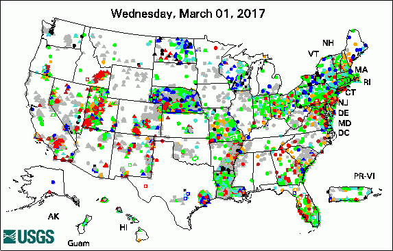

The USGS Active Groundwater Level Network includes about 20,000 wells that have been measured by the USGS or USGS cooperators at least once within the past 13 months. The animation shows a daily snapshot of water-level statistics in the network for March 2017. Credit: USGS. The image is in the public domain.
20 Years Researching Harmful Algal Blooms Supports Sustainable Water Supply in Wichita (03/31/17)
Public Invitation: The State of Your State's Vital Water Resources (03/27/17)
Helping Desert Communities Find Hidden Water (03/27/17)
How Well Do You Know Groundwater (03/09/17)
Understanding Managed Aquifer Recharge as a Water Storage Option in the Pojoaque River Basin (03/08/17)
Worth the Weight: New Table Aims to Clarify Variable Atomic Weight Values (03/07/17)
The Challenge of Tracking Nutrient Pollution 2,300 Miles (03/06/17)
USGS Finds Elevated Levels of Arsenic, Radon, Methane in Some Private Wells in Lycoming County, Pennsylvania (03/06/17)
Human, Cattle Viruses Detected in Some Great Lakes Tributaries (03/02/17)
USGS Groundwater-Related Publications
Neonicotinoid insecticide removal by prairie strips in row-cropped watersheds with historical seed coating use (03/29/17)
Hydrology and numerical simulation of groundwater flow and streamflow depletion by well withdrawals in the Malad-Lower Bear River Area, Box Elder County, Utah (03/29/17)
Geophysical logging and thermal imaging near the Hemphill Road TCE National Priorities List Superfund site near Gastonia, North Carolina (03/31/17)
Kansas Water Science Center bookmark (03/27/17)
County-level estimates of nitrogen and phosphorus from animal manure for the conterminous United States, 2007 and 2012 (03/27/17)
Decreased runoff response to precipitation, Little Missouri River Basin, northern Great Plains, USA (03/23/17)
Estimated dissolved-solids loads and trends at selected streams in and near the Uinta Basin, Utah, Water Years 1989-2013 (03/24/17)
Vertebrate paleontology, stratigraphy, and paleohydrology of Tule Springs Fossil Beds National Monument, Nevada (USA) (03/16/17)
Functional traits and ecological affinities of riparian plants along the Colorado River in Grand Canyon (03/15/17)
Ascii grids of predicted pH in depth zones used by domestic and public drinking water supply depths, Central Valley, California (03/10/17)
Groundwater-quality data in 12 GAMA study units: Results from the 2006-10 initial sampling period and the 2008-13 trend sampling period, California GAMA Priority Basin Project (03/10/17)
Geology and mining history of the Southeast Missouri Barite District and the Valles Mines, Washington, Jefferson, and St. Francois Counties, Missouri (03/09/17)
Predicted pH at the domestic and public supply drinking water depths, Central Valley, California (03/09/17)
Vertical datum conversion process for the inland and coastal gage network located in the New England, Mid-Atlantic, and South Atlantic-Gulf hydrologic regions (03/08/17)
Prediction and visualization of redox conditions in the groundwater of Central Valley, California (03/07/17)
Enhanced and updated spatially referenced statistical assessment of dissolved-solids load sources and transport in streams of the Upper Colorado River Basin (03/08/17)
Groundwater quality for 75 domestic wells in Lycoming County, Pennsylvania, 2014 (03/06/17)
Water resources of the Southern Hills regional aquifer system, southeastern Louisiana (03/06/17)
Land-use change and managed aquifer recharge effects on the hydrogeochemistry of two contrasting atoll island aquifers, Roi-Namur Island, Republic of the Marshall Islands (03/27/17)
Partitioning evapotranspiration into green and blue water sources in the conterminous United States (03/08/17)
Regional water table (2014) in the Mojave River and Morongo Groundwater Basins, southwestern Mojave Desert, California (03/31/17)
Use of multiple age tracers to estimate groundwater residence times and long-term recharge rates in arid southern Oman (03/24/17)
Paleogeographic implications of Late Miocene lacustrine and nonmarine evaporite deposits in the Lake Mead region: Immediate precursors to the Colorado River (03/02/17)
USGS Groundwater Flow and Transport Model Data Releases
Note: The following links take you to data.gov
MODFLOW-2000 model used in the simulation of reclaimed-water injection and pumping scenarios and particle-tracking analysis near Mount Pleasant, South Carolina: U.S. Geological Survey data release
MODFLOW-2005 and PEST models used to simulate multiple-well aquifer tests and characterize hydraulic properties of volcanic rocks in Pahute Mesa, Nevada
MODFLOW-NWT groundwater flow model used to evaluate conditions in the Northern High Plains Aquifer in Colorado, Kansas, Nebraska, South Dakota, and Wyoming: U.S. Geological Survey data release
Field Photo:
The USGS studies groundwater quality around the Nation. In this photo, USGS Hydrographer Jessica Anderson collects a water-chemistry sample from Pigeon Spring near Snake Gulch, Arizona, in February 2017. A recent USGS study found that uranium in Pigeon Spring was likely not related to nearby mining activity. The sampling was conducted as part of USGS studies to better understand the potential impacts of uranium mining activities on cultural, biological, and water resources near Grand Canyon National Park. To learn more, see the original USGS research article.

Credit: USGS/Jamie Macy. Photo is in the public domain. Click on photo for larger version.
