USGS Groundwater Information
|
USGS Groundwater Information > March 1, 2017 Highlights USGS Monthly Groundwater News and Highlights: March 1, 2017Subscribe and get the latest USGS groundwater news and science sent to your inbox every month! Featured Product: Saltwater intrusion in the Floridan aquifer system near downtown Brunswick, Georgia, 1957-2015![Chloride concentrations over time. [ Map of Chloride concentration in the upper water-bearing zone of the Upper Floridan aquifer in Brunswick, Georgia. ]](images/feature/20170301_ofr20171010.jpg)
Chloride concentration in the upper water-bearing zone of the Upper Floridan aquifer in Brunswick, Georgia. Source: Figure 1, USGS OFR 2017-1010. Credit: USGS. Image is in the public domain. Groundwater pumping can reduce freshwater flow toward coastal discharge areas and cause saltwater to be drawn toward the freshwater zones of an aquifer. Saltwater intrusion decreases freshwater storage in aquifers, and, in extreme cases, can result in the abandonment of supply wells. The Floridan Aquifer System covers approximately 100,000 square miles in Florida and portions of Georgia, Alabama, Mississippi, and South Carolina. The Upper Floridan aquifer has become a major source of water supply along coastal Georgia, including Glynn County and the city of Brunswick. Saltwater was first detected in the Floridan Aquifer System in wells near the southern part of the city of Brunswick in late 1957. By the 1970s, a plume of groundwater with high chloride concentrations had migrated northward toward two major industrial pumping centers, and since 1965, chloride concentrations have steadily increased in the northern part of the city. A recent USGS study compared historical and current groundwater conditions to better understand this saltwater intrusion and to provide data water resource managers can use to inform management of local drinking water supplies. Learn more in the recent USGS report. USGS Groundwater-Related Press Releases 
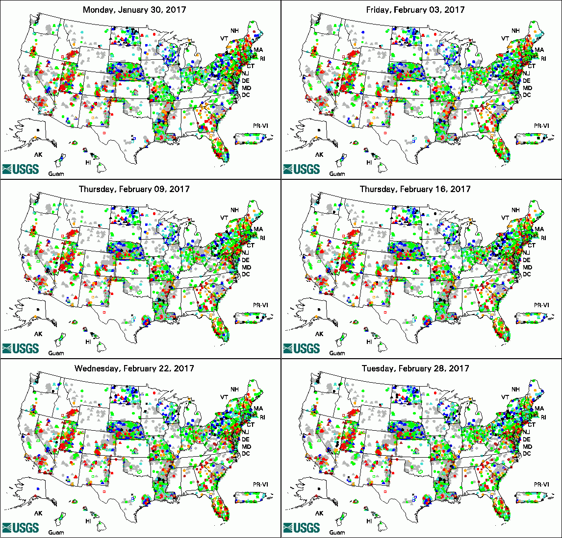
The USGS Active Groundwater Level Network includes about 20,000 wells that have been measured by the USGS or USGS cooperators at least once within the past 13 months. The animation shows a daily snapshot of water-level statistics in the network for February 2017. Credit: USGS. The image is in the public domain. USGS Releases New JavaScript Library for Plotting Water Data for the Nation (02/08/17)
USGS Groundwater-Related PublicationsWater resources of Iberia Parish, Louisiana (02/27/17) Water resources of Concordia Parish, Louisiana (02/27/17) Water resources of Catahoula Parish, Louisiana (02/24/17) Water quality data for national-scale aquatic research: The Water Quality Portal (02/15/17) Thickness of the surficial aquifer, Delmarva Peninsula, Maryland and Delaware (02/14/17) Geologic map of Great Sand Dunes National Park, Colorado (02/16/17) Dating base flow in streams using dissolved gases and diurnal temperature changes (02/28/17)
USGS Groundwater-Related Software Updates and New Releases
Field Photo:Did you know that USGS scientists use UAS (unoccupied aerial systems) as an efficient, safe, and cost-effective remote sensing tool for science? Researchers are engaged in UAS and sensor technology evaluations and the performance of proof-of-concept missions to test the effectiveness of UAS data collection for monitoring environmental conditions and supporting resource management. In this photo, Department of Interior Geographer John Vogel (left) and USGS hydrologist Bob Stogner (right) prepare to fly a small UAS in a recent training on how to use small UAS safely. Stogner is preparing to use small UAS for USGS Colorado Water Science Center studies, including to assess groundwater discharge to streams. Vogel is an instructor in the course from Interior's Office of Aviation Services. Archive of Past Highlights: |