USGS Groundwater Information
|
USGS Groundwater Information > December 1, 2016 Highlights USGS Monthly Groundwater News and Highlights: December 1, 2016Subscribe and get the latest USGS groundwater news and science sent to your inbox every month! Featured Product: Ozark Plateaus Groundwater Availability StudyUSGS scientists recently completed a multi-year regional groundwater availability study of the Ozark Plateaus Aquifer System to understand current groundwater resources and to evaluate how those resources have changed over time. The Ozark Plateaus aquifer system underlies parts of southern Missouri, southeastern Kansas, northwestern Arkansas, and northeastern Oklahoma. Groundwater in the Ozarks Plateau plays an important part in supporting societal needs and local ecosystems. The USGS study provides the tools needed to simulate groundwater system response to future human and environmental stresses, including climate change. The results of the study are available for use by federal, state and local agencies to inform the evaluation and design of existing and new groundwater monitoring networks and other water-resource management decisions. Learn more: USGS Groundwater-Related Press Releases 
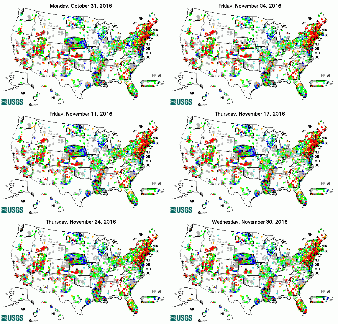
The USGS Active Groundwater Level Network includes about 20,000 wells that have been measured by the USGS or USGS cooperators at least once within the past 13 months. The animation shows a daily snapshot of water-level statistics in the network for November 2016. Credit: USGS. The image is in the public domain. Schmidt is New Deputy Director of USGS Idaho Water Science Center (11/28/16) SF Bay-Delta Conference: Science for Solutions (11/15/16) Media Advisory: SF Bay-Delta Conference - Science for Solutions (11/09/16) Study to Uncover Yellowstone's Subsurface Mysteries (11/03/16)
USGS Groundwater-Related PublicationsHydrogeology and hydrologic conditions of the Ozark Plateaus aquifer system (11/29/16) Water resources of West Baton Rouge Parish, Louisiana (11/23/16) Patterns of diel variation in nitrate concentrations in the Potomac River (11/16/16) Potash--A vital agricultural nutrient sourced from geologic deposits (11/15/16) Groundwater quality in the Lake Champlain and Susquehanna River basins, New York, 2014 (11/04/16) Hydrogeologic framework of LaSalle County, Illinois (11/01/16)
USGS Groundwater Flow and Transport Model Data ReleasesNote: The following links take you to data.gov MODFLOW-NWT 2016 groundwater flow model for Dane County, Wisconsin (11/23/2016) Field Photo:In these photos, USGS scientist John Lane uses geophysical equipment to study the distribution of fresh groundwater at Palmyra Atoll National Wildlife Refuge (NWR) in the central Pacific Ocean. Dr. Lane (Chief, USGS Office of Groundwater, Branch of Geophysics) installed seismometers and operated time-domain electromagnetic induction equipment as part of an ongoing USGS study to better understand fresh groundwater response to long- and short-term climatic patterns (e.g., climate change, El Niño). Surface geophysical measurements were collected next to shallow groundwater wells (white standpipes) installed by John and Marty Briggs in 2013, where ongoing time series of water-quality data are logged. Improved understanding of these systems can be used by NWR resource managers to inform decisions about how to protect and preserve sensitive habitats. The lessons learned on Palmyra can also be applied to other atolls with larger human populations to inform plans to manage important drinking-water supplies and ecological systems. Archive of Past Highlights: |