USGS - science for a changing world

USGS Groundwater Information

*  Home *  Monthly Highlights *  Data & Information *  Publications *  Methods & Modeling *  Selected Topics *  Programs *  About *  Contact Us

USGS Groundwater Information > November 1, 2016 Highlights


USGS Monthly Groundwater News and Highlights: November 1, 2016

Featured Product: 100 Years of Los Angeles Groundwater Replenishment

 [ Diagram of study area. ]

A new USGS study offers the most sophisticated analyses to date on how Los Angeles-area groundwater supplies are replenished. The analyses provide water managers with a clearer understanding of the sources and amount of available groundwater in the region -- information that is important for planning and management of the vital resource. Learn more:


USGS Groundwater-Related Press Releases

Animation of Groundwater Watch Active Water Level Network, 30 days
legend

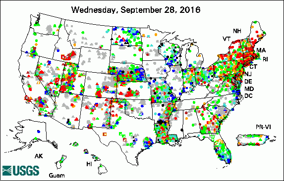
The USGS Active Groundwater Level Network includes about 20,000 wells that have been measured by the USGS or USGS cooperators at least once within the past 13 months. The animation shows a daily snapshot of water-level statistics in the network for October 2016. Credit: USGS. The image is in the public domain.

USGS Seeks National Ground-Water Monitoring Network Proposals for 2017 (October 27, 2016)

Water-Level Changes in Northeast Twin Cities Lakes Vary with Landscape Setting (October 19, 2016)

Where Does it Go? New Method Evaluates Fate of Methane Released into Streams (October 17, 2016)

Scientists Assess 100 years of Los Angeles Groundwater Replenishment (October 17, 2016)

Large Precipitation Events are Critical in Replenishing Groundwater Resources (October 11, 2016)


USGS Groundwater-Related Publications

Bedrock Morphology and Structure, Upper Santa Cruz Basin, South-Central Arizona, with Transient Electromagnetic Survey Data (10/31/16)

Time-lapse gravity data for monitoring and modeling artificial recharge through a thick unsaturated zone (10/31/16)

Groundwater response to the 2014 pulse flow in the Colorado River Delta (10/31/16)

Hydrogeologic Framework of LaSalle County, Illinois (10/31/16)

Water-level data for the Albuquerque Basin and adjacent areas, central New Mexico, period of record through September 30, 2015 (10/27/16)

A history of the 2014 Minute 319 environmental pulse flow as documented by field measurements and satellite imagery (10/25/16)

Assessment of hydrogeologic terrains, well-construction characteristics, groundwater hydraulics, and water-quality and microbial data for determination of surface-water-influenced groundwater supplies in West Virginia (10/24/16)

Simulated effects of groundwater withdrawals from aquifers in Ocean County and vicinity, New Jersey (10/21/16)

Geologic map of Great Sand Dunes National Park, Colorado (10/25/16)

Water levels and groundwater and surface-water exchanges in lakes of the northeast Twin Cities Metropolitan Area, Minnesota, 2002 through 2015 (10/19/16)

Statistical analysis of lake levels and field study of groundwater and surface-water exchanges in the northeast Twin Cities Metropolitan Area, Minnesota, 2002 through 2015: Chapter A of Water levels and groundwater and surface-water exchanges in lakes of the northeast Twin Cities Metropolitan Area, Minnesota, 2002 through 2015 (10/27/16)

Estimating spatially and temporally varying recharge and runoff from precipitation and urban irrigation in the Los Angeles Basin, California (10/18/16)

Triennial changes in groundwater quality in aquifers used for public supply in California: Utility as indicators of temporal trends (10/11/16)

Water-level altitudes 2016 and water-level changes in the Chicot, Evangeline, and Jasper aquifers and compaction 1973-2015 in the Chicot and Evangeline aquifers, Houston-Galveston region, Texas (10/07/16)

Effects of water-supply reservoirs on streamflow in Massachusetts (10/06/16)

Delineation of areas contributing groundwater to selected receiving surface water bodies for long-term average hydrologic conditions from 1968 to 1983 for Long Island, New York (10/05/16)

Characterization of fractures and flow zones in a contaminated crystalline-rock aquifer in the Tylerville section of Haddam, Connecticut (10/04/16)

Paleomagnetic correlation of basalt flows in selected coreholes near the Advanced Test Reactor Complex, the Idaho Nuclear Technology and Engineering Center, and along the southern boundary, Idaho National Laboratory, Idaho (10/04/16)

Status of groundwater quality in the Santa Barbara Study Unit, 2011: California GAMA Priority Basin Project (10/03/16)

Groundwater quality in the Santa Barbara Coastal Plain, California (10/04/16)

Benthic processes affecting contaminant transport in Upper Klamath Lake, Oregon (10/12/16)

Geologic structure of the Yucaipa area inferred from gravity data, San Bernardino and Riverside Counties, California (10/03/16)

MT3D-USGS version 1: A U.S. Geological Survey release of MT3DMS updated with new and expanded transport capabilities for use with MODFLOW (10/03/16)


USGS Groundwater-Related Software Updates and New Releases

MODPATH v7.1.00


USGS Groundwater Flow and Transport Model Data Releases

Note: The following links take you to data.gov

MODFLOW2005 model used to simulate the effects of groundwater withdrawals from aquifers in Ocean County and vicinity, New Jersey (October 26, 2016)

MODFLOW-2005 and MODPATH6 models used to delineate areas contributing groundwater to selected surface receiving waters for long-term average hydrologic stress conditions from 1968 to 1983, Long Island, New York (October 12, 2016)


Field Photo: Using Geophysics to Study Groundwater

In this photo, USGS scientists Eric White and Marty Briggs conduct field work in Alaska to improve our understanding of how groundwater and permafrost change across the seasons and due to climate change. White (left) is collecting radar, and Briggs (right) is collecting broadband electromagnetic induction data in the foothills of the Brooks Range in Alaska. The flowing water visible in the background is groundwater discharging at a spring. During the winter, the water from the spring freezes, causing thick accumulations of ice called aufeis.


Photo of scientists carrying geophysics equipment in the field

Credit: USGS. Photo is in the public domain. Click on photo for larger version.


Archive of Past Highlights:

Past monthly summaries are available online.


USGS Home Water Climate and Land Use Change Core Science Systems Ecosystems Energy and Minerals Environmental Health Natural Hazards

Accessibility FOIA Privacy Policies and Notices

USA.gov logo U.S. Department of the Interior | U.S. Geological Survey
URL: http://water.usgs.gov/ogw/highlights/2016-11-01.html
Page Contact Information: Contact the USGS Office of Groundwater
Page Last Modified: Tuesday, 01-Nov-2016 10:38:25 EDT