USGS Groundwater Information
|
USGS Groundwater Information > October 1, 2016 Highlights USGS Monthly Groundwater News and Highlights: October 1, 2016Featured Product: Northern Atlantic Coastal Plain Groundwater Availability Study![[ Diagram of study area. ]](images/feature/20161001-NACP-study-area.png "Diagram of study area. Click for larger image.")
Block diagram showing the Northern Atlantic Coastal Plain aquifer system, which includes the areas east of the Fall Line from Long Island to northern North Carolina. This multilayer system consists of confined aquifers and confining units capped by an unconfined, surficial aquifer. Groundwater flows predominantly from west to east from the Fall Line to the Atlantic Ocean, except where high-capacity pumping wells alter this regional flow pattern. Credit: USGS. Image is in the public domain. Groundwater is among the Nation's most important natural resources. It provides half our drinking water and is essential to the vitality of agriculture and industry, as well as to the health of rivers, wetlands, and estuaries throughout the country. The USGS is undertaking a series of regional groundwater availability studies to improve our understanding of groundwater availability in major aquifers across the Nation. The USGS Northern Atlantic Coastal Plain groundwater availability study focuses on improving fundamental knowledge of the water budget of this aquifer system, including the flows, storage, and use by humans and the environment. The study area extends from New York to North Carolina. An improved quantitative understanding of the aquifer system's water budget not only provides key information about water quantity, but also is essential for assessments of water quality and ecosystem health. The objectives of this study are:
To learn more about the USGS Northern Atlantic Coastal Plain Groundwater Availability study, visit: USGS Groundwater-Related Press Releases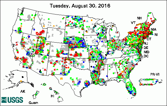 
The USGS Active Groundwater Level Network includes about 20,000 wells that have been measured by the USGS or USGS cooperators at least once within the past 13 months. The animation shows a daily snapshot of water-level statistics in the network for September 2016. Credit: USGS. The image is in the public domain.
USGS Groundwater-Related PublicationsPotential sources of analytical bias and error in selected trace element data-quality analyses Groundwater contaminant plume maps and volumes, 100-K and 100-N Areas, Hanford Site, Washington User guide for MODPATH Version 7 -- A particle-tracking model for MODFLOW Observations of nearshore groundwater discharge: Kahekili Beach Park submarine springs, Maui, Hawaii Sea-level rise and coastal groundwater inundation and shoaling at select sites in California, USA Custom map projections for regional groundwater models Assessing groundwater depletion and dynamics using GRACE and InSAR: Potential and limitations Science center capabilities to monitor and investigate Michigan's water resources, 2016 Sustainability of groundwater supplies in the Northern Atlantic Coastal Plain aquifer system Methods for exploring uncertainty in groundwater management predictions Fate of nutrients in shallow groundwater receiving treated septage, Malibu, CA
USGS Groundwater-Related Software Updates and New Releases
USGS Groundwater Flow and Transport Model Data ReleasesNote: The following links take you to data.gov Field Photo: Water quality and sampling at spring siteUnderstanding the interaction of groundwater and surface water is essential to water managers and hydrologists for the development of effective water-resource policy, protection, and management. Groundwater/surface-water interactions include the exchange of fluids and solutes, which can affect water quality and water supply. Groundwater is a major source of water to streams, lakes, and wetlands; surface water can also recharge (replenish) groundwater supplies. In this photo, water quality and sampling equipment are deployed at spring site near Roaring Judy, Colorado. Groundwater discharge that flows into the Upper Colorado River Basin varies in response to drought, which is likely due to aquifer systems that contain relatively young groundwater, according to a recent U.S. Geological Survey study. 
Credit: USGS. Photo is in the public domain. Click on photo for larger version. Archive of Past Highlights: |
![]() U.S. Department of the Interior |
U.S. Geological Survey
U.S. Department of the Interior |
U.S. Geological Survey
URL: http://water.usgs.gov/ogw/highlights/2016-10-01.html
Page Contact Information: Contact the USGS Office of Groundwater
Page Last Modified: Friday, 30-Sep-2016 13:47:12 EDT
