USGS Groundwater Information
|
USGS Groundwater Information > September 1, 2016 Highlights USGS Monthly Groundwater News and Highlights: September 1, 2016Featured Product: Simulation of climate change effects on streamflow, groundwater, and stream temperature using GSFLOW and SNTEMP in the Black Earth Creek Watershed, Wisconsin![Conceptual diagram of model layers. [ Conceptual diagram of model layers. ]](images/feature/2016-09-01_Fig1-2.png)
Black Earth Creek MODFLOW model layers, major hydrostratigraphic units, and stream cells. Source: USGS Scientific Investigation Report 2016-5091 USGS scientists create and apply computer programs to simulate or forecast groundwater flow conditions over time. Although groundwater and surface water are considered a single resource, many hydrologic models don't fully simulate the connections between groundwater systems and other hydrologic processes. USGS recently constructed a groundwater/surface-water model for the Black Earth Creek watershed in south-central Wisconsin using the computer code GSFLOW (Groundwater/Surface-water FLOW) to simulate hydrologic processes in the atmosphere, at land surface, in streams, within the soil zone, and in groundwater on a daily time step during water years 1985-2007. The model was then run to simulate scenarios representing common societal concerns in the basin, focusing on maintaining a cold-water resource in an urbanizing fringe near the upper stream reaches of Black Earth Creek and minimizing downstream flooding. Learn more about the project in the new report, Simulation of climate change effects on streamflow, groundwater, and stream temperature using GSFLOW and SNTEMP in the Black Earth Creek Watershed, Wisconsin Scientific Investigations Report 2016-5091. USGS Groundwater-Related Press Releases 
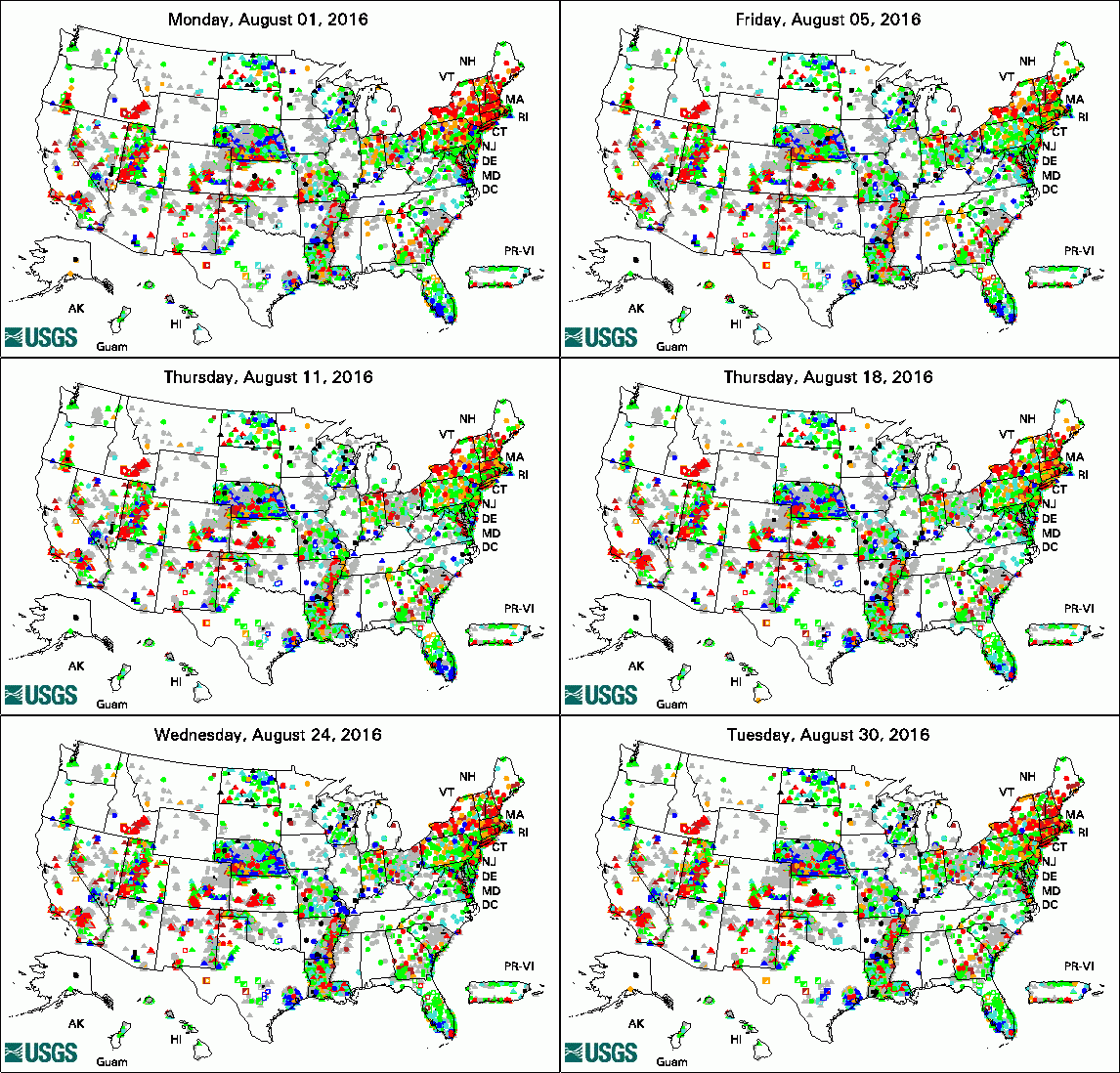
The USGS Active Groundwater Level Network includes about 20,000 wells that have been measured by the USGS or USGS cooperators at least once within the past 13 months. The animation shows a daily snapshot of water-level statistics in the network for August 2016. Credit: USGS. The image is in the public domain. Groundwater Sampling Method Key to Monitoring Success of Carbon Sequestration (August 29, 2016) More than a Century of USGS Water Quality Studies in National Parks (August 25, 2016) Water Levels Declining in Areas Along San Pedro River near Sierra Vista, Arizona (August 18, 2016) Indiana-Kentucky Spring-Summer 2016 Newsletter (August 8, 2016)
USGS Groundwater-Related PublicationsMethods for exploring uncertainty in groundwater management predictions Groundwater quality at the Saline Valley Conservancy District well field, Gallatin County, Illinois Geomorphological control on variably saturated hillslope hydrology and slope instability Changes in groundwater recharge under projected climate in the upper Colorado River basin
USGS Groundwater-Related Software Updates and New ReleasesField Photo: Scientists Never Stop LearningFor USGS scientists, learning doesn't stop when we leave school. We are constantly learning -- new tools, new scientific methods, and new science. Recently a group of USGS scientists took a a field class to learn more about groundwater and surface-water exchange at Lake Tahoe, California. USGS hydrologists are studying Lake Tahoe to gain an understanding of heat and nutrient transport through Lake Tahoe's shoreline environments. Participating scientists got a chance to see and try a variety of scientific instruments being used as part of this and related studies, including the broadband electromagnetic induction tool shown in the first photo below, demonstrated by USGS hydrologist Eric White. In the bottom photo below, USGS research hydrologist Ramon Naranjo introduces scientists to one of the field sites. Archive of Past Highlights: |