USGS Groundwater Information
|
USGS Groundwater Information > May 1, 2016 Highlights USGS Monthly Groundwater News and Highlights: May 1, 2016Featured Product: FloPy, a Python package for creating, running, and post-processing MODFLOW-based models![Example model image generated with FloPy [ Example model image generated with FloPy ]](images/feature/20160501-flopyfig2.png)
FloPy generated map showing inactive parts of the model, stream boundary conditions, and simulated head and groundwater-flow directions. From Bakker and others, 2016. Are you a groundwater modeler? Do you also code with Python? Then FloPy is for you! FloPy is a Python package that enables scientists to
For groundwater modelers, use of Python with its available scientific packages and FloPy facilitates
Perhaps the most important advantage of FloPy is that a script forms a record of the entire model construction process, which makes it transparent and reproducible. With FloPy
FloPy includes support for MODFLOW-2000, MODFLOW-2005, MODFLOW-NWT, MODPATH (version 6), MT3D and SEAWAT. USGS Groundwater-Related Press Releases 
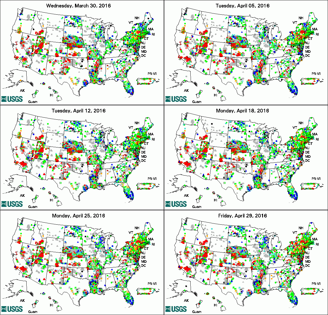
The USGS Active Groundwater Level Network includes about 20,000 wells that have been measured by the USGS or USGS cooperators at least once within the past 13 months. The animation shows a daily snapshot of water-level statistics in the network for April 2016. Credit: USGS. The image is in the public domain. Nitrogen in Lakes Connected to Groundwater (April 28, 2016) South Dakota Scientists Help Restore Water in Armenia (April 26, 2016) New Tool and Knowledge to Aid Columbia Basin Water Managers (April 4, 2016)
USGS Groundwater-Related PublicationsUrban hydrology -- Science capabilities of the U.S. Geological Survey Geologic map of the Rio Rico and Nogales 7.5' quadrangles, Santa Cruz County, Arizona Natural inactivation of Escherichia coli in anoxic and reduced groundwater Hydrologic monitoring for Chicago's Sustainable Streetscapes Program Normal streamflows and water levels continue -- Summary of hydrologic conditions in Georgia, 2014 Hydrologic Conditions in Kansas, water year 2015
Field Photo: Groundwater Modeling & LearningIn modern hydrogeology, not all of the work happens outside. Important work happens back at the office as scientists process, analyze, and share groundwater data and information. As part of this work, USGS scientists create computer programs to simulate or forecast groundwater flow conditions over time. In this photo, USGS scientists are participating in training on using Python (a computer programming language) in their groundwater modeling. The tools available to scientists change over time, as technology changes and improves. USGS scientists participate in ongoing formal and informal training throughout their careers to refine their scientific skills and to expand their expertise in scientific tools and methods that can be used in their daily work. Archive of Past Highlights: |