USGS Groundwater Information
|
USGS Groundwater Information > January 1, 2016 Highlights USGS Monthly Groundwater News and Highlights: January 1, 2016Featured Product: Understanding and Managing the Effects of Groundwater Pumping on Streamflow![[ Diagram of residual effects of streamflow depletion after pumping stops ]](images/2016-01-01_CIRC1376-fig32_600.png "Diagram of residual effects of streamflow depletion after pumping stops")
It is a common misconception that streamflow depletion stops when groundwater pumping stops. This diagram shows the residual effects of streamflow depletion after pumping stops. Wells that pump groundwater out of aquifers can reduce the amount of groundwater that flows into rivers and streams, which can have detrimental effects on aquatic ecosystems and the availability of surface water. Estimation of rates, locations, and timing of streamflow depletion due to groundwater pumping is needed for water-resource managers and users throughout the United States, but the complexity of groundwater and surface-water systems and their interactions presents a major challenge. The understanding of streamflow depletion and evaluation of water-management practices have improved during recent years through the use of computer models that simulate aquifer conditions and the effects of pumping groundwater on streams. Learn more: 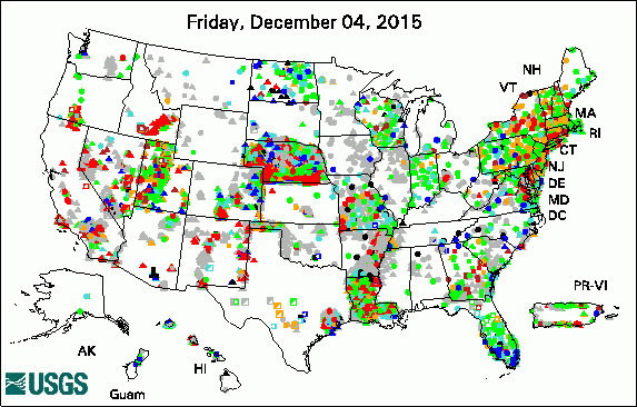 
The USGS Active Groundwater Level Network includes about 20,000 wells that have been measured by the USGS or USGS cooperators at least once within the past 13 months. The animation shows a daily snapshot of water-level statistics in the network for December 2015. Credit: USGS. The image is in the public domain. USGS Groundwater-Related PublicationsHydrogeology of the Owego-Apalachin Elementary School geothermal fields, Tioga County, New York Estimating natural recharge in San Gorgonio Pass watersheds, California, 1913-2012 Water use in Georgia by county for 2010 and water-use trends, 1985-2010 Hydrologic data for the Walker River Basin, Nevada and California, water years 2010-14 Potentiometric surface of the Catahoula aquifer in central Louisiana, 2013 smwrBase — An R package for managing hydrologic data, version 1.1.1 Sustainable groundwater management in California U.S. Geological Survey National Water Census: Colorado River Basin Geographic Focus Area Study Hydrogeochemistry of prairie pothole region wetlands: Role of long-term critical zone processes USGS Groundwater-Related Software Updates and New Releases
Field Photos:USGS scientists study the hydrogeology of geothermal fields around the United States. The insights gained during these studies can be beneficial for the design of the geothermal drilling program and protection of the overlying aquifer during construction. Our improved understanding of these important natural resources may also be useful for the development of future geothermal fields and other energy-related activities, such as drilling for oil and natural gas in similar fractured-bedrock settings. These field photos are from USGS science activities at two different study sites. 
Hydraulic-rotary and air-percussion drilling rigs and geophysical logging truck during construction and data collection at the Owego-Apalachin Elementary School geothermal fields, Tioga County, New York, August 11, 2014. Learn more about this study. Photo Credit: USGS/John Williams. Photo is in the public domain. Click on a photo for larger version.  Hydrogeophysical logging of a test hole at the edge of a Marcellus gas-well pad, Lycoming County, Pennsylvania, August 19, 2014. USGS scientists are holding a geophysical tool that will be lowered into a well. Note their safety gear, including hardhats, safety glasses, steel-toe boots, and fire-retardant coveralls. Photo Credit: USGS/John Williams. Photo is in the public domain. Click on a photo for larger version. Archive of Past Highlights: |
![]() U.S. Department of the Interior |
U.S. Geological Survey
U.S. Department of the Interior |
U.S. Geological Survey
URL: http://water.usgs.gov/ogw/highlights/2016-01-01.html
Page Contact Information: Contact the USGS Office of Groundwater
Page Last Modified: Wednesday, 06-Jan-2016 12:28:48 EST
