USGS Groundwater Information
|
USGS Groundwater Information > September 1, 2015 Highlights USGS Monthly Groundwater News and Highlights: September 1, 2015Featured Product: USGS Groundwater Technical Procedures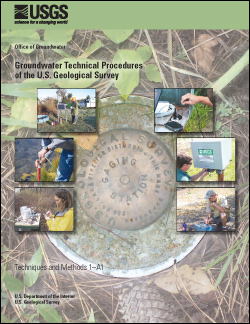
Groundwater Technical Procedures of theUSGS, Techniques and Methods 1-A1 To promote consistent and accurate collection of groundwater-level data and related field practices, USGS scientists use a common set of technical procedures. These procedures are used by the USGS as guidance for field work, standardization of measurements and other tasks, training of staff, and quality assurance. In response to the need for citable standardized technical procedures of the USGS, a report documenting some of the most common groundwater field procedures was published and is freely available for download online. These technical procedures provide step-by-step instructions, diagrams, sample field forms, and more. The report compiles techniques for groundwater-site establishment, well maintenance, water-level measurements, groundwater-discharge measurements, and single-well aquifer tests. Making these standards publicly available also allows hydrologists, technicians, and data managers from outside the USGS to reference techniques used by the USGS. The documents can also be used to provide a consistent set of training materials for those new to the routine aspects of groundwater-data collection and handling. Recently the USGS has also started to produce a companion set of groundwater technical procedure videos. In the videos, USGS hydrologists demonstrate the technical procedures in the field. Watch the example view below, which shows how to measure the depth to groundwater below land surface using a type of tape measure called an electric tape. Or, browse the growing collection of groundwater technical procedure videos. USGS Groundwater-Related Press Releases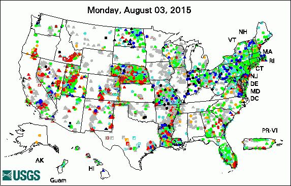 
The USGS Active Groundwater Level Network includes about 20,000 wells that have been measured by the USGS or USGS cooperators at least once within the past 13 months. The animation shows a daily snapshot of water-level statistics in the network for August 2015. Credit: USGS. The image is in the public domain. Media Advisory: Yes, Humans Really Are Causing Earthquakes -- Public Lecture USGS Groundwater-Related PublicationsChemical considerations for an updated National assessment of brackish groundwater resources A new temperature profiling probe for investigating groundwater-surface water interaction Modeling groundwater nitrate exposure for an agricultural health study cohort in Iowa Multimodel analysis of anisotropic diffusive tracer-gas transport in a deep arid unsaturated zone USGS Groundwater-Related Software Updates and New Releases
 Photo Credit: USGS/Colin Kikuchi. The photo is in the public domain. Field Photo:Scientists across the USGS use geophysical tools and methods to study groundwater. In this photo, USGS scientist Jeff Kennedy is setting up a tool to collect gravity measurements as part of a study on aquifer storage. Gravity is a measurement of mass: the greater an object's mass, the stronger its gravitational pull. By measuring changes in gravity over time, scientists estimate changes in mass. In hydrology, this can be used to study water in the subsurface. If the amount of groundwater in a particular area increases over time, gravity will also increase. Likewise, decreases in the amount of groundwater will cause gravity to decrease. The instruments need to be very sensitive, though, because the changes in gravity are very small. (Too small for a human to feel any change!) Learn about other examples of geophysical tools and methods applied to USGS groundwater studies. Archive of Past Highlights |
![]() U.S. Department of the Interior |
U.S. Geological Survey
U.S. Department of the Interior |
U.S. Geological Survey
URL: http://water.usgs.gov/ogw/highlights/2015-09-01.html
Page Contact Information: Contact the USGS Office of Groundwater
Page Last Modified: Wednesday, 28-Dec-2016 01:36:32 EST
