USGS Groundwater Information
|
USGS Groundwater Information > July 1, 2015 Highlights USGS Monthly Groundwater News and Highlights: July 1, 2015 
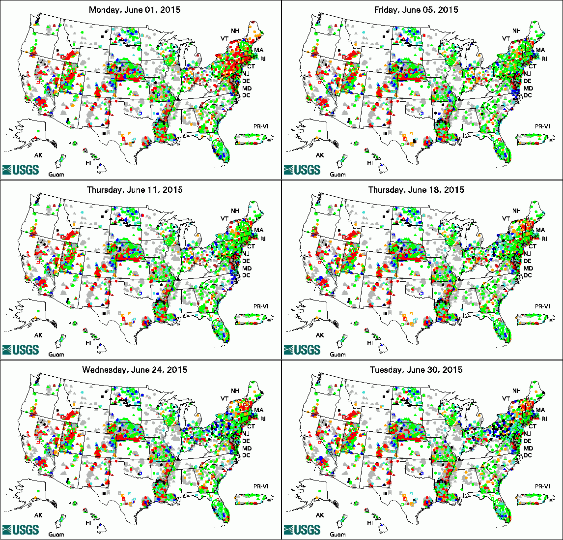
The animation shows a daily snapshot of water-level statistics in the USGS Active Groundwater Level Network during June 2015. Credit: USGS. The image is in the public domain. Featured Product: Groundwater Watch: USGS Groundwater NetworksThe USGS collects groundwater data from wells across the Nation as part of USGS investigations and programs. Groups of related wells are combined into networks at local, regional, or national levels to help us better understand groundwater conditions over a certain area and how those conditions change over time. Basic statistics about water-level data from these USGS networks are available through the USGS Groundwater Watch web site. The USGS Active Groundwater Level Network, shown in the map to the left, includes about 20,000 wells that have been measured by the USGS or USGS cooperators at least once within the past 13 months. USGS Groundwater-Related PublicationsProgress toward a National Water Census Hydrologic model of the Modesto Region, California, 1960-2004 Estimated water use in Arkansas, 2010 Accounting for groundwater in stream fish thermal habitat responses to climate change Framework for a hydrologic climate-response network in New England Water resources of St. James Parish, Louisiana USGS Groundwater-Related Press ReleasesWater Used for Hydraulic Fracturing Varies Widely Across United States Declining Water Levels Pose Challenges for Eastern Idaho Aquifer Monitoring New Screening Tool Protects Streams, Wetlands, and Residences From Landfill Risks Congressional Hearings, Briefings, and StatementsUSGS Groundwater-Related Software Updates and New ReleasesPhoto Credit: USGS/Micah Claypoole. The photo is in the public domain. Field Photo:Martin Briggs (Hydrologist, USGS OGW Branch of Geophysics) is shown guiding in a float plane for transportation from a native village in Fort Yukon, Alaska, to a remote lake which has recently been changing size, possibly as a result of climate change. The field work was part of USGS applied research to evaluate the use of new or emerging hydrogeophysical tools and methods to improve our understanding of groundwater/surface-water exchange. Learn more about geophysics for USGS groundwater/surface-water interaction studies. |