National Water-Quality Assessment (NAWQA) Project
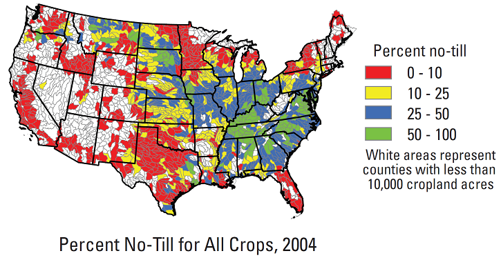
In cooperation with the Conservation Technology Information Center (CTIC), county-level tillage practices provided by the CTIC were aggregated to 8-digit hydrologic unit watersheds. Tillage systems include three types of conservation tillage (no-till, ridge-till, and mulch-till), reduced tillage, and intensive tillage. The dataset includes total planted acreage by tillage type for selected crops (corn, cotton, grain sorghum, soybeans, fallow, forage, newly established permanent pasture, spring and fall seeded small grains, and "other" crops for 1989-2004.
The USGS report and associated datasets can be accessed at: http://pubs.usgs.gov/ds/ds573/.