National Water-Quality Assessment (NAWQA) Project
The USGS implemented the National Water-Quality Assessment (NAWQA) Program in 1991 to develop long-term consistent and comparable information on streams, rivers, ground water, and aquatic systems in support of national, regional, State, and local information needs and decisions related to water-quality management and policy. The NAWQA program is designed to address the following objectives and answer these questions:
USGS scientists collect and interpret data about surface- and ground-water chemistry, hydrology, land use, stream habitat, and aquatic life in parts or all of nearly all 50 States using a nationally consistent study design and uniform methods of sampling analysis (access NAWQA protocols).
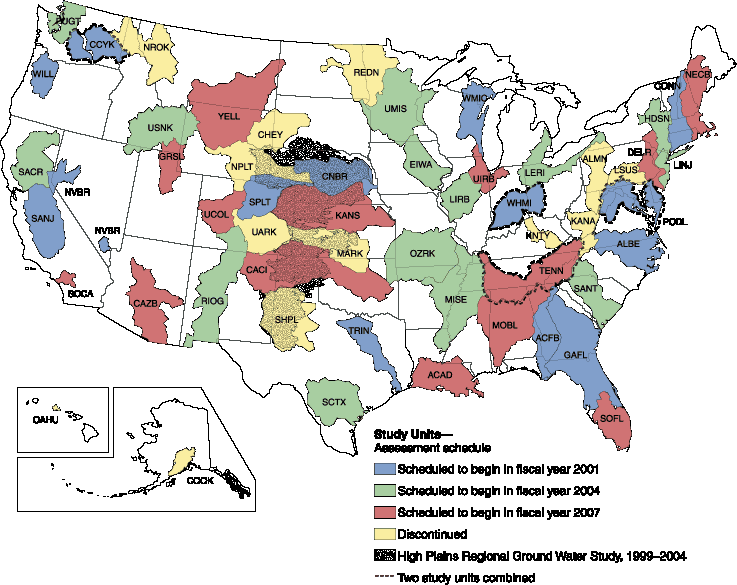
From 1991-2001, the NAWQA Program conducted interdisciplinary assessments and established a baseline understanding of water-quality conditions in 51 of the Nation's river basins and aquifers, referred to as Study Units. Descriptions of water-quality conditions in streams and ground water were developed in more than a thousand reports (access NAWQA publications). Non-technical Summary Reports, written primarily for those interested or involved in resource management, conservation, regulation, and policymaking, were completed for each of the 51 Study Units. Non-technical national summary reports on pesticides, nutrients, and volatile organic compounds (VOCs) also were completed, in which water-quality conditions were compared to national standards and guidelines related to drinking water, protection of aquatic life, and nutrient enrichment.
NAWQA activities during the second decade (2001-2012) focus in large part on national and regional assessments, all of which build on continued monitoring and assessments in 42 of the 51 Study Units completed in the first cycle (USGS Fact Sheet 071-01).
Selected major activities during the second decade include:
NAWQA is planning activities for its third decade (2013-2023) (access a summary of the Program's progress through 2008 and setting the stage for the future).
How does NAWQA answer Program objectives and questions? Despite a shift in specific activities between the first and second decades of the Program from local to more regional and national assessments, NAWQA objectives and questions remain the same, as do the fundamental tenets of the Program design:
Design Element |
Outcomes |
|
Study design and methods are nationally consistent (access NAWQA protocols) |
. . . .so that. . . . |
water-quality conditions can be compared on a regional and national basis. |
Studies are long-term and cyclical |
. . . .so that. . . . |
trends in water quality can be analyzed to determine whether conditions are getting better or worse. |
Studies relate human activities (contaminant sources, land and chemical use) and natural factors (soils, geology, hydrology, climate) to water quality, aquatic life, and stream habitat |
. . . .so that. . . . |
findings help with decisions about managing water resources and protecting drinking water and aquatic ecosystems. |
Studies place water-quality findings in a human-health context |
. . . .so that. . . . |
findings help to assess and protect the quality of source water and finished water associated with many of the Nation’s drinking-water supplies. |
Assessments integrate monitoring with modeling and other scientific tools. |
. . . .so that. . . . |
knowledge of water quality based on data collected at individual sites is extended to unmonitored, yet comparable areas, and to evaluate various resource-management scenarios and predict how our actions are likely to affect water conditions. |
USGS scientists collaborate with government officials, resource managers, industry representatives, and other interested parties |
. . . .so that. . . . |
data from other organizations are integrated into the assessments, where appropriate, and findings are relevant to decision makers (pdf) |
USGS scientists cover a range of disciplines, including hydrology, geology, geophysics, biology, geography, and statistics |
. . . .so that. . . . |
the interdependent nature of river basins and aquifer systems can be analyzed. |
USGS is committed to making its unbiased scientific information available to everyone |
. . . .so that. . . . |
findings are presented in multiple formats, including raw data, reports, journal articles, pamphlets, and videos (access NAWQA publications). |

![]() U.S. Department of the Interior | U.S. Geological Survey
U.S. Department of the Interior | U.S. Geological Survey
URL: http://water.usgs.gov/nawqa/about.html
Page Contact Information: gs-w_nawqa_whq@usgs.gov
Page Last Modified: Tuesday, 28-Oct-2014 12:20:32 EDT
