About the Aquifer
|
 |
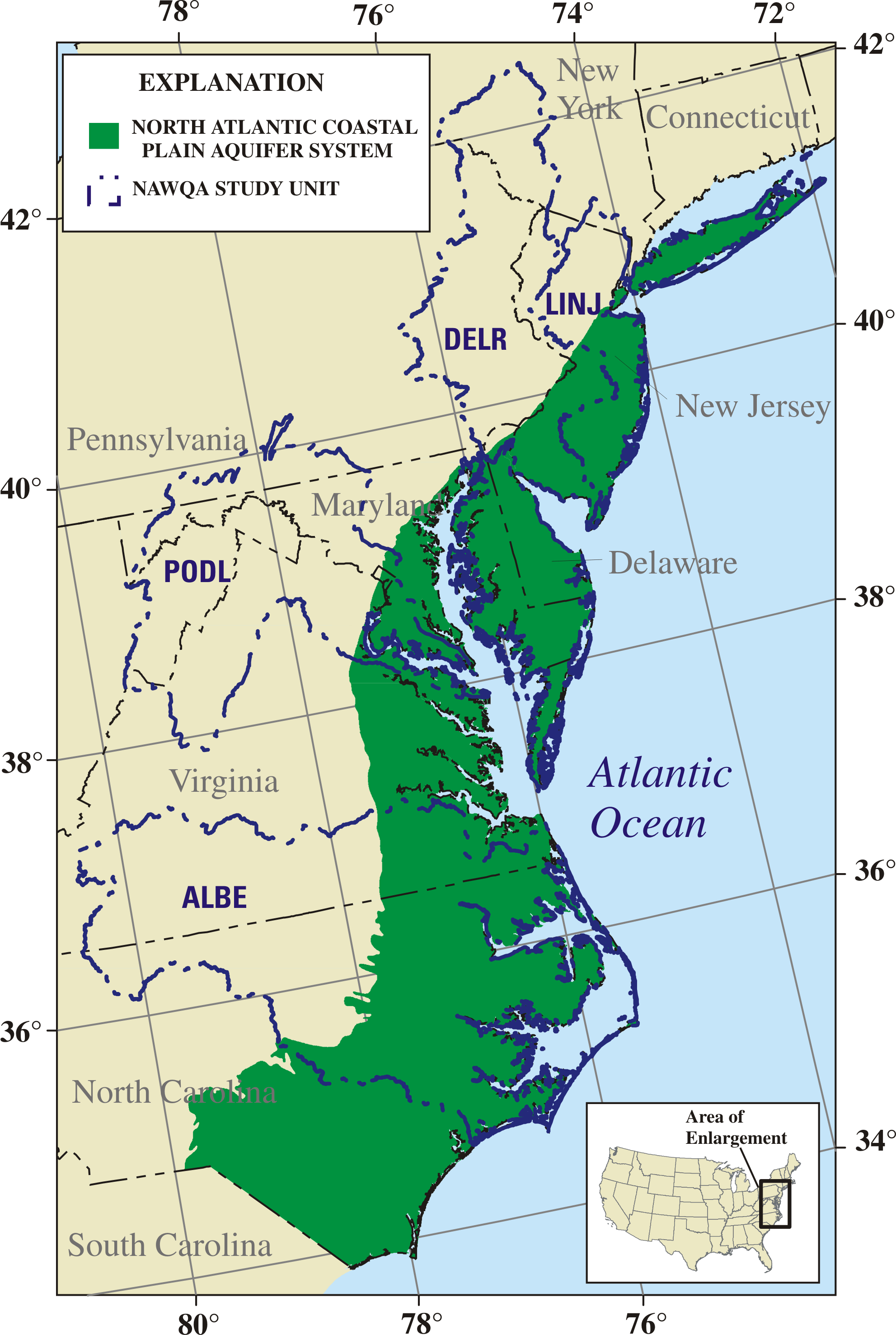
The NACPAS covers about 50,000 square miles extending from the North Carolina – South Carolina State border northward to Long Island, New York (Trapp and Horn, 1997a and 1997b). The aquifer system grades southward into the South Eastern Coastal Plain Aquifer System and is bounded on the west by the Fall Line, which separates the Piedmont and Coastal Plain Physiographic Provinces, and on the east by the Atlantic Ocean (Trapp and Horn, 1997a). On Long Island , which is part of the Coastal Plain physiographic province, deposits of glacial origin mantle NACPAS sediments. NACPAS sediments that underlie Long Island are the sole source of potable water for nearly 3 million residents and these sediments are in hydraulic connection with the overlying glacial deposits that also provide potable water for Long Island residents. . For these reasons, Long Island is an area that is of interest to participants of both the NACP and the glacial deposits principal aquifer study groups.
|
|
The Northern Atlantic Coastal Plain aquifer system (NACPAS) was selected as one of the principal aquifer systems for investigation during cycle II. Four NAWQA study units (ALBE, PODL, DELR, and LINJ) overly the NACPAS (see map above).
|
| |
|
Bibliography
Hydrogeology of the Aquifer -- Ground Water Atlas
|
|
|
|
|
|
|
|
|
For more information, please contact:
Judy Denver, Hydrologist,
Team Leader
302-734-2506 x229
jmdenver@usgs.gov
|
|
|