USGS - science for a changing world

USGS Groundwater Information

*  Home *  Monthly Highlights *  Data & Information *  Publications *  Methods & Modeling *  Selected Topics *  Programs *  About *  Contact Us *  OGW Intranet

USGS Groundwater Information > January 6, 2020


USGS Monthly Groundwater News and Highlights: January 6, 2020

Subscribe to get the latest USGS groundwater news and science sent to your inbox every month!


Feature: Groundwater Data You Can Use

 [ Screenshot of GeoLog Locator web site. ]

Snapshot of the GeolLog Locator: web-based tool to view and download USGS borehole geophysical logs and related data files.

The USGS has a long history of providing the data behind the science in USGS publications, producing reproducible science. Since October 2016, USGS also has required that the USGS data on which any USGS publication is based be made available online, as part of the USGS Public Access Plan. These data are available for download by resource managers, policy makers, students, researchers, and any other member of the public. Example USGS data resources about groundwater that you can download and use include:
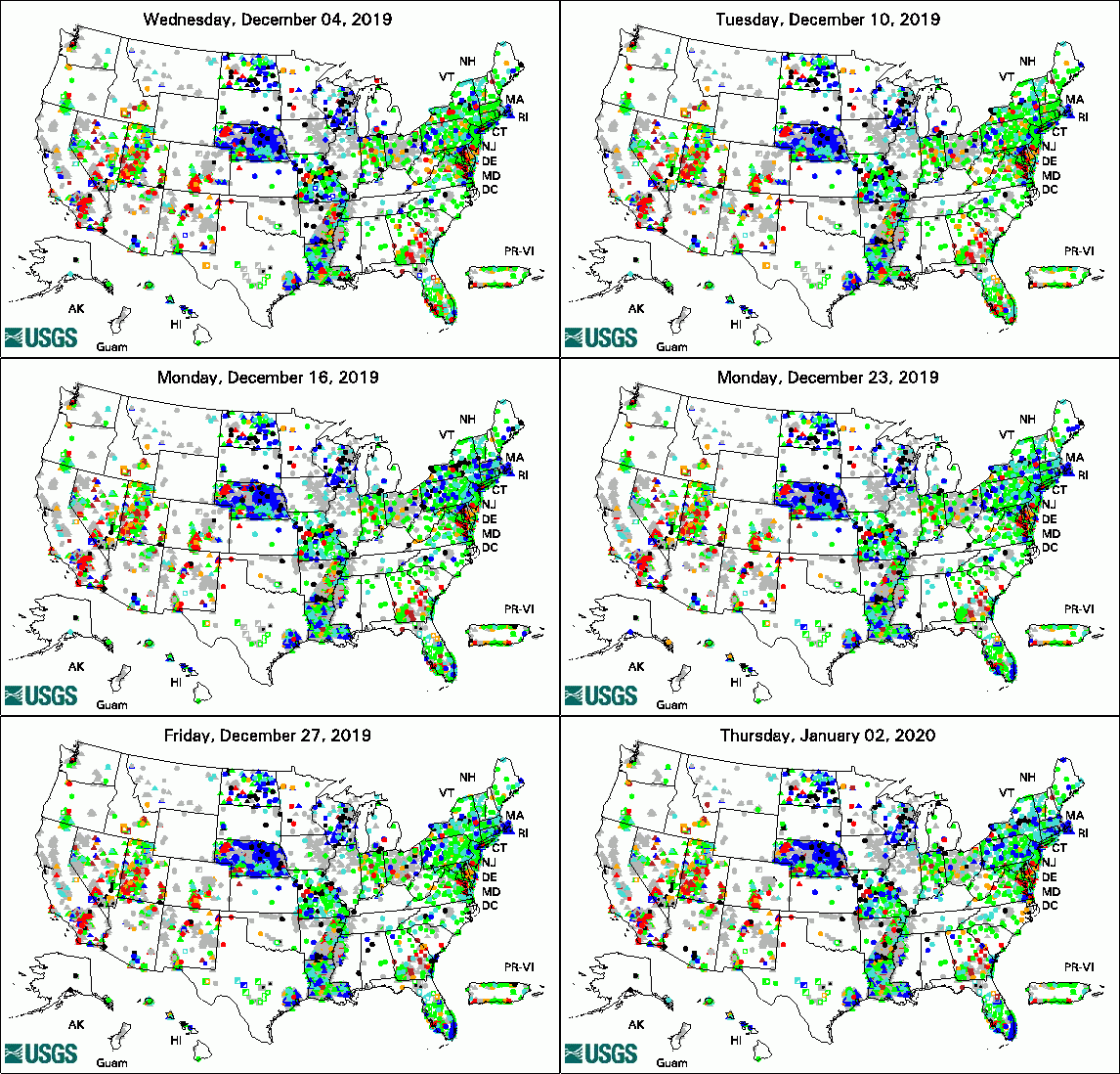


Animation of Groundwater Watch Active Water Level Network
legend

The USGS Active Groundwater Level Network includes about 20,000 wells that have been measured by the USGS or USGS cooperators at least once within the past 13 months. The animation shows a daily snapshot of water-level statistics in the network for December 2019. Credit: USGS. The image is in the public domain.

USGS Groundwater-Related Publications

Simulation of groundwater flow and chloride transport in the "1,500-foot" sand, "2,400-foot" sand, and "2,800-foot" sand of the Baton Rouge area, Louisiana (12/23/19)

Estimation of groundwater flow through Yucca Flat based on a multiple-well aquifer test at well ER-6-1-2 main, Nevada National Security Site, southern Nevada (12/19/19)

Simulated water-table and pond-level responses to proposed public water-supply withdrawals in the Hyannis Ponds Wildlife Management Area, Barnstable, Massachusetts (12/19/19)

Determination of study reporting limits for pesticide constituent data for the California Groundwater Ambient Monitoring and Assessment Program Priority Basin Project, 2004-2018 -- Part 1: National Water Quality Schedules 2003, 2032, or 2033, and 2060 (12/18/19)

Geohydrology and water quality of the unconsolidated aquifers in the Enfield Creek Valley, town of Enfield, Tompkins County, New York (12/13/19)

Depth to bedrock based on modeling of gravity data of the eastern part of Edwards Air Force Base, California (12/14/19)

Multiorder hydrologic position in the conterminous United States: A set of metrics in support of groundwater mapping at regional and national scales (12/30/19)

Slug-test analysis of selected wells at an earthen dam site in southern Westchester County, New York (12/09/19)

Hydrogeologic framework of the Virginia Eastern Shore (12/05/19)

Managing effects of drought in Hawai'i and U.S.-affiliated Pacific Islands (12/12/19)

History and sources of co-occurring pesticides in an abstraction well unravelled by age distributions of depth specific groundwater samples (12/18/19)


USGS Groundwater Flow and Transport Model Data Releases

SEAWAT Model of Flow and Chloride Transport in the "1,500-Foot", "2,400-Foot", and "2,800-Foot" Sands of the Baton Rouge Area, Louisiana


Field Photo

Groundwater science doesn't take a winter vacation! In these photos, USGS hdyrologic technicians Jeffrey Kinsey and Jeremiah Pomerleau are snowshoeing to a USGS groundwater monitoring sites in Maine. USGS scientists visit USGS groundwater observation wells year-round to measure water levels and maintain equipment. You can view or download USGS groundwater-level data from the USGS National Water Information System (NWIS) web site. These monitoring wells (Eustis and Middle Dam) are managed by the USGS New England Water Science Center.


 [ Photo of scientist in snowy field with trees and groundwater well in the background. ]

Credit: USGS/Jeremiah Pomerleau. Photo is in the public domain. Click on photo for larger version.

 [ Photo of scientist opening well housing in snow. ]

Credit: USGS/Jeffrey Kinsey. Photo is in the public domain. Click on photo for larger version.


USGS Home Water Climate and Land Use Change Core Science Systems Ecosystems Energy and Minerals Environmental Health Natural Hazards

Accessibility FOIA Privacy Policies and Notices

USA.gov logo U.S. Department of the Interior | U.S. Geological Survey
URL: http://water.usgs.gov/ogw/highlights/2020-01.html
Page Contact Information: Contact the USGS Office of Groundwater
Page Last Modified: Wednesday, 08-Jan-2020 15:35:33 EST