USGS Groundwater Information
|
USGS Groundwater Information > September 3, 2018 Highlights USGS Monthly Groundwater News and Highlights: September 4, 2018To continue to get the latest highlights, we recommend you subscribe to get the latest USGS groundwater news and science sent to your inbox every month! Feature: Effect of spatial and temporal scale on simulated groundwater recharge investigationsWhat effect does scale have on modeling groundwater recharge estimated from large-scale climate data? We presume that modeling over smaller areas and shorter time scales allows us to simulate physical processes more realistically, and thus provide better forecasts for water management decisions. This hypothesis was investigated using a Soil Water Balance model of the upper Colorado River Basin, where some management decisions are based on a ten-year moving average. The authors found that differences in the amount of modeled groundwater recharge were substantial during some seasonal comparisons. But trends in recharge were almost identical across scales, leading to similar conclusions about change from "normal" recharge. Considering the uncertainty inherent in projected climate data, coarser spatial and longer temporal scale input data may be sufficient for water resources managers who need to understand changes in trends in groundwater recharge over water-year or longer time periods. Learn more about this recent USGS study. ![[ Map of upper Colorado River basin study area ]](images/feature/20180901_TillmanFig1_1160.jpg "Map of upper Colorado River basin study area")
Figure: Location of the upper Colorado River basin study area within the southwestern United States. Source: Tillman and others, 2018. Figure is in the public domain. 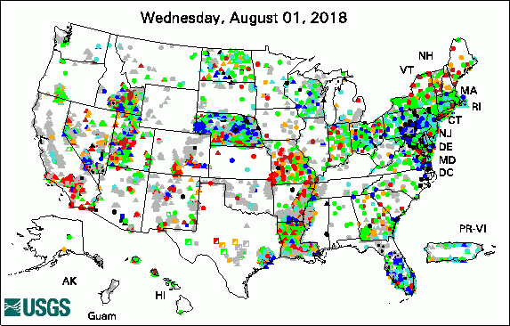 
The USGS Active Groundwater Level Network includes about 20,000 wells that have been measured by the USGS or USGS cooperators at least once within the past 13 months. The animation shows a daily snapshot of water-level statistics in the network for August 2018. Credit: USGS. The image is in the public domain. USGS Groundwater-Related PublicationsDiffering modes of biotic connectivity within freshwater ecosystem mosaics (08/30/18) Input data processing tools for the integrated hydrologic model GSFLOW (08/28/18) Effect of spatial and temporal scale on simulated groundwater recharge investigations (08/10/18) Brackish groundwater and its potential as a resource in the southwestern United States (08/06/18) Tritium deposition in precipitation in the United States, 1953-2012 (08/02/18) Hydrothermal discharge from the El Tatio basin, Atacama, Chile (08/30/18)
Field PhotoDid you know that plants can sometimes help us understand what is happening underground? Studying plants in an area can provide information about soil conditions, water availability, and water quality. In these photos, USGS Oregon Water Science Center hydrologists Brandon Overstreet and Gabe Gordon are using small unoccupied aircraft systems — sUAS or "drones" — to collect information about vegetation on Malheur National Wildlife Refuge in Oregon in August 2018. The data will be used to improve our understanding of Harney Basin region water resources, including groundwater availability. ![[ Photo of scientist operating small drone in the field ]](images/field/20180901_HGBUAS_P8095138.JPG "Photo of scientist operating small drone in the field")
Credit: USGS/Cian Dawson. Photo is in the public domain. Click on photo for larger version. ![[ Photo of scientist operating small drone in the field ]](images/field/20180901_HGBUAS_IMG_3575.JPG "Photo of scientist operating small drone in the field")
Credit: USGS/Cian Dawson. Photo is in the public domain. Click on photo for larger version. Archive of Past Highlights: |
![]() U.S. Department of the Interior |
U.S. Geological Survey
U.S. Department of the Interior |
U.S. Geological Survey
URL: http://water.usgs.gov/ogw/highlights/2018-09-04.html
Page Contact Information: Contact the USGS Office of Groundwater
Page Last Modified: Tuesday, 04-Sep-2018 15:42:37 EDT
