USGS Groundwater Information
|
USGS Groundwater Information > June 1, 2016 Highlights USGS Monthly Groundwater News and Highlights: June 1, 2016Featured Product: Improving River and Reservoir Management through Better Modeling Tools![Conceptual model of MODSIM-MODFLOW [ Conceptual model of MODSIM-MODFLOW ]](images/feature/20160601_MODSIM-MODFLOW.jpg)
Conceptual model of MODSIM-MODFLOW. From Morway and others, 2016. Efforts to address the growing divide between water supply and water demands around the Nation are complicated by uncertain water supplies as a result of climate variability, growing water demands, over-allocation of water resources, and other challenges. Due to the time delays of groundwater response to groundwater and surface-water management actions, the effects of a new water management decision can take days to decades to propagate through a connected river/aquifer system. Water managers need better tools to represent changes in groundwater resources and how those changes affect and are affected by rivers and reservoirs over time. A new software tool has been developed that can help water managers better represent how groundwater and surface water interact, and use that information to inform river operations. MODSIM-MODFLOW is a new software program that combines the river operations model MODSIM with MODFLOW, the world's most widely used groundwater modeling program. As a result, mangers can better evaluate the potential consequences of new or changed water management plans. Learn More:
USGS Groundwater-Related Press Releases 
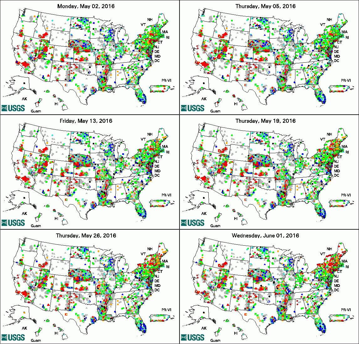
The USGS Active Groundwater Level Network includes about 20,000 wells that have been measured by the USGS or USGS cooperators at least once within the past 13 months. The animation shows a daily snapshot of water-level statistics in the network for May 2016. Credit: USGS. The image is in the public domain. Pharmaceuticals Commonly Detected in Small Streams in the Southeastern United States (May 25, 2016) New Tool Aims to Help Balance Supply and Demand of Water Resources (May 23, 2016) Changing California Land Uses will Shape Water Demands in 2062 (May 18, 2016) Fireworks Likely Caused Water Contamination at Mount Rushmore (May 2, 2016)
USGS Groundwater-Related PublicationsThe presence of rapidly degrading permafrost plateaus in southcentral Alaska Toward improved simulation of river operations through integration with a hydrologic model Building science-based groundwater tools and capacity in Armenia for the Ararat Basin The importance of base flow in sustaining surface water flow in the Upper Colorado River Basin Mid-latitude shrub steppe plant communities: Climate change consequences for soil water resources Numerical simulation of the groundwater-flow system of the Kitsap Peninsula, west-central Washington Hydrologic exchanges and baldcypress water use on deltaic hummocks, Louisiana, USA
USGS Groundwater-Related Software Updates and New Releases
Field Photo: Water Sampling from Well in ArmeniaDid you know the USGS collaborates with other federal agencies, as well as with governments in other countries to share science and improve our understanding of groundwater resources? In this photo, Mark Anderson, Director of the USGS South Dakota Water Science Center, demonstrates how to collect a stable isotope sample from a flowing well near Sis, Armenia. The USGS and U.S. Agency for International Development (USAID) began a study in 2016 to help build science-based groundwater tools and capacity for the Ararat Basin in Armenia. The growth of aquaculture and other uses in the Ararat Basin has been accompanied by increased withdrawals of groundwater, which has resulted in decreased springflow, well discharges, and water levels, including loss of flowing wells in many places. This study is in partnership with USAID/Armenia in the implementation of its Science, Technology, Innovation, and Partnerships (STIP) effort through the Advanced Science and Partnerships for Integrated Resource Development (ASPIRED) program and associated partners, including the Government of Armenia, Armenia's Hydrogeological Monitoring Center, and the USAID Global Development Lab and its GeoCenter. Scientific tools will be developed through this study that groundwater-resource managers in Armenia can use to understand and forecast the consequences of their resource management decisions. Archive of Past Highlights: |