USGS Groundwater Information
|
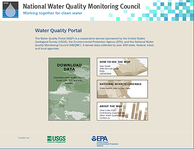
USGS Groundwater Information > November 1, 2015 Highlights USGS Monthly Groundwater News and Highlights: November 1, 2015Featured Product: Water Quality Data PortalThe Water Quality Portal (WQP) is a cooperative service sponsored by USGS, U.S. Environmental Protection Agency (EPA), and the National Water Quality Monitoring Council that integrates publicly available water-quality data from the USGS National Water Information System (NWIS) database and the EPA STOrage and RETrieval (STORET) data warehouse. The WQP makes it easy to download USGS and (or) EPA groundwater-quality states from sites around the country using a web form or web services. For information about how to access other USGS water-quality data, see our list of USGS national water-quality databases and web applications.
USGS Groundwater-Related Press Releases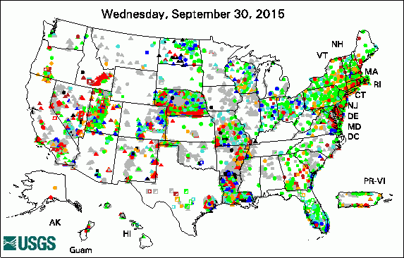 
The USGS Active Groundwater Level Network includes about 20,000 wells that have been measured by the USGS or USGS cooperators at least once within the past 13 months. The animation shows a daily snapshot of water-level statistics in the network for October 2015. Credit: USGS. The image is in the public domain. Uncovering the Mighty Mississippi's Natural Potential for Nitrogen Removal Scientists Able to Track Contaminated Water from Lower Yakima Valley Wells to Sources New Model Improves Predictions for How Climate Change Will Affect Fish Habitat It's a Bird! It's a Plane! No, it's SCIENCE! Aquifer Mapping Project Begins This Week USGS Scientists Discuss Climate, Drought and Resource Management at Colorado Plateau Conference Wichita's Primary Water Supply Source Recovering Due to City's Efforts
USGS Groundwater-Related PublicationsChesapeake Bay Impact Structure: A Blast from the Past Particle tracking for selected groundwater wells in the lower Yakima River Basin, Washington Temporal geochemical variations in above- and below-drainage coal mine discharge Relating subsurface temperature changes to microbial activity at a crude oil-contaminated site Water availability and subsidence in California's Central Valley USGS Groundwater-Related Software Updates and New Releases

Photo Credit: USGS/Shelley Niesen. The photo is in the public domain. Field Photo:Did you know that USGS conducts groundwater-quality studies around the Nation? These studies help us better understand local groundwater quality conditions that could affect water availability and use and human health and the environment. In this photo, a student technician from the USGS Missouri Water Science Center is observing water-quality properties at a groundwater sampling well near Independence, Missouri, in August 2013. The work was part of a USGS study comparing two types of water-quality sampling methods to determine any differences in results from the two methods. Understanding the differences in the accuracy and precision of different water-quality sampling techniques, as well as the labor, time, and costs involved, enables scientists to make informed decisions about the best methods and tools to use for a particular study. To learn more about the investigation, see the report that came out this month: Concentration comparison of selected constituents between groundwater samples collected within the Missouri River alluvial aquifer using purge and pump and grab-sampling methods, near the city of Independence, Missouri, 2013 Archive of Past Highlights: |
![]() U.S. Department of the Interior |
U.S. Geological Survey
U.S. Department of the Interior |
U.S. Geological Survey
URL: http://water.usgs.gov/ogw/highlights/2015-11-01.html
Page Contact Information: Contact the USGS Office of Groundwater
Page Last Modified: Tuesday, 03-Nov-2015 18:47:14 EST