National Assessment of Water Availability and Use
Great Lakes Basin PilotSurface-Water Flows and StorageThe major tasks include:
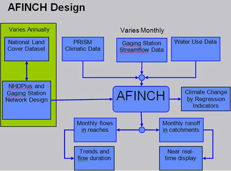
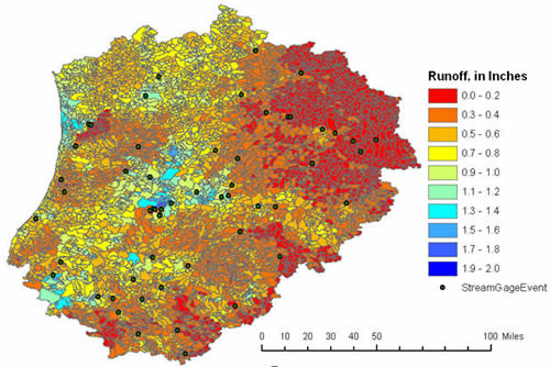
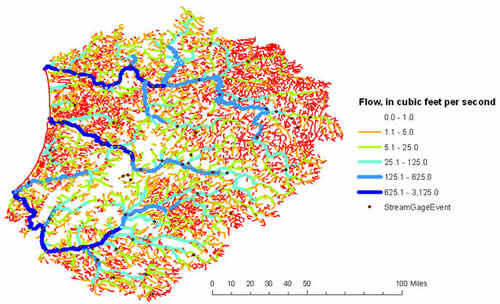
StatusA prototype model, aFINCH (analysis of Flows in Networks of Channels), has been developed and applied to a hydrologic subregion within the U.S. Great Lakes Basin (0405). The model provides an estimator of flows in reaches and runoff from catchments in the NHDPlus network. Features of the estimator include:
|

![]() U.S. Department of the Interior |
U.S. Geological Survey
U.S. Department of the Interior |
U.S. Geological Survey
URL: http://water.usgs.gov/wateravailability/greatlakes/surface.html
Page Contact Information: Webmaster
Page Last Modified: Friday, 23-Nov-2007 11:30:41 EST