
|
|
|||||||
| If using Internet Explorer, right click on and use the "Save Target As" function to directly | |||||||
| download .doc, .jpg and .xls files | |||||||
| Site ID: 84 | James River @ 247th Street near Mitchell, SD | ||||||
| File Name | Description | ||||||
| 247St_DetailExample.doc | Detailed summary of the site and data collection during the April, 2001 flood. | ||||||
| Flood_photos.zip | Photos taken during April, 2001 flood, description of each photo is documented in 247_Photos.doc Word file | ||||||
| PostFlood_photos.zip | Photos taken during October, 2001 low-flow survey, description for each is documented in Post-Flood_Photos.doc Microsoft Word file | ||||||
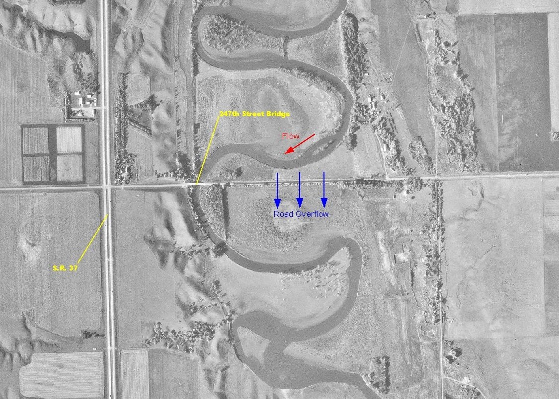
| 247st.jpg | Descriptive Digital Ortho Quad image of the bridge site | ||||||
| Q_Measurement.xls | Excel spreadsheet containing AA current meter discharge measurement during April, 2001 flood. | ||||||
| Bathymetry.xls | Excel spreadsheet containing cross-sections collected during the April, 2001 flood from the bridge deck | ||||||
| 247DS(FullValley).xls | Excel spreadsheet containing surveyed data for the exit section used in a HEC-RAS model of the reach. | ||||||
| 247US(FullValley).xls | Excel spreadsheet containing surveyed data for the approach section used in a HEC-RAS model of the reach | ||||||
| 247(ROAD).xls | Excel spreadsheet containing surveyed data of the roadway (247th Street). | ||||||
| 247st_Hec-Ras.xls | Excel spreadsheet summarizing the elev. and stationing for all sections in the HEC-RAS model of the reach. | ||||||
| GrainSizeDist.xls | Bed material grain size distribution for the site, determined by analysis of samples collected during post-flood survey. | ||||||
| All(Site84).zip | All files listed above | ||||||
| Accessibility FOIA Privacy Policies and Notices | |
| U.S. Department of the Interior | U.S. Geological Survey URL: http://water.usgs.gov/osw/techniques/bs/BSDMS/Supporting_Files/Site84.htm Page Contact Information: GS-W_OSW_Webmaster@usgs.gov |
 |