
|
|
|||||||
| If using Internet Explorer, right click on and use the "Save Target As" function to directly | |||||||
| download .doc, .jpg and .xls files | |||||||
| Site ID: 81 | Cedar River @ Janesville, IA | ||||||
| File Name | Description | ||||||
| saab.meas.outp | Scour calculations output worksheet | ||||||
| wsp_calb.prt | WSPRO output file for calibration model using surveyed high-water marks and discharge | ||||||
| wsp_prel.prt | WSPRO output file for model using pre-flood geometry for scour calculations. | ||||||
| AllSections.xls | Excel spreadsheet with all surveyed channel bathymetry | ||||||
| f218.xls | Excel spreadsheet with all surveyed floodplain topography. | ||||||
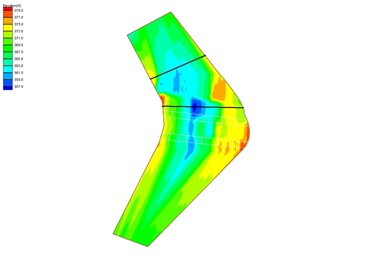
| Janesville_Topo.jpg | Plot of surveyed channel bathymetry on July 23, 1999. | ||||||
| LongProfile.xls | Longitudinal profile of surveyed channel reach used to establish contraction scour reference surface. | ||||||
| NewBridgeLocation.jpg | Sketch of new bridge location and alignment relative to old bridge. | ||||||
| Photos.zip | DCP00172.jpg - DCP00207.jpg - photos taken during 1999 flood | ||||||
| DCP00252.jpg-DCP00344.jpg - photos taken during after 1999 flood receded. | |||||||
| DSCN0123.jpg-DSCN0138.jpg - photos taken during low-flow and floodplain survey (2000). | |||||||
| Janesville photos.doc - Word document description of all site photos. | |||||||
| Iowa_Janesville_3-25-90.jpg - Aerial photo of site taken in 1990, prior to construction of new bridges | |||||||
| Iowa_Janesville_5-01-94.jpg - Aerial photo of site taken in 1994, after construction of new bridges | |||||||
| ADCP.zip | IOWA003.vel - IOWA 031.vel - output files of ADCP data collected on at site 7-23-99. | ||||||
| (Header Definitions for ADCP Files) | |||||||
| All(Site81).zip | All files listed above | ||||||
| Accessibility FOIA Privacy Policies and Notices | |
| U.S. Department of the Interior | U.S. Geological Survey URL: http://water.usgs.gov/osw/techniques/bs/BSDMS/Supporting_Files/Site81.htm Page Contact Information: GS-W_OSW_Webmaster@usgs.gov |
 |