Importing Shapefiles |
Importing Shapefiles |
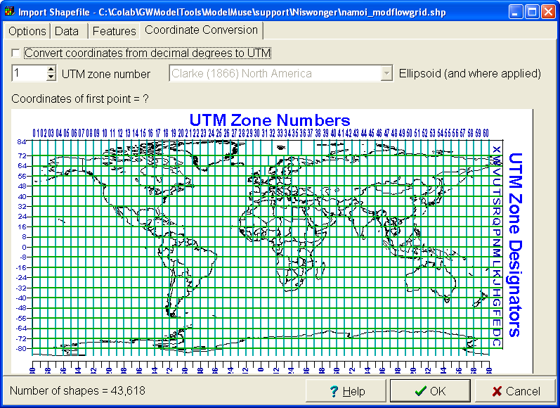
ModelMuse can import Shapefiles (a common format for Geographic Information Systems; Environmental Systems Research Institute, Inc., 1998). Shapefiles can be obtained from many sources such as http://nationalatlas.gov/maplayers.html. For the purposes of this exercise, the Shapefile used is unimportant. To import a Shapefile, select File|Import|Shapefile... Then select a Shapefile to import. After reading the shapes, the Import Shapefile dialog box will appear (fig. 87). The user can decide which attributes of the Shapefile to import. If the coordinates of the shapes in the Shapefile are expressed in degrees, the user can convert them to Universe Transverse Mercator (UTM) coordinates using the Coordinate Conversion tab (fig. 88). If the user only wants to import some of the shapes, it is possible to restrict the shapes to import using the "Import criterion." Any shape for which the import criterion evaluates to True will be imported. Any of the attributes of the shapes can be used in the import criterion.
After importing the shapes, it is possible that none of the shapes will be in the field of view. Use the menu item Navigation|Go To... to go to one of the imported shapes.
 |
Figure 87. The Import Shapefile dialog box. |
 |
Figure 88. Coordinate conversion in the Import Shapefile dialog box. |