Occurrence of Pesticides in Shallow Ground Water of the United
States: Initial Results from the National Water-Quality Assessment
Program
Dana W. Kolpin, Jack E. Barbash, and Robert J. Gilliom
||
Figure 1 ||
Figure 2 ||
Figure 3 ||
Figure 4 ||
Figure 5 ||
Figure 6 ||
Figure 7 ||
FIGURES 1 - 7
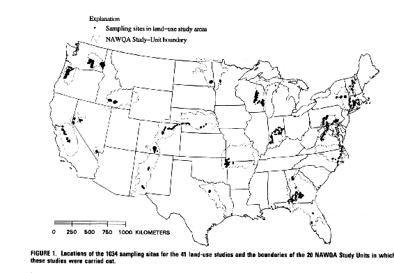
Figure 1.
Locations of the 1,034 sampling sites for the 41 land-use studies, and the
boundaries of the 20 NAWQA Study Units in which these studies were carried
out.
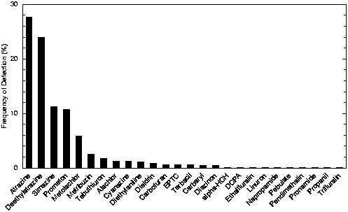
Figure 2.
Frequencies of detection of pesticide compounds in shallow ground water during the 41 land-use studies, adjusted to a common detection threshold of
0.01 µg/L.
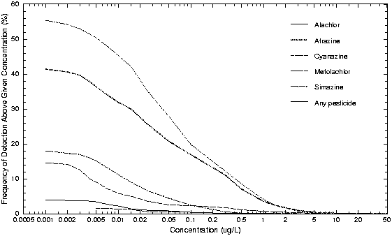
Figure 3.
Frequencies of detection of selected pesticides in relation to detection
threshold for shallow ground water sampled in 41 land-use studies. The line
for "any pesticide" represents the frequencies with which the sum of all
pesticide compound concentrations in individual samples exceeded the given
concentration (concentrations of compounds that were not detected were set to
zero).
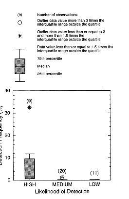
Figure 4.
Frequencies of detection (%) of pesticides detected >=0.01 µg/L in
relation to agricultural use and K
oc. (<300 mL/g); those with
"Low" likelihood had both low use (<1.00 kg/km
2) and high
K
oc (>=300 mL/g); those with "Medium" likelihood had either high
use and high K
oc or low use and low K
oc. Number of
pesticides in each category is given in parentheses.
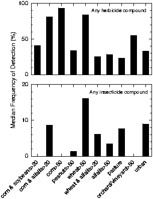
Figure 5.
Frequencies of detection (>=0.01 µg/L) of individual pesticides
in shallow ground water beneath ten different land-use settings
(N = number of land-use studies in each category).
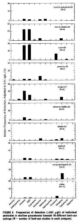
Figure 6.
Frequencies of detection (>=0.01µg/L) of individual pesticides
in shallow ground water beneath 10 different land-use settings
(N = number of land-use studies in each category).
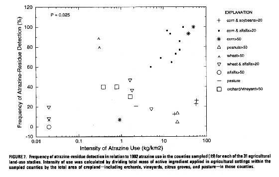
Figure 7.
Frequency of atrazine-residue detection in relation to 1992 atrazine use in
the counties sampled (
19) for each of the 31 agricultural land-use
studies. Intensity of use was calculated by dividing total mass of active
ingredient applied in agricultural settings within the sampled counties by
the total area of cropland---including orchards, vineyards, citrus groves and
pasture---in those counties
Back to:
Index

