Classification and Mapping of Agricultural Land for National Water-Quality Assessment
By Robert J. Gilliom and Gail P. Thelin
U.S. Geological Survey Circular 1131

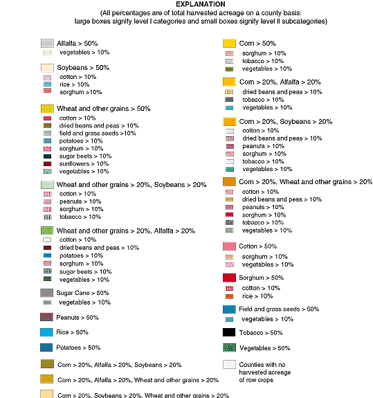
Figure 12. Distribution and classification of cropland areas of the
United States based on Major Land Uses of the United States (U.S.
Geological Survey, 1970) and the row-crop classification system.

Figure 12. Continued
Back to:
Table of Contents

