National Water-Quality Assessment (NAWQA) Program
Go to:
GIF files are intended for viewing only, not for publication output.
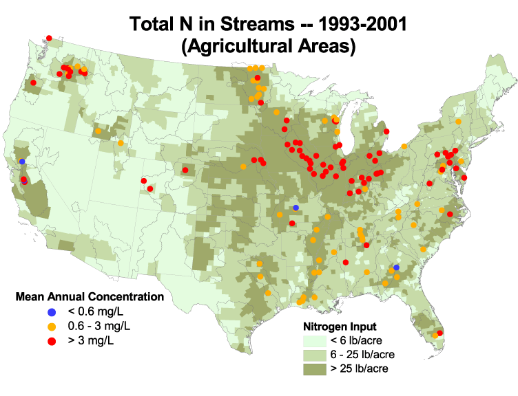
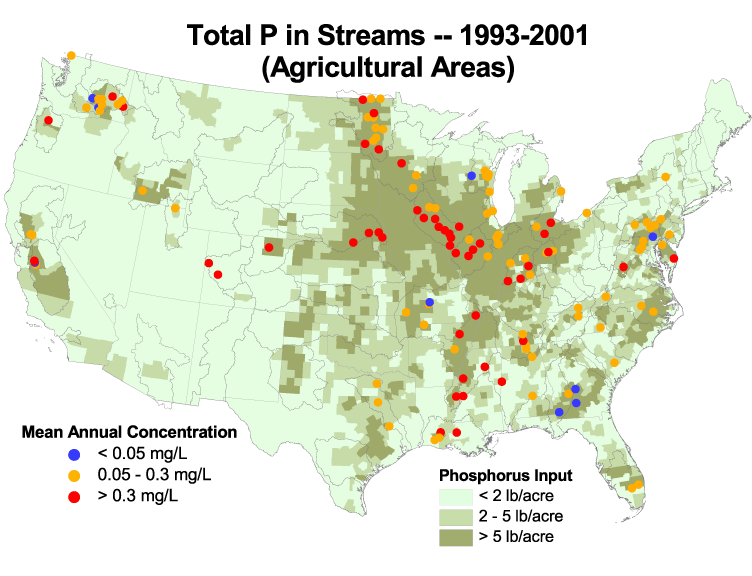
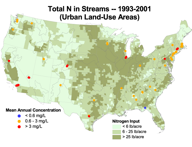
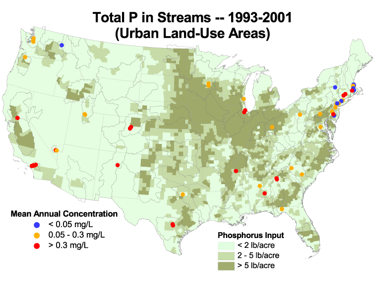
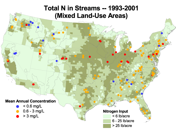
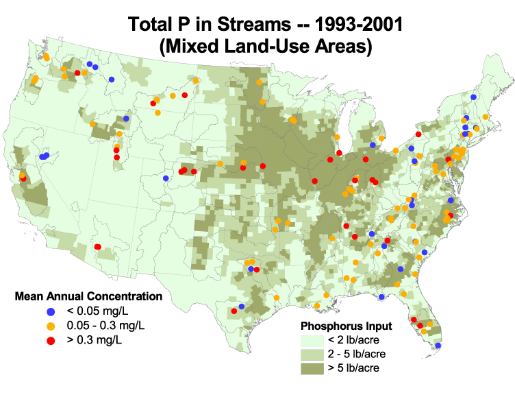
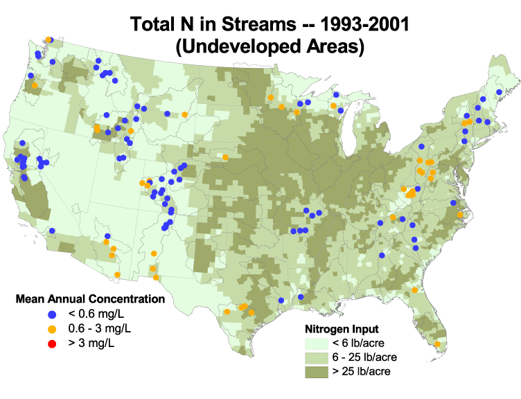
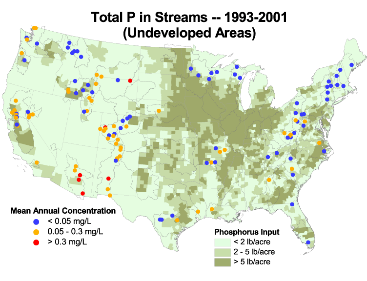
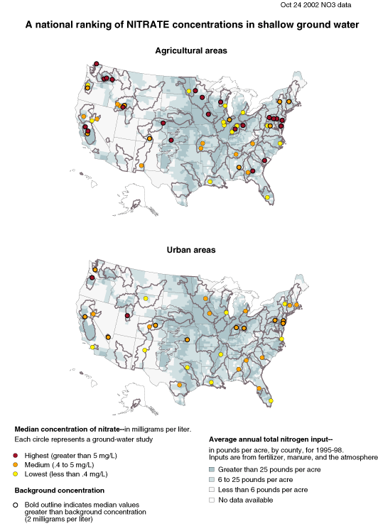
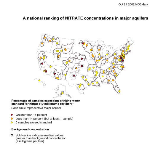
Maps showing nutrient concentrations in streams, conterminous U.S.
NOTE:
Ag, mixed, and undeveloped maps
revised 10/28/2002.
All maps revised again 11/27/2002. N input
units now are lb/acre.
Ag and mixed maps revised 12/03/2002 and
1/13/2003.
Ag maps revised 1/14/2003.
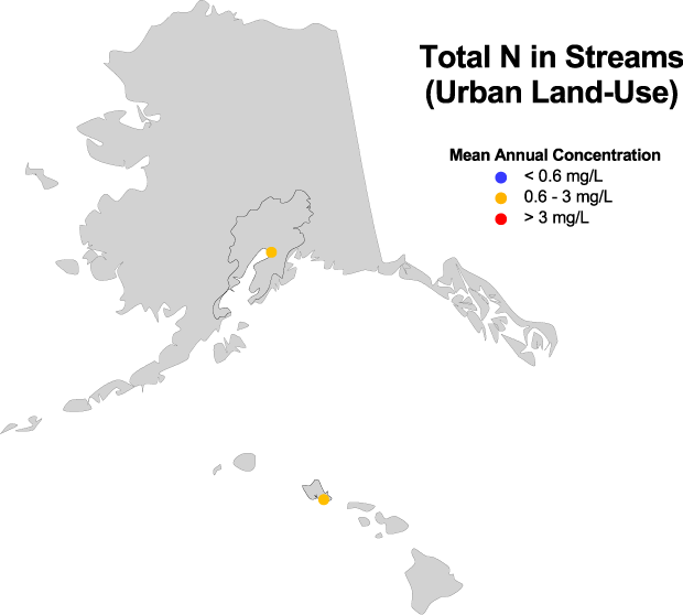
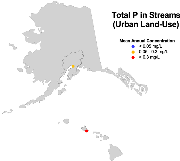
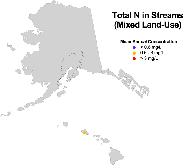
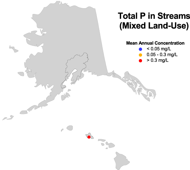
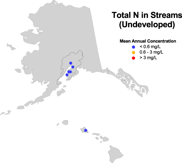
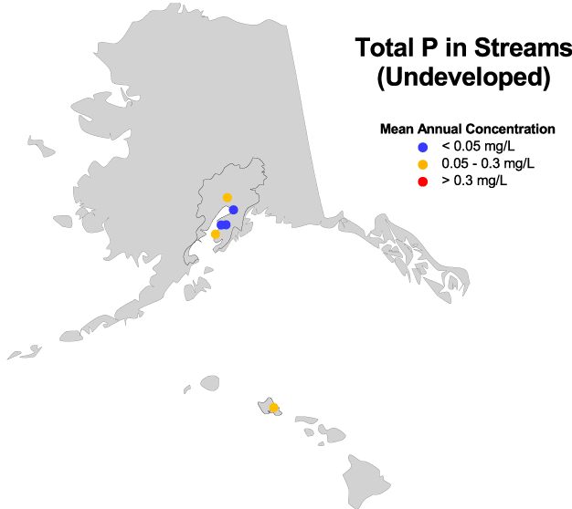
Maps showing nutrient concentrations in streams, Alaska and Hawaii
10/11/2002
11/05/2002
Revised 12/19/02
The material prepared for the 1994 summary reports is outdated, and we have placed the information in an archive.

 U.S. Department of the Interior |
U.S. Geological Survey
[an error occurred while processing this directive]
URL: http://water.usgs.gov
Page Contact Information: Carise Barbour
Page Last Modified: Friday, 12-Mar-2010 17:04:35 EST