Water Resources of the United States


[an error occurred while processing this directive]

Flood Policies and Procedures

USGS National Flood Plan
WMA Policy Memo 2016.01
WMA Flood Response Policy
Flood AEP Computation:
Project Alert Form:
More policies and procedures...  

Regional and Local Flood Alerts

PROJECT ALERT NOTICE (TX) Flooding in Texas
Mon, 14 Jul 2025 11:53:34 EDT
Response to continued flooding in Texas.
PROJECT ALERT NOTICE (TX) Flooding in Texas
Sun, 13 Jul 2025 14:42:26 EDT
Overnight and early morning rain resulted in more flooding in Texas.
PROJECT ALERT NOTICE (NC) Tropical Storm Chantal
Wed, 09 Jul 2025 16:03:36 EDT
North Carolina crews continue to flag and survey high water marks, repair downed gages, and make measurements following Tropical Storm Chantal
PROJECT ALERT NOTICE (NM) Flooding in Ruidoso, NM
Wed, 09 Jul 2025 12:48:03 EDT
NMWSC field crews are responding to the flood event in Ruidoso, NM.
PROJECT ALERT NOTICE (NC) local flooding in North Carolina
Mon, 07 Jul 2025 15:46:12 EDT
The USGS South Atlantic Water Science Center (SAWSC) North Carolina Data Section responds to local flood event in central North Carolina.
FULL ALERT LISTING

State-based Flood Information

There is a USGS Water Science Center office in each State. Alabama Arkansas Georgia Illinois Indiana Kansas Louisiana Montana North Carolina North Dakota Oklahoma South Carolina Tennessee Wyoming Texas Alaska Arizona California Caribbean Colorado Connecticut Florida Hawaii Idaho Iowa Kentucky Maine Maryland-Delaware-D.C. Massachusettes Michigan Minnesota Mississippi Missouri Nebraska Nevada New Hampshire New Jersey New Mexico New York Ohio Oregon Pennsylvania Rhode Island South Dakota Utah Vermont Virginia Washington West Virginia Wisconsin

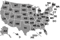
Click the map above to visit a State-specific flood page (if available), or check out one of these State flood databases:


Colorado Flood Database

Oklahoma Flood Database

USGS Contact Information

For questions related to this site or to contribute content, please email TODD KOENIG or BOB HOLMES.

USGS Flood Information   

The USGS provides practical, unbiased information about the Nation's rivers and streams that is crucial in mitigating hazards associated with floods. This site provides information about the USGS activities, data, and services provided during regional high-flow events, such as hurricanes or multi-state flooding events. The USGS response to these events is typically managed by the National Floods Specialist.

[an error occurred while processing this directive]

USGS Hazards Data Distribution System (HDDS)

How to use USGS HDDS to download flood imagery:

  1. Click the HDDS image listed above to open the HDDS site in a separate window.

    (If you have not previously registered on either EarthExplorer or HDDS, select the "Register" link in the top right corner of the screen and go through the registration process. It is a very simple process. Once registered, you will have access to USGS EarthExplorer along with HDDS download capabilities.)

  2. To sign up for the HDDS event 'restricted' access, select the login button in the upper right corner of the screen.
  3. Enter your usercode and password.
  4. Fill out an access request form.
  5. Select the required event for access.
  6. Complete the justification (text box) and submit.

Please contact Rynn Lamb (lamb@usgs.gov) or Brenda Jones (bkjones@usgs.gov) if you have any questions.


For questions related to this site or to contribute content, please email Todd Koenig or Bob Holmes at the USGS Office of Surface Water.

USGS Home Core Science Ecosystems Energy and Minerals Environmental Health Land Resources Hazards Water

Accessibility FOIA Privacy Policies and Notices

U.S. Department of the Interior | U.S. Geological Survey

URL: https://water.usgs.gov/floods/usgs/HowToHDDS.html

Page Contact Information: Water Webserver Team
Page Last Modified: Wednesday, 10-Feb-2016 19:18:20 EST