Water Resources of the United States


USGS Flood-related Publications

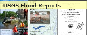
Visit the USGS Flood Reports page for floods dating back over 100 years.

Related Links

Archive of USGS Project Alert flood notices - local and regional flood briefs since 2008.
100-Year Flood--It's All About Chance - poster discussing the meaning and use of probability language in flood characterization.
Video: 2011: The Year of the Flood

State-based Flood Information

There is a USGS Water Science Center office in each State. Alabama Arkansas Georgia Illinois Indiana Kansas Louisiana Montana North Carolina North Dakota Oklahoma South Carolina Tennessee Wyoming Texas Alaska Arizona California Caribbean Colorado Connecticut Florida Hawaii Idaho Iowa Kentucky Maine Maryland-Delaware-D.C. Massachusettes Michigan Minnesota Mississippi Missouri Nebraska Nevada New Hampshire New Jersey New Mexico New York Ohio Oregon Pennsylvania Rhode Island South Dakota Utah Vermont Virginia Washington West Virginia Wisconsin

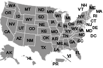
Click the map above to visit a State-specific flood page (if available), or check out one of these State flood databases:


Colorado Flood Database

Oklahoma Flood Database

USGS Contact Information

For questions related to this site or to contribute content, please email TODD KOENIG or BOB HOLMES.

USGS Flood Information   

The USGS provides practical, unbiased information about the Nation's rivers and streams that is crucial in mitigating hazards associated with floods. This site provides information about the USGS activities, data, and services provided during regional high-flow events, such as hurricanes or multi-state flooding events. The USGS response to these events is typically managed by the National Floods Specialist.

  • 2017 Flood Events

Highlighted 2017 Flood Events

USGS WaterWatch flood map

Pacific Winter Floods

The 2017 flood season began with atmospheric rivers pouring rain over large areas of California, Nevada, and Oregon.

Click the title above or the image at left to see the USGS response for the resulting floods.

USGS technician inspects gage during flood

Midwest Spring Floods

Large portions of Missouri, Illinois, Indiana, Ohio, Oklahoma, and Arkansas experienced widespread springtime flooding.

Click the title above or the image at left to see the USGS response for the resulting floods.

Hurricane image

New Floods Website

Note: in 2017, the USGS launched a new website, with capabilities for quickly documenting widespread storm events. Items listed below can be found at the USGS special-topics pages, and all future events will be documented in the new system.

USGS Home Core Science Ecosystems Energy and Minerals Environmental Health Land Resources Hazards Water

Accessibility FOIA Privacy Policies and Notices

U.S. Department of the Interior | U.S. Geological Survey

URL: https://water.usgs.gov/floods/events/2017/

Page Contact Information: Water Webserver Team
Page Last Modified: Friday, 06-Oct-2017 15:18:33 EDT