Water Resources of the United States


USGS Flood-related Publications

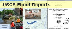
Visit the USGS Flood Reports page for floods dating back over 100 years.

Related Links

Archive of USGS Project Alert flood notices - local and regional flood briefs since 2008.
100-Year Flood--It's All About Chance - poster discussing the meaning and use of probability language in flood characterization.
Video: 2011: The Year of the Flood

State-based Flood Information

There is a USGS Water Science Center office in each State. Alabama Arkansas Georgia Illinois Indiana Kansas Louisiana Montana North Carolina North Dakota Oklahoma South Carolina Tennessee Wyoming Texas Alaska Arizona California Caribbean Colorado Connecticut Florida Hawaii Idaho Iowa Kentucky Maine Maryland-Delaware-D.C. Massachusettes Michigan Minnesota Mississippi Missouri Nebraska Nevada New Hampshire New Jersey New Mexico New York Ohio Oregon Pennsylvania Rhode Island South Dakota Utah Vermont Virginia Washington West Virginia Wisconsin

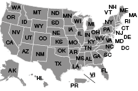
Click the map above to visit a State-specific flood page (if available), or check out one of these State flood databases:


Colorado Flood Database

Oklahoma Flood Database

USGS Contact Information

For questions related to this site or to contribute content, please email TODD KOENIG or BOB HOLMES.

USGS Flood Information   

The USGS provides practical, unbiased information about the Nation's rivers and streams that is crucial in mitigating hazards associated with floods. This site provides information about the USGS activities, data, and services provided during regional high-flow events, such as hurricanes or multi-state flooding events. The USGS response to these events is typically managed by the National Floods Specialist.

USGS Storm Tide and Rapid Deployment Gages used during Hurricane Irene

Click here to jump to a list of definitions below

Prior to the arrival of Hurricane Irene, the USGS Storm Tide Team deployed a total of 203 storm tide sensors, 70 barometric pressure sensors, 3 wave height sensors, and 11 Rapid Deployment Gages (RDGs) along the east coast of the United States extending from South Carolina to Maine. The storm tide sensors do not provide real-time data but are used to record the event and provide water-level data to determine the extent of the storm tide inundation and the depth of water over the land surface. Barometric pressure sensor data are used to adjust the recorded water level data and may also be used by meteorologists to document weather conditions. Rapid Deployment Gages perform a function similar to the storm tide sensors in that they record the water level data but they also provide those data on a real time basis. Some RDGs also record and transmit real time meteorological data. Information from these instruments has been retrieved and posted for display on the USGS Hurricane Irene Flood Event Viewer.

In addition to storm tide data, high water marks were identified and preserved to provide additional documentation for the extent of inundation and depth of water from both storm tide and inland riverine flooding.

Definitions

Hurricane Irene data sites

Storm Tide
Temporary instrument that records storm-tide data (abnormal rise in sea level accompanying hurricanes).
Rapid deployment streamgages
Temporary streamgages setup to provide short-term water-level data for critical areas lacking streamgages during an event.
Wave height
Temporary instrument that records wave height (recording intervals of 2 secs. or less).
Barometric pressure
Temporary atmospheric pressure recorders used to correct the storm tide data.
High Water Marks
Physical or natural evidence of previous water levels. Click here for more info.

Real-time gaging sites

Streamgages
Location on a watercourse where systematic observations of stage and/or flow are measured. For more information about streamgages, see NWIS Web Interface.
Tide gages
Gages that record long-term tidal water level.
Tidal crest gages
Gages that record maximum tide for observation period (months or years).

Interested in learning more?

A more comprehensive discussion of USGS efforts during hurricanes can be found in this article:

USGS Streamgaging Program Prepares for Future Hurricanes To Ensure the Availability of Flood Data Before, During, and After the Storm

USGS Home Core Science Ecosystems Energy and Minerals Environmental Health Land Resources Hazards Water

Accessibility FOIA Privacy Policies and Notices

U.S. Department of the Interior | U.S. Geological Survey

URL: https://water.usgs.gov/floods/events/2011/irene/SurgeAndRDG.html

Page Contact Information: Water Webserver Team
Page Last Modified: Friday, 03-Feb-2017 11:22:44 EST