USGS Water-Quality Information
![[Photo: USGS scientist collects water-quality samples.]](/owq/images/sidebar/Hawaii-2015.jpg "USGS scientists deploy SPMD and POCIS samplers to collect waterborne contaminants in Manoa Stream on Oahu, Hawaii.")
USGS scientists deploy SPMD and POCIS samplers to collect waterborne contaminants in Manoa Stream on Oahu, Hawaii. NoteworthyPress Releases
Featured Science:
Water Quality DataToday's Water Conditions Get continuous real-time water-quality measurements from Water-Quality Watch maps. Water Quality Portal (WQP) Get current and historical USGS and EPA water-quality data at the WQP. BioData Get stream ecosystem aquatic bioassessment data from BioData. For More Data View a complete list of USGS water-quality data resources. USGS in Your AreaUSGS Water Science Centers are located in each state. ![[Map: There is a USGS Water Science Center office in each State.]](/owq/images/usmapsmall.gif)
|
USGS Water-Quality Sampling of Flood Waters > 2011 - Hurricane Irene Photos of flooding and USGS activities. USGS Water-Quality Sampling after Hurricane Irene, August 2011Originally posted August 29, 2011; Revised August 30, 2011 OverviewWhen a hurricane happens, USGS field crews are among the first to respond. USGS scientists, engineers, and technicians are working along the eastern U.S. coast in response to Hurricane Irene. The USGS is making storm surge, streamflow, and water quality measurements related to hurricane floods and providing geospatial products of Hurricane Irene's movement and the storm aftermath. In the coming weeks and months, USGS, in concert with our partners, will provide scientific assessments of the challenges wrought by Irene. Storms and associated flooding can affect the quality of our Nation's water resources. The USGS responds to major events that can affect water quality by working with local, State, and Federal agencies and the citizenry to identify, quantify, and understand environmental issues and concerns. During and after flooding events, USGS may collect additional water samples to help us understand how the hurricane and any associated flooding is affecting water quality in the short and long term. The frequency and location of water sampling varies by local conditions and depends on the needs and concerns of our Cooperators and local communities. ActivitiesPlease note: this page highlights USGS water-quality sampling related to Hurricane Irene. For all USGS Hurricane Irene response activities, see the main USGS Hurricane Irene Activities page. USGS Water Science Centers are collecting water-quality samples in major coastal drainages expected to be impacted from Irene (see Table 1, below). During the high flows expected along major rivers in the days following Irene, USGS crews will monitor concentrations and transport to coastal areas of
It is important for the USGS to monitor and document water quality after significant high-water events like Hurricane Irene. These events can cause changes in water quality that affect human health and the environment or affect commercial and recreational use of our Nation’s water resources. Large storms can
Excessive nutrients in rivers, streams, and coastal areas can cause algal blooms that increase the costs of drinking-water treatment, limit recreational activities, and threaten valuable commercial and recreational fisheries. Increased sediment can cause costly changes in shipping channels, where new sediment can require additional dredging. USGS information and data from areas affected by Irene can be used by scientists to better understand how large storm events impact our water resources. Water managers and municipalities will be able to use the USGS data to make resource management and response decisions based on sound science. Table 1: USGS water-quality sampling locations in response to Hurricane Irene. (Table will be updated as information becomes available.)
The constituents measured and sample collection methods may vary by site. Information on typical National Stream Quality Accounting Network (NASQAN) constituents measured and methods of sample collection are available from NASQAN. Press Releases
For more information:
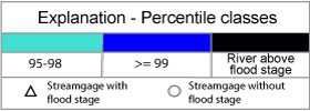
The USGS WaterWatch (http://waterwatch.usgs.gov) web site displays maps, graphs, and tables describing real-time, recent, and past streamflow conditions for the United States. The real-time information generally is updated on an hourly basis. USGS Flood Monitoring and Data CollectionFor information on overall USGS flood monitoring and data collection activities, see: For more information on USGS water-quality sampling, contact the USGS Office of Water Quality. To learn more about USGS water-quality sampling methods and protocols, see:
Health and Safety InformationEvery effort should be made to limit contact with flood water due to potentially elevated levels of contamination associated with raw sewage and other hazardous substances. |
|||||||||||||||||||||||||||
![]() U.S. Department of the Interior |
U.S. Geological Survey
U.S. Department of the Interior |
U.S. Geological Survey
URL: https://water.usgs.gov/owq/floods/2011/Irene/index.html
Page Contact Information: USGS Office of Water Quality
Page Last Modified: Wednesday, 28-Dec-2016 18:54:55 EST

![[Sample Water-Quality Watch Map]](http://waterwatch.usgs.gov/images/?g=wqw&w=200)