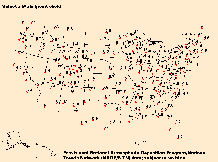
A list of the approximately 190 sites comprising the total Network and additional data for the sites are available from the NADP/NTN Coordination Office, Illinois State Water Survey, 2204 Griffith Drive, Champaign, IL 61880.
| Animation Index | Change from Previous Month | Great Lakes Water Levels | pH of Precipitation | Monthly Conditions by State | NWC Back Issues | Explanation of NWC Data | USGS Water Resources home Page |
![]() U.S. Department of the Interior |
U.S. Geological Survey
U.S. Department of the Interior |
U.S. Geological Survey
URL: https://water.usgs.gov/nwc/NWC/pH/html/ph.html
[an error occurred while processing this directive]
Page Contact Information: Water Webserver Team
Page Last Modified: Friday, 08-Jun-2007 16:36:06 EDT
URL: https://water.usgs.gov/nwc/NWC/pH/html/ph.html
Page Contact Information: NatWeb Team (GS_Help_Natweb@usgs.gov)
Page Last Modified: Friday, 08-Jun-2007 16:36:06 EDT