
Download published journal manuscript (PDF file - 1,335 Kb).
Total nitrogen and total phosphorus transport (i.e., export) and point and nonpoint source contributions were estimated for hydrologic cataloging units in the conterminous United States in a recent national application of SPARROW (Smith and others, 1997). These watersheds are a logical choice for characterizing national-level water quality because they represent a systematically developed and widely recognized delineation of U.S. watersheds, and provide a spatially representative view of water-quality conditions.
The national nutrient models relate in-stream measurements of TN and TP at approximately 400 long-term stream monitoring sites to upstream nitrogen sources and physical characteristics of the watersheds. The models empirically estimate the delivery of nutrients to streams and the outlets of watersheds from point and nonpoint sources. Estimates of stream transport (dependent variable in the SPARROW models) are adjusted to reflect 1987 nutrient inputs and long-term mean flow conditions (1970-1988), based on records of the concentration and flow for the period 1974 to 1989. Nitrogen nonpoint source data are for 1987. Point source data are for the period 1977-81. A digital river reach file of the United States (U.S. EPA River Reach File 1-RF1), consisting of more than 60,000 reaches of about one million kilometers of total channel length, was used to define the surface-water flow paths linking watershed characteristics to downstream monitoring locations.
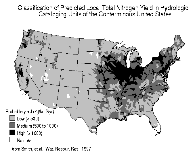
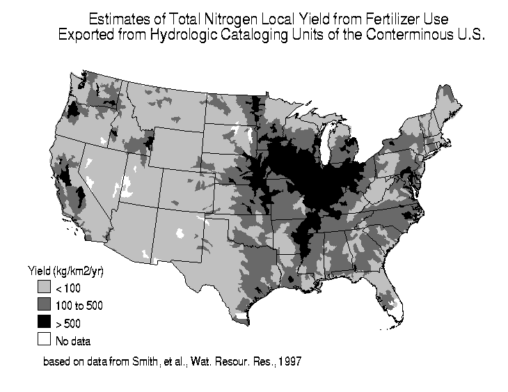
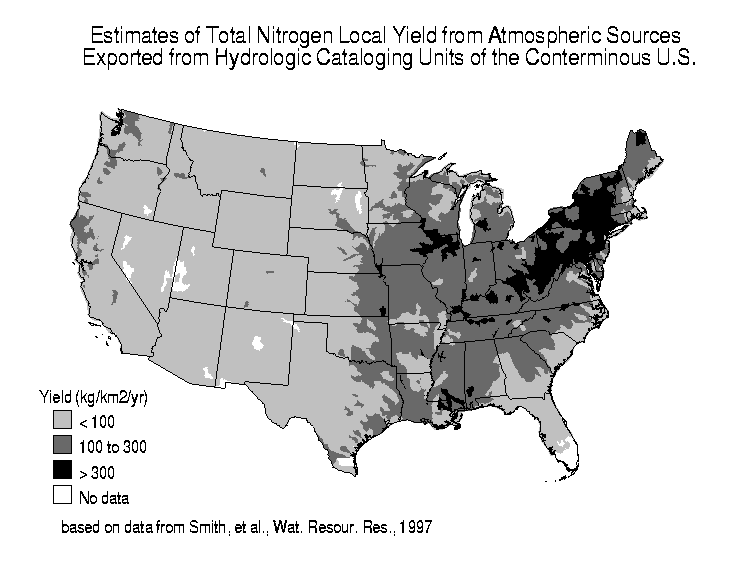
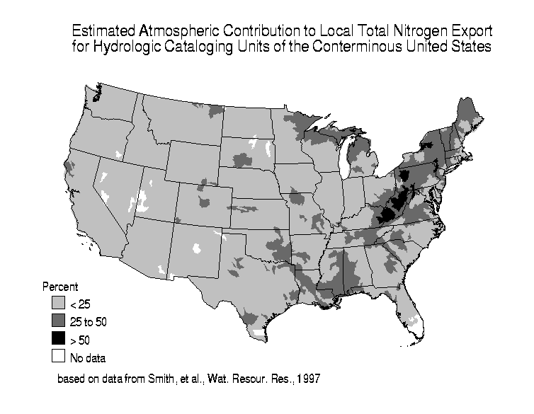
The calibrated models were applied to all river reaches in the conterminous United States. The results were aggregated by hydrologic cataloging unit, and are presented in tabular form in the tables listed below. The predictions of TN and TP export from hydrologic units describe the contributions from local (within-hydrologic unit) sources, exclusive of inflows from upstream watersheds. The in-stream estimates of source contributions (mass, yield, and relative percentages) are identified for five major sources: agriculture (fertilizer, livestock wastes), point sources, atmospheric deposition (TN only), and nonagricultural nonpoint sources. Predictions of export and source contributions are accompanied by estimates of uncertainty (standard error) reflecting uncertainties of the model coefficients and unexplained variability in the observed stream monitoring data.
Results for Hydrologic Cataloging Units:
National Maps of Selected TN Results for Hydrologic Cataloging Units: