
Gold King Mine release (2015): USGS water-quality data and activities Active
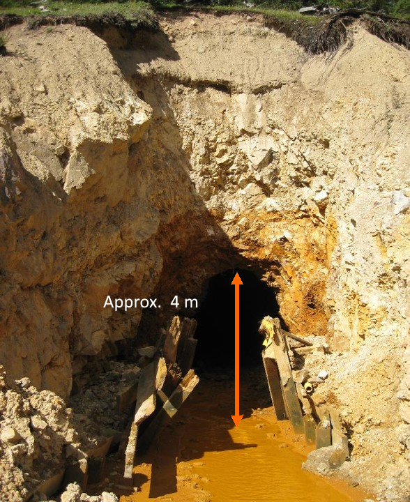
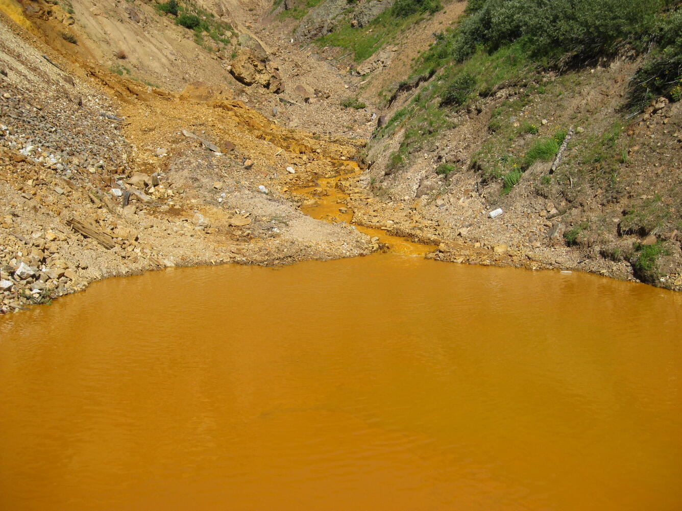
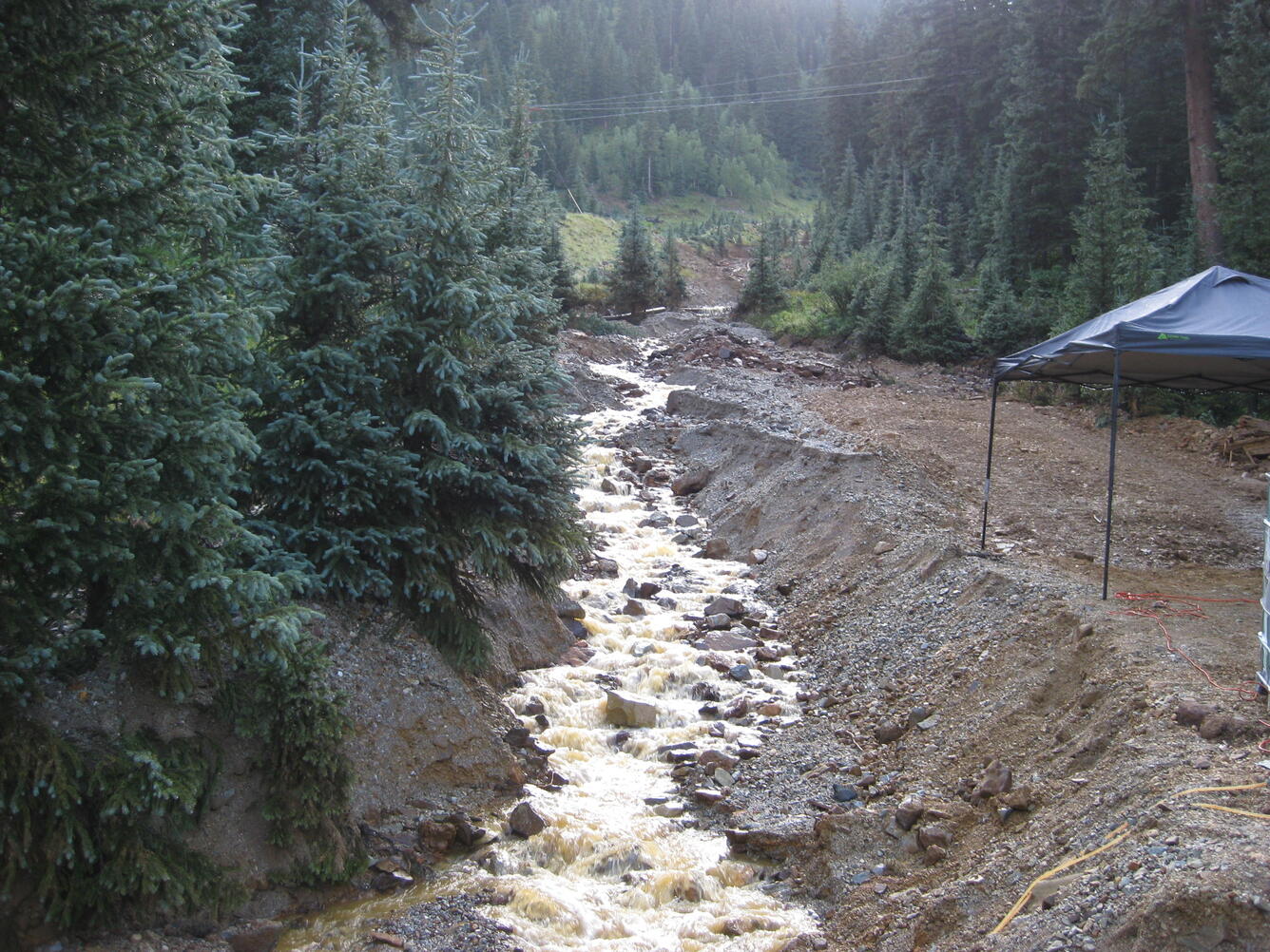
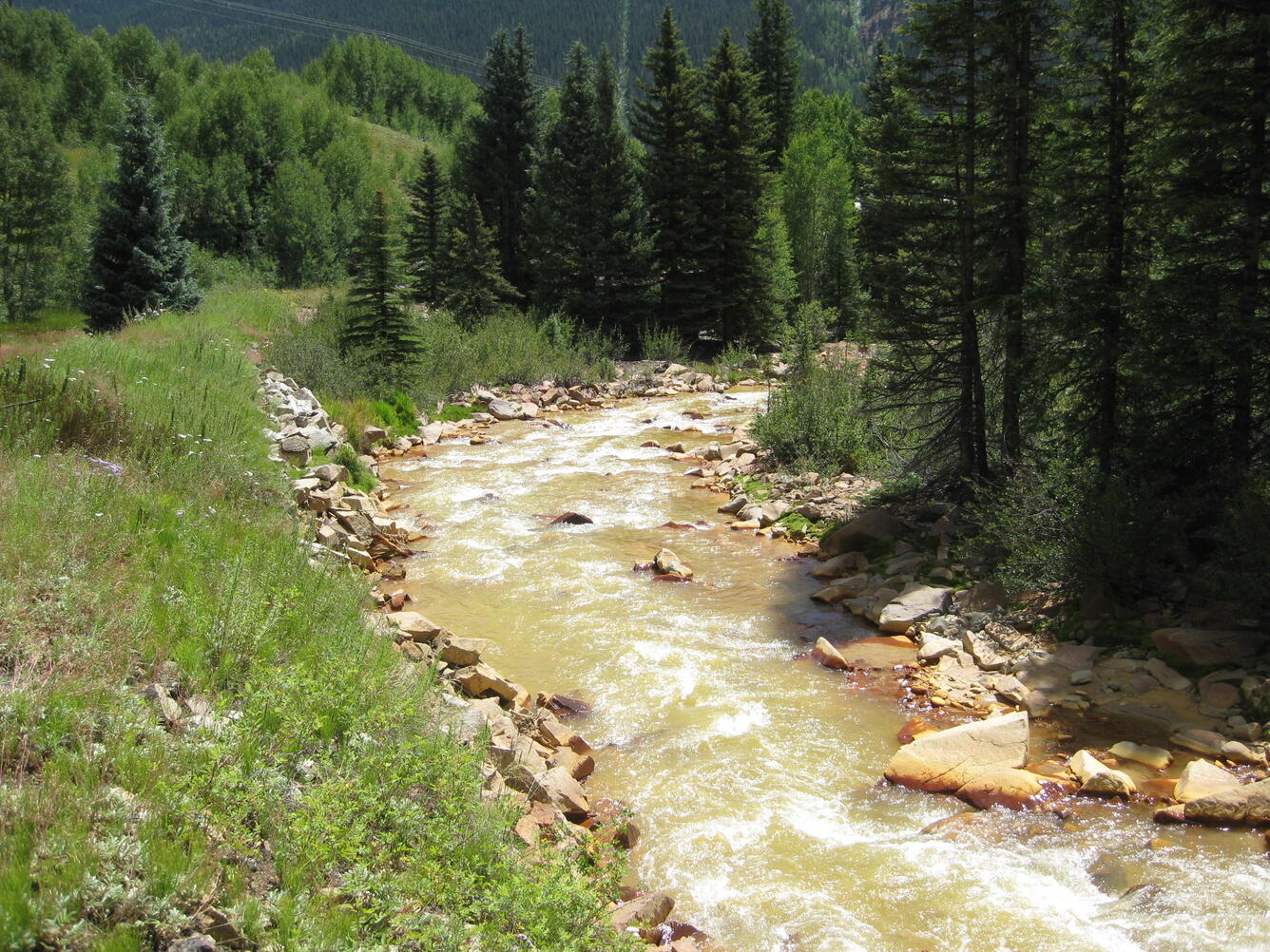
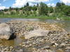
On August 5, 2015, U.S. EPA was conducting an investigation of the Gold King Mine near Silverton, Colorado. While excavating as part of the investigation, water began leaking from the mine tunnel, and about three million gallons of water and sediment were released into Cement Creek, a tributary of the Animas River. The USGS provided pre- and post-release water-quality and streamflow data from nearby gages.
On August 5, 2015, a release of about three million gallons of water and sediment occurred at the Gold King Mine near Silverton, Colorado. At the time of the release, the U.S. Environmental Protection Agency (EPA) was conducting an investigation of the Gold King Mine to assess the on-going water releases from the mine, to treat mine water, and to assess the feasibility of further mine remediation. During exploratory excavation of the mine portal, pressurized water began leaking from the mine tunnel, releasing water and sediment into Cement Creek, a tributary of the Animas River.
This website provides:
- Easy access to USGS data in the area of the release
- Updates on recent USGS activities in the area of the release
For emergency response concerns or questions: Please contact the U.S. Environmental Protection Agency (EPA) or call the EPA hotline at 844-607-9700. The USGS is not a regulatory, permitting or enforcement agency; Federal government response to the Gold King Mine is coordinated by the EPA.
Current USGS Activities
The USGS Water Science Centers monitor current streamflow and water-quality conditions at various sites in the Animas and San Juan River Basins in Colorado, New Mexico, and Utah.
Streamgages at these sites provide continuous data on streamflow and select water-quality constituents including specific conductance, water temperature, pH, and turbidity. In addition, water samples are collected periodically for lab analysis of more constituents at several of the sites.
Subsequent to the Gold King Mine Release and in addition to USGS and EPA sampling, water-quality samples were collected and analyzed from sites on the Animas and San Juan Rivers by other Federal, State, tribal, and local agencies. All available data were compiled by the EPA Office of Research and Development (ORD) and are being made available to the public through the National Water Quality Monitoring Council (NWQMC) Water Quality Portal (WQP). The WQP is a cooperative service sponsored by the USGS, the EPA, and the NWQMC that serves data collected by over 400 Federal, State, tribal, and local agencies. The USGS is working with the EPA ORD to explore the use of all available data in developing statistical relations between field water-quality parameters and water-quality sampling results. The USGS is collaborating with the EPA ORD to:
- Assess quality of the water-quality data collected by other agencies
- Use these data as appropriate in developing statistical relations (regression models) between field water-quality parameters (indicators) and water-quality sampling results
- Identify gaps in the available data sets
Linear, multiple-linear, or logistic regression techniques may be used, depending on which method results in the best fit to the data and minimizes the error of prediction. If supported by the data and regression statistics, continuous-monitoring data from the USGS water-quality sondes can potentially be used as surrogates for metal concentrations in surface water. The resulting regression models will be published as a USGS Scientific Investigations Report in 2019.
USGS Activities in Response to Gold King Mine Release
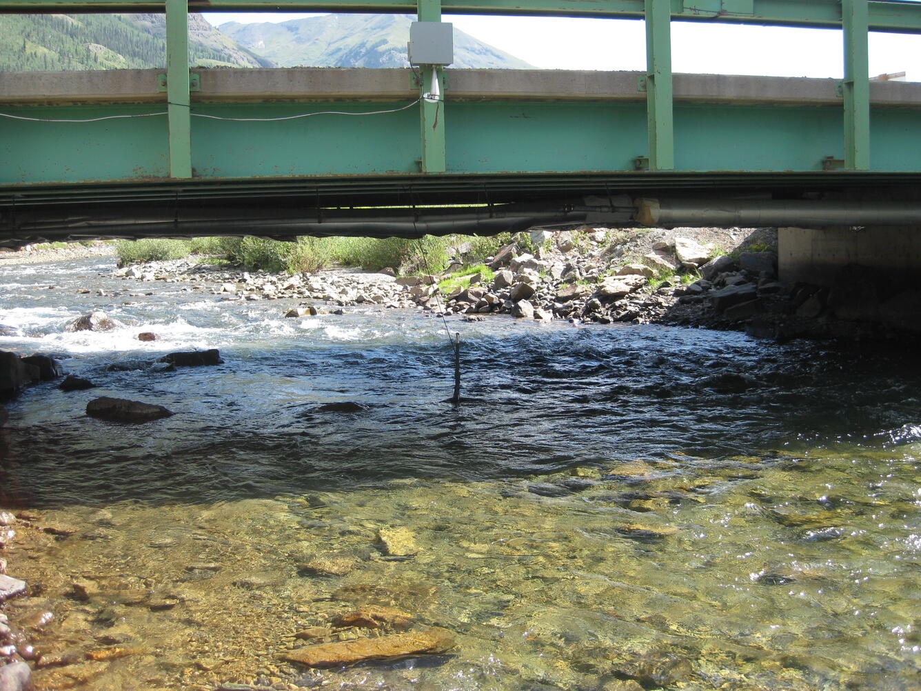
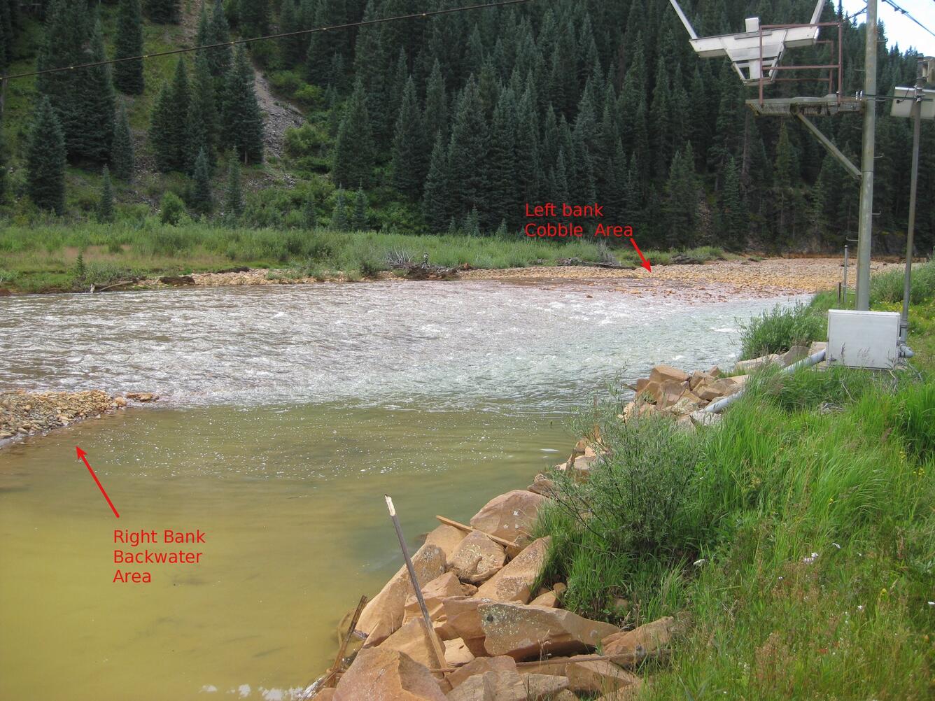
At the request of the U.S. EPA, USGS hydrologists conducted an analysis of streamflow data from USGS streamgages along Cement Creek, Mineral Creek, and the Animas River near Silverton, Colorado. The results were used by U.S. EPA to estimate the amount of water released from the Gold King Mine on August 5, 2015.
In addition, the USGS has collected water and sediment samples:
- along Cement Creek upstream from Silverton,
- downstream along the Animas River from Silverton to the confluence with the San Juan River, and
- downstream along the San Juan River in neighboring New Mexico and Utah.
Current conditions of real-time sites:
- Cement Creek at Silverton, CO (09358550)
- Animas River at Silverton, CO (09358000)
- Mineral Creek at Silverton, CO (09359010)
- Animas River below Silverton, CO (09359020)
- Animas River at Durango, CO (09361500)
- Animas River near Cedar Hill, NM (09363500)
- Animas River below Aztec, NM (09364010)
- San Juan River at Farmington, NM (09365000)
- San Juan River at Shiprock, MN (09368000)
- San Juan River at Four Corners, CO (09371010)
- San Juan River near Bluff, UT (09379500)
Digital Database from Integrated Investigations of Environmental Effects of Historical Mining in the Animas River Watershed, San Juan County, Colorado, 1996 to 2001:
- During the USGS Animas River watershed Abandoned Mine Lands Initiative between 1996 and 2001, scientists collected diverse data that describe and characterize the geology, geophysics, geography, biology, mining, and water quality of the Animas River watershed. Team scientists produced and compiled many layers of spatial digital data to support the multiple objectives of the Animas River watershed project.
- Base cartographic data covering the project study area were used to provide geographic reference for display of scientific information and results. The digital database accompanying the report contains these data and provides users with capabilities for viewing these data layers and for utilizing the information for user-defined purposes. The data not only are useful for cartographic displays of scientific results, but also can be used for watershed characterization, investigative analysis, and modeling.
The digital database is available online in the downloads directory as part of:
- Church, S.E., von Guerard, Paul, and Finger, S.E., eds., 2007, Integrated investigations of environmental effects of historical mining in the Animas River watershed, San Juan County, Colorado: U.S. Geological Survey Professional Paper 1651, 1,096 p. plus CD-ROM. [In two volumes.]
For a complete description of the database, refer to Volume 2, Chapter G. Digital databases and CD-ROM for the Animas River watershed.
(Note: At this time, the water-quality data in this database are not available in the USGS National Water Information System [NWIS].)
Historical Data
The upper Animas River watershed near Silverton, Colorado, has been an area of extensive interdisciplinary USGS research on abandoned mine lands. Prior to mining in this area, the mineralized rocks were natural sources of metals and acidity to streams. Historical mining also contributed to the metals and acidity in streams of this area. Multiple USGS papers have been published about the environmental effects of unmined mineralized areas and historical mine sites in the Animas River watershed. These reports, and the data contained therein, provide a critical environmental baseline against which the effects of the Gold King Mine release can be assessed. The locations, types of data, and frequency of data vary based on the objectives of the USGS program or study for which they were collected.
Why do we need data from before the release?
Scientists can use data collected before the August 5, 2015, Gold King Mine release to help answer important questions, including:
- What were the water-quality conditions in Cement Creek and other downstream water bodies before the release?
- How did the release affect the water quality downstream?
- How will we know when downstream water bodies have recovered from the release?
Water-quality data
As part of our routine science activities, USGS collects water-quality data around the Nation, and the USGS has collected water-quality samples at a number of sites downstream from the Gold King Mine since the August 2015 release. The region near Silverton, Colorado, has been an area of extensive USGS research on abandoned mine lands and on natural sources of metals and acidity to streams. The locations, types of data, and frequency of data vary based on the objectives of the USGS program or study for which they were collected. Recent water-quality data for the Animas watershed are available from the National Water Information System (NWIS) website. Historical data for the Animas River watershed are available from the Downloads Directory of USGS Professional Paper 1651: Integrated Investigations of Environmental Effects of Historical Mining in the Animas River Watershed. Please visit the Data & Tools tab to see other databases that are available.
Satellite imagery
Satellite imagery of the Gold King Mine area is available from the USGS. The imagery includes both pre- and post-event data. The pre-event imagery starts around June 1, 2015. The post-event imagery continues to be collected. All data are being made available on the USGS Hazards Data Distribution System (HDDS).
To register on the HDDS system and request access to the licensed imagery, please use their instructions. Once registered on HDDS (Step 1), you will also need to follow Step 2: Request Restricted Access for event "201508_Spill_CO".
Please note: while it is possible to search for data on HDDS by event (201508_Spill_CO) without logging in, the search results only include up to 100 responsive items. To see the complete collection of publicly available data, users must register and log in.
The imagery focuses on the area around and downstream from the Gold King Mine, including:
- the Animas River and tributaries (including the headwaters of Cement Creek) and
- the San Juan River and its tributaries down to and including the San Juan Arm of Lake Powell.
Imagery below is being obtained from the following sources:
- WorldView: 1-4 meter data from the DigitalGlobe WorldView satellites. These data are licensed for response use only. Please contact bkjones@usgs.gov for more information.
- GeoEye: 1-4 meter data from the DigitalGlobe GeoEye satellites. These data are licensed for response use only. Please contact bkjones@usgs.gov for more information
- ASTER (Advanced Spaceborne Thermal Emission and Reflection Radiometer): High-resolution (15- to 90-meter) multispectral data from the Terra satellite
- EO-1: 10- to 30-meter multispectral and hyperspectral data from the Earth Observing-1 (EO-1) Extended Mission
- GeoEye's OrbView-3 satellite
- Landsat 8: 15- to 30- meter multispectral data from Landsat 8
- Landsat 7: 15- to 30-meter multispectral data from Landsat 7
For a complete explanation of the satellite data types, refer to the USGS Earth Resources Observation Center (EROS) satellite imagery descriptions.
A news feed (RSS) of the satellite imagery is available.
Please contact bkjones@usgs.gov with questions about the satellite imagery or additional data requests.


Below are other science projects associated with the Gold King Mine release.

A Shallow to Deep View Inside the Hydrothermally Altered and Mineralized Silverton Caldera Complex: New Geologic Insights Gained From Modern Geophysical Interpretations

Lake Powell Coring

Monitoring for Potential Effects of the Gold King Mine Release on Water Quality in the Animas and San Juan Rivers in New Mexico using Continuous Monitors and Automatic Samplers
Below are multimedia items associated with Gold King Mine.

- Overview
On August 5, 2015, U.S. EPA was conducting an investigation of the Gold King Mine near Silverton, Colorado. While excavating as part of the investigation, water began leaking from the mine tunnel, and about three million gallons of water and sediment were released into Cement Creek, a tributary of the Animas River. The USGS provided pre- and post-release water-quality and streamflow data from nearby gages.
On August 5, 2015, a release of about three million gallons of water and sediment occurred at the Gold King Mine near Silverton, Colorado. At the time of the release, the U.S. Environmental Protection Agency (EPA) was conducting an investigation of the Gold King Mine to assess the on-going water releases from the mine, to treat mine water, and to assess the feasibility of further mine remediation. During exploratory excavation of the mine portal, pressurized water began leaking from the mine tunnel, releasing water and sediment into Cement Creek, a tributary of the Animas River.
This website provides:
- Easy access to USGS data in the area of the release
- Updates on recent USGS activities in the area of the release
For emergency response concerns or questions: Please contact the U.S. Environmental Protection Agency (EPA) or call the EPA hotline at 844-607-9700. The USGS is not a regulatory, permitting or enforcement agency; Federal government response to the Gold King Mine is coordinated by the EPA.
Current USGS Activities
The USGS Water Science Centers monitor current streamflow and water-quality conditions at various sites in the Animas and San Juan River Basins in Colorado, New Mexico, and Utah.
Streamgages at these sites provide continuous data on streamflow and select water-quality constituents including specific conductance, water temperature, pH, and turbidity. In addition, water samples are collected periodically for lab analysis of more constituents at several of the sites.
Subsequent to the Gold King Mine Release and in addition to USGS and EPA sampling, water-quality samples were collected and analyzed from sites on the Animas and San Juan Rivers by other Federal, State, tribal, and local agencies. All available data were compiled by the EPA Office of Research and Development (ORD) and are being made available to the public through the National Water Quality Monitoring Council (NWQMC) Water Quality Portal (WQP). The WQP is a cooperative service sponsored by the USGS, the EPA, and the NWQMC that serves data collected by over 400 Federal, State, tribal, and local agencies. The USGS is working with the EPA ORD to explore the use of all available data in developing statistical relations between field water-quality parameters and water-quality sampling results. The USGS is collaborating with the EPA ORD to:
- Assess quality of the water-quality data collected by other agencies
- Use these data as appropriate in developing statistical relations (regression models) between field water-quality parameters (indicators) and water-quality sampling results
- Identify gaps in the available data sets
Linear, multiple-linear, or logistic regression techniques may be used, depending on which method results in the best fit to the data and minimizes the error of prediction. If supported by the data and regression statistics, continuous-monitoring data from the USGS water-quality sondes can potentially be used as surrogates for metal concentrations in surface water. The resulting regression models will be published as a USGS Scientific Investigations Report in 2019.
USGS Activities in Response to Gold King Mine Release
At the request of the U.S. EPA, USGS hydrologists conducted an analysis of streamflow data from USGS streamgages along Cement Creek, Mineral Creek, and the Animas River near Silverton, Colorado. The results were used by U.S. EPA to estimate the amount of water released from the Gold King Mine on August 5, 2015.
In addition, the USGS has collected water and sediment samples:
- along Cement Creek upstream from Silverton,
- downstream along the Animas River from Silverton to the confluence with the San Juan River, and
- downstream along the San Juan River in neighboring New Mexico and Utah.
Current conditions of real-time sites:
- Cement Creek at Silverton, CO (09358550)
- Animas River at Silverton, CO (09358000)
- Mineral Creek at Silverton, CO (09359010)
- Animas River below Silverton, CO (09359020)
- Animas River at Durango, CO (09361500)
- Animas River near Cedar Hill, NM (09363500)
- Animas River below Aztec, NM (09364010)
- San Juan River at Farmington, NM (09365000)
- San Juan River at Shiprock, MN (09368000)
- San Juan River at Four Corners, CO (09371010)
- San Juan River near Bluff, UT (09379500)
Digital Database from Integrated Investigations of Environmental Effects of Historical Mining in the Animas River Watershed, San Juan County, Colorado, 1996 to 2001:
- During the USGS Animas River watershed Abandoned Mine Lands Initiative between 1996 and 2001, scientists collected diverse data that describe and characterize the geology, geophysics, geography, biology, mining, and water quality of the Animas River watershed. Team scientists produced and compiled many layers of spatial digital data to support the multiple objectives of the Animas River watershed project.
- Base cartographic data covering the project study area were used to provide geographic reference for display of scientific information and results. The digital database accompanying the report contains these data and provides users with capabilities for viewing these data layers and for utilizing the information for user-defined purposes. The data not only are useful for cartographic displays of scientific results, but also can be used for watershed characterization, investigative analysis, and modeling.
The digital database is available online in the downloads directory as part of:
- Church, S.E., von Guerard, Paul, and Finger, S.E., eds., 2007, Integrated investigations of environmental effects of historical mining in the Animas River watershed, San Juan County, Colorado: U.S. Geological Survey Professional Paper 1651, 1,096 p. plus CD-ROM. [In two volumes.]
For a complete description of the database, refer to Volume 2, Chapter G. Digital databases and CD-ROM for the Animas River watershed.
(Note: At this time, the water-quality data in this database are not available in the USGS National Water Information System [NWIS].)
Historical Data
The upper Animas River watershed near Silverton, Colorado, has been an area of extensive interdisciplinary USGS research on abandoned mine lands. Prior to mining in this area, the mineralized rocks were natural sources of metals and acidity to streams. Historical mining also contributed to the metals and acidity in streams of this area. Multiple USGS papers have been published about the environmental effects of unmined mineralized areas and historical mine sites in the Animas River watershed. These reports, and the data contained therein, provide a critical environmental baseline against which the effects of the Gold King Mine release can be assessed. The locations, types of data, and frequency of data vary based on the objectives of the USGS program or study for which they were collected.
Why do we need data from before the release?
Scientists can use data collected before the August 5, 2015, Gold King Mine release to help answer important questions, including:- What were the water-quality conditions in Cement Creek and other downstream water bodies before the release?
- How did the release affect the water quality downstream?
- How will we know when downstream water bodies have recovered from the release?
Water-quality data
As part of our routine science activities, USGS collects water-quality data around the Nation, and the USGS has collected water-quality samples at a number of sites downstream from the Gold King Mine since the August 2015 release. The region near Silverton, Colorado, has been an area of extensive USGS research on abandoned mine lands and on natural sources of metals and acidity to streams. The locations, types of data, and frequency of data vary based on the objectives of the USGS program or study for which they were collected. Recent water-quality data for the Animas watershed are available from the National Water Information System (NWIS) website. Historical data for the Animas River watershed are available from the Downloads Directory of USGS Professional Paper 1651: Integrated Investigations of Environmental Effects of Historical Mining in the Animas River Watershed. Please visit the Data & Tools tab to see other databases that are available.
Satellite imagery
Satellite imagery of the Gold King Mine area is available from the USGS. The imagery includes both pre- and post-event data. The pre-event imagery starts around June 1, 2015. The post-event imagery continues to be collected. All data are being made available on the USGS Hazards Data Distribution System (HDDS).
To register on the HDDS system and request access to the licensed imagery, please use their instructions. Once registered on HDDS (Step 1), you will also need to follow Step 2: Request Restricted Access for event "201508_Spill_CO".
Please note: while it is possible to search for data on HDDS by event (201508_Spill_CO) without logging in, the search results only include up to 100 responsive items. To see the complete collection of publicly available data, users must register and log in.
The imagery focuses on the area around and downstream from the Gold King Mine, including:
- the Animas River and tributaries (including the headwaters of Cement Creek) and
- the San Juan River and its tributaries down to and including the San Juan Arm of Lake Powell.
Imagery below is being obtained from the following sources:
- WorldView: 1-4 meter data from the DigitalGlobe WorldView satellites. These data are licensed for response use only. Please contact bkjones@usgs.gov for more information.
- GeoEye: 1-4 meter data from the DigitalGlobe GeoEye satellites. These data are licensed for response use only. Please contact bkjones@usgs.gov for more information
- ASTER (Advanced Spaceborne Thermal Emission and Reflection Radiometer): High-resolution (15- to 90-meter) multispectral data from the Terra satellite
- EO-1: 10- to 30-meter multispectral and hyperspectral data from the Earth Observing-1 (EO-1) Extended Mission
- GeoEye's OrbView-3 satellite
- Landsat 8: 15- to 30- meter multispectral data from Landsat 8
- Landsat 7: 15- to 30-meter multispectral data from Landsat 7
For a complete explanation of the satellite data types, refer to the USGS Earth Resources Observation Center (EROS) satellite imagery descriptions.
A news feed (RSS) of the satellite imagery is available.
Please contact bkjones@usgs.gov with questions about the satellite imagery or additional data requests.


- Science
Below are other science projects associated with the Gold King Mine release.
A Shallow to Deep View Inside the Hydrothermally Altered and Mineralized Silverton Caldera Complex: New Geologic Insights Gained From Modern Geophysical Interpretations
The Silverton caldera complex in southwest Colorado hosts base and precious metals that have been mined since the late 1800s. Extensive mine workings, excellent bedrock exposures, and deeply incised drainages make this area a natural laboratory ideally suited for furthering our understanding of the mineral systems in a volcanic environment. In addition, state-of-the-art geophysical data processing...Lake Powell Coring
In response to the August 5, 2015, Gold King Mine Spill from the Bonita Peak Mining District that resulted in the release of three-million gallons of mine-impacted waters, the Utah Water Science Center, in partnership with the Utah Division of Water Quality, National Park Service, and U.S. Bureau of Reclamation, cored the San Juan and Colorado River deltas in multiple locations in Lake Powell...Monitoring for Potential Effects of the Gold King Mine Release on Water Quality in the Animas and San Juan Rivers in New Mexico using Continuous Monitors and Automatic Samplers
On August 5, 2015, about three million gallons of water and sediment were released from the Gold King Mine near Silverton, Colorado, into Cement Creek, a tributary of the Animas River. The New Mexico Environment Department, among other State, Tribal, and local entities in CO, NM, and UT, is concerned that metals associated with the water and sediment released from the Gold King Mine could have... - Multimedia
Below are multimedia items associated with Gold King Mine.
USGS Site Visit and Sampling at Gold King Mine, August 11-13, 2015 - Publications
- Web Tools
- News